BLOG: Winter Is Here
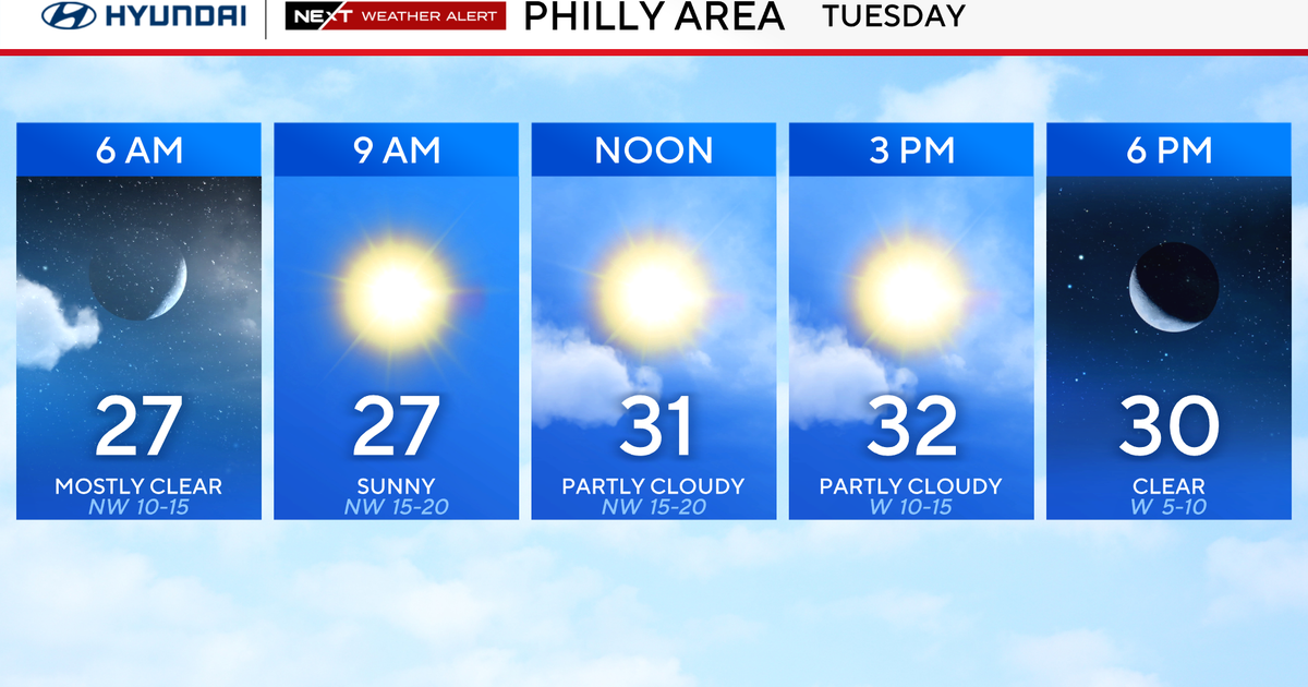
Certainly a big change to colder with the front that moved through early yesterday morning and kept temperatures in the 30s during the day yesterday. Although the winds will not be as strong and gusty as yesterday, we will still have an active wind and cold air in place today that keeps it feeling colder than it actually will be. There are going to be intervals of sunshine, but probably in general, more in the way of clouds than sunshine as the second cold front now off to the north swings through. This front will have no real impact on our weather as it crosses late today and this evening, other than to reinforce the cold air for overnight tonight and tomorrow We probably have no more than patchy clouds at times tonight and tomorrow as that front pushes off to the south and high pressure settles in from the west. However, this air mass is cold, and despite a good deal of sunshine tomorrow temperatures will probably not rise the middle 30s.
As the high slides off to the east, there will be some moderation in temperatures Monday midday and afternoon. There will probably be some clouds starting to show up, mainly mid and high clouds, Monday afternoon then the moistening ahead of the next front and developing low pressure area will probably send some rain into our area later Monday night and Tuesday. Not a steady, soaking rain, but more of an intermittent rain with a southwest flow helping push temperatures toward 50 Tuesday afternoon and evening. The developing low will pass by to the north Tuesday night and swing a cold front in later Tuesday night that shuts off any showers and sends colder, drier air back in on brisk northwest winds Wednesday. A weak clipper system will track to the north later Thursday and Thursday night and send some clouds across our area, but any precipitation should stay to the north.