WEATHER BLOG: Preakness Weekend
There will be plenty of concerns as we move through the latter part of the week into the weekend. In the meantime we'll enjoy a nice start to the weekend.
There will be plenty of clouds off to the south and east from a nearly stationary upper low centered over the southeast. There is a weak ridge axis running from central Texas northeastward through the eastern Great Lakes that is also holding its ground and this is bottling the whole works upstream. Farther west a trough covers the central and northern Plains states, and it is this feature that breaks down the bottleneck, but it doesn't go cleanly. So, through the Plains the trough starts to kick out the northern side of the ridge, almost breaking it in two (though it was only weakly connected to start). Then, the trough starts to make a connection with the upper low in the southeast, drawing it slowly north and west and placing it over the Middle Atlantic region. Once located in this region it will be stuck in place for several days and then we'll have to figure out how much rain we'll have to deal with each day.
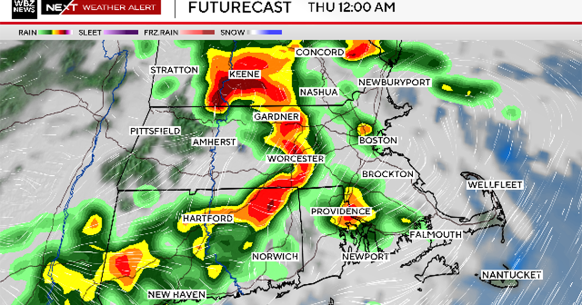
Now, as this upper system starts to move northward Sunday clouds will increase later in the day or at night and some energy located farther to the east will rotate back to the west and spread a shower into the region Sunday night. The amount of showers will depend on the strength of the upper energy. The models are still creating more questions than answers on that matter. At this point we'll still call it a shower or two, mainly after midnight.