Tropical Storm Isaias could bring flooding, strong winds to metro Atlanta this weekend

Tropical Storm Isaias has formed off eastern Mexico on Wednesday morning and is expected to develop into the first hurricane of the season before hitting the Gulf Coast this week.
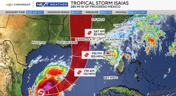
As of Wednesday morning, Isaias was centered about 285 miles west of Progreso, Mexico, and about 580 miles southwest of the Mississippi River's mouth, according to the Miami-based National Hurricane Center. It had maximum sustained winds of 40 mph and was moving east-northeast at 8 mph.
The official track from the Hurricane Center brings the storm into the northern Gulf as a category two hurricane by Friday morning with winds up to 110 mph.
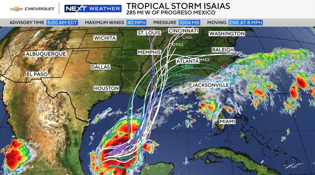
Forecasters predict that Isaias will become a hurricane by Thursday and will likely make landfall as a category two hurricane somewhere between New Orleans and Panama City Beach, Florida, either late Friday or early Saturday.
The storm will weaken over land, but its outer bands will still impact North Georgia and metro Atlanta this weekend.
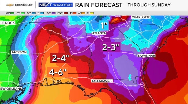
The main threats on the current track will be gusty winds, possibly up to hurricane strength, as well as flooding rain. Rain totals in much of metro Atlanta could be between two and three inches by Sunday.

There is a NEXT Weather Alert for both Saturday and Sunday as CBS News Atlanta continues to track these changing weather conditions. It is still a bit early to pinpoint exactly what impacts can be expected.
The storm is likely to tie or break a 121-year-old record as the latest arriving first hurricane of the Atlantic season. The record goes back to 1905, when the first hurricane formed in the Atlantic on Oct. 8.
The storm comes as the Atlantic hurricane season has been unusually quiet this year due to a strong El Niño, which disrupts storm formation over that ocean. Storm activity in the Pacific has been above average.


