Weather alerts in place as dangerous cold, wintry mix cover North Texas
NORTH TEXAS - Weather Alerts are in place today and Tuesday for the dangerous cold and areas of snow and freezing rain in North Texas.
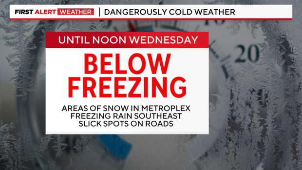
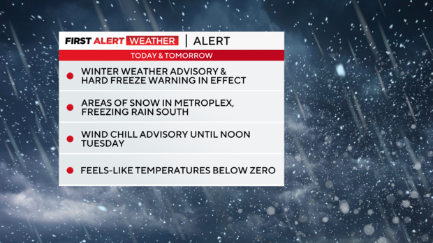
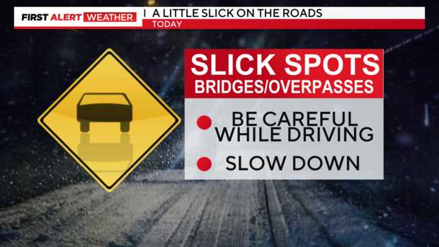
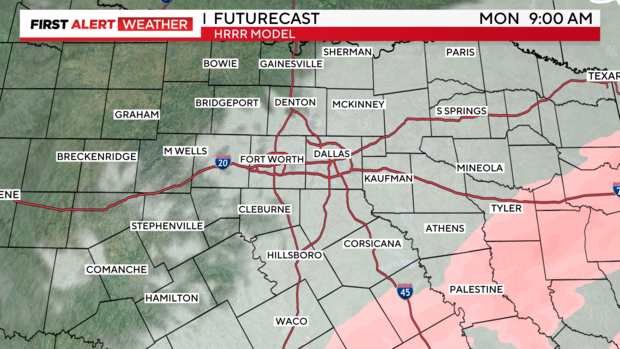
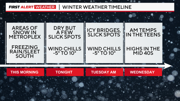
A winter weather advisory is in effect until noon today. Be careful while driving, especially on bridges and overpasses and untreated roads. We've seen bands of lake effect snow in parts of North Texas. Parts of the Metroplex, in particular, could see up to an inch of snow or more. Most of North Texas, though, will see less than .25" of snow—more of a dusting, in fact.
We've also seen areas of freezing rain and sleet toward the southeast in Corsicana, Athens and Palestine. Accumulations of ice and sleet could get up to a tenth of an inch, capable of producing some power outages. We'll likely see snow and freezing rain/sleet ending by mid to late this morning.
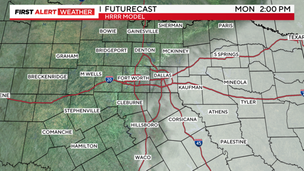
Then, this afternoon, we'll see some peaks of sunshine before the clouds move back over our area tonight.
However, with temperatures remaining below freezing today and tonight, it's going to be rough on our area roads.
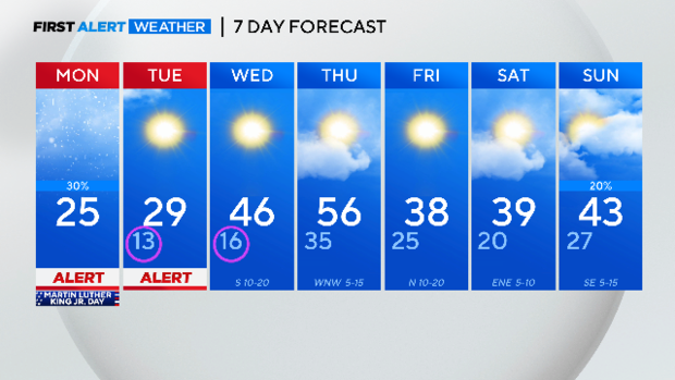
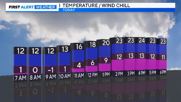
This arctic outbreak continues to set records. This morning we tied the record low of 11 degrees at DFW set back in 1905. We may see more records tied or broken through Tuesday, as temperatures remain below freezing.
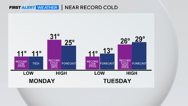
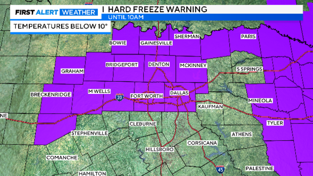
A hard freeze warning is in effect for the Metroplex and surrounding areas until 10am for temperatures below 10 degrees. We may see the warning extended further south as another push of arctic air surges into the state this afternoon.
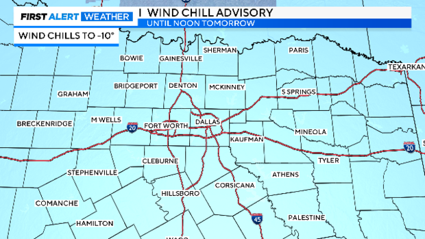
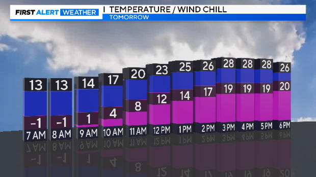
The wind chill advisory has been extended for all North Texas through noon tomorrow as the reinforcing push of arctic air arrives. Wind chills to -10 are possible especially in the morning hours.
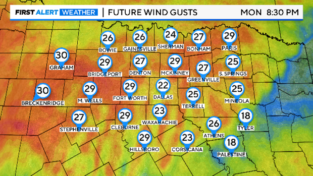
Northerly winds will pick up this evening into Tuesday morning continuing the dangerously cold conditions.
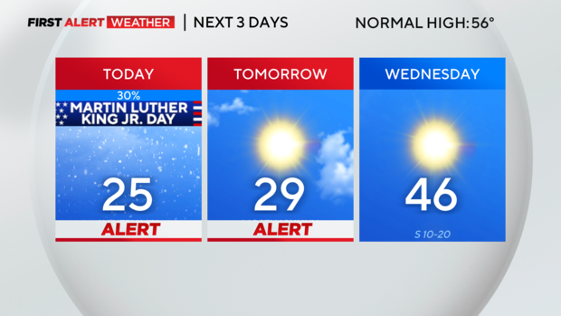
Please minimize your time outdoors and cover up any exposed skin when you do venture outside. Temperatures only top out in the 20s this afternoon but the warmest we will feel is the 10s.
Tuesday morning wind chills to -10 will be widespread. As winds subside in the afternoon, it will feel like the upper 10s, with temperatures in the upper 20s.
Our frigid temperatures extend into Wednesday morning, but we make it into the 40s by the afternoon with sunshine! Thursday will be our warmest day of the week and temperatures heat in to the 50s ahead of the next cold front. The front returns us to the 30s to wrap up the work week with rain chances arriving late Sunday night.