Tracking threat of storms after Severe Thunderstorm Watch expires for North Texas
NORTH TEXAS (CBSNewsTexas.com) - The Severe Thunderstorm has expired for North Texas.
We're still tracking a few strong thunderstorms in the area right now, including some in the Metroplex.
After a round of severe storms in North Texas Sunday evening, your CBS News Texas First Alert Weather Team is still tracking the threat of more storms in parts of the area late tonight into Monday morning.
A cold front is sliding into North Texas from the north. As it pushes farther south, it will keep our weather a bit unsettled overnight into Monday morning with a few scattered showers and storms.
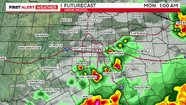
Storms will be capable of producing heavy rain, frequent lightning and small hail. Some localized flooding is also possible.
Remember, turn around, don't drown.
Storms could be strong and marginally severe tonight, so keep that in mind.
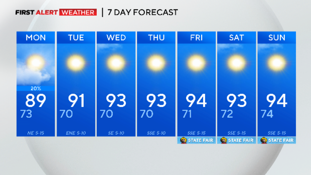
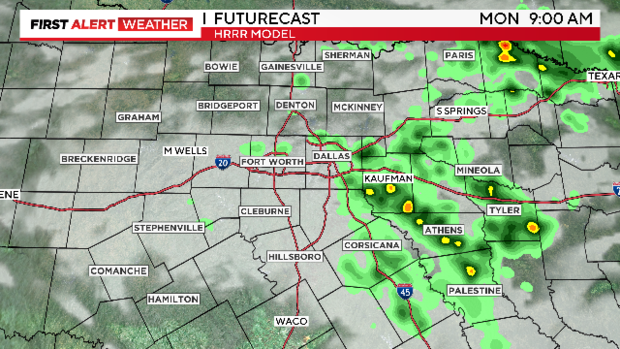
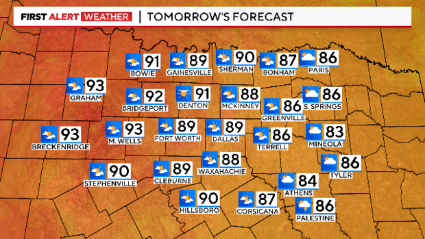
Otherwise, expect mostly cloudy skies and lows in the low to mid-70s.On Monday, a few early morning showers and storms are possible. But with the front sliding slowly south through the early to mid-afternoon, an isolated shower or storm will be possible. The chance for rain by Monday afternoon is around 20%. Otherwise, we'll see a mix of sun and clouds and highs in the upper 80s.
On Tuesday, we'll see sunny skies and highs in the low 90s.
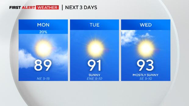
Wednesday through the weekend, we'll likely have highs in the low to mid-90s. Much of the week and next weekend looks dry.