Warm and wet weekend ahead for North Texas
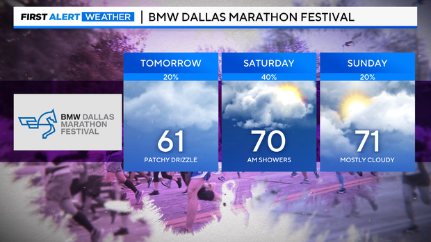
NORTH TEXAS — The saying goes: Save your money for a rainy day. If your weekend plans include heading out to the mall or the BMW Dallas Marathon Festival, prepare for a muggy and rainy forecast.
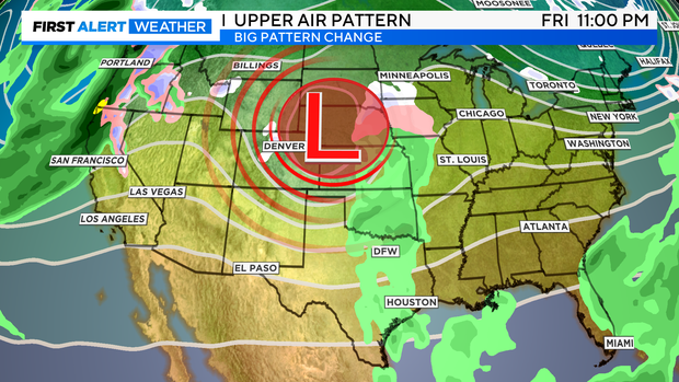
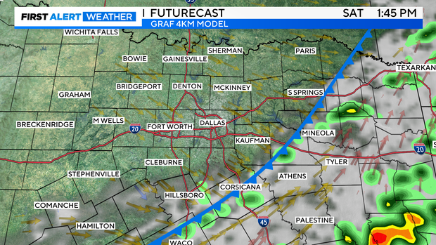
This is due to an upper-level low moving eastward, and an associated surface frontal passage forecast expected to pass through on Saturday.
On Friday, a south wind will bring up humidity levels. This allows for a chance of spotty showers and drizzle throughout the day.
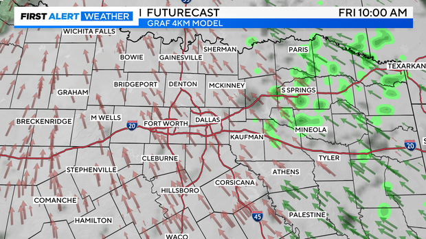
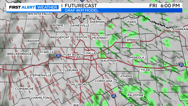
There will be enough moisture and energy to ignite storms ahead of Saturday's frontal passage. A few isolated cells and widespread showers will be likely occur in the morning through the late afternoon, with conditions clearing from west to east. By Saturday night, expect mild conditions.

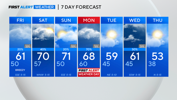
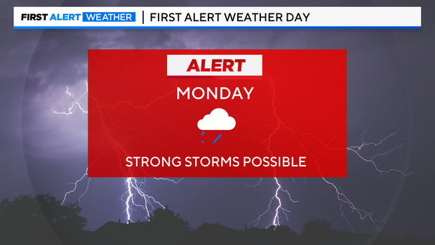
The First Alert Weather Team is tracking another opportunity for strong thunderstorms on Monday, so a First Alert Weather Day has been issued for this day. This front will bring a strong line of thunderstorms across the region for the Monday morning commute. Later in the evening there is also the potential for more strong activity.
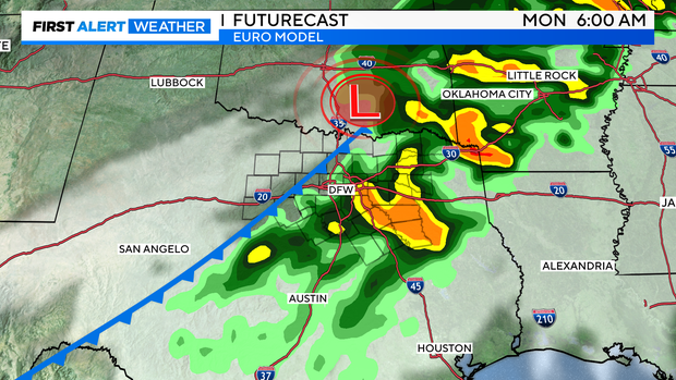
In addition to thunderstorms, there will also be gusty winds and colder temperatures behind the system. Another front is expected through the area on Wednesday, keeping the cooler weather in the forecast. It's about to finally feel like winter, so if you haven't already, grab those winter jackets.