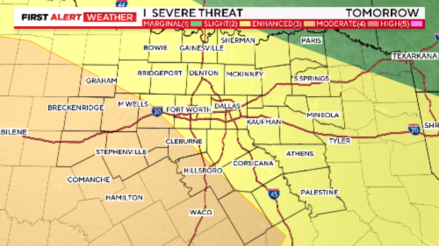
Slight to enhanced risk of severe storms in North Texas on Tuesday

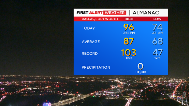
NORTH TEXAS — We saw a hot Memorial Day across North Texas with our high temperature reaching 96° at DFW but the feels-like temperature reached near 105°.
A stalled boundary across North Texas provided enough lift for isolated strong to severe storms to develop late Monday afternoon. Some of the storms intensified enough for near baseball-sized hail falling over parts of Tarrant County.
The threat of more severe weather continues Tuesday with a slight to enhanced risk of storms reaching severe limits and a weather alert is issued for the potential of severe storms. Large hail and damaging winds will be the main threat but the chance of an isolated tornado can't be ruled out.
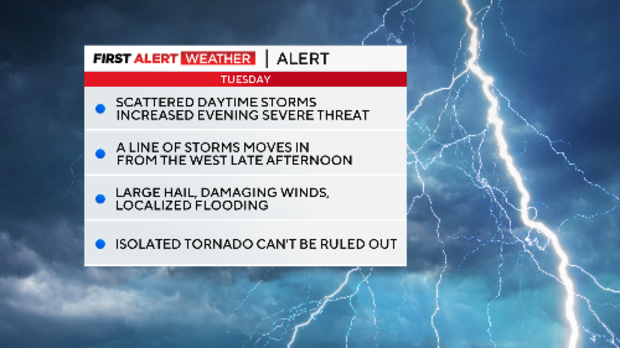
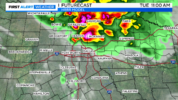
There will be rounds of rain and storms Tuesday. There will be storms moving into North Texas in the morning to early afternoon hours out of Oklahoma.
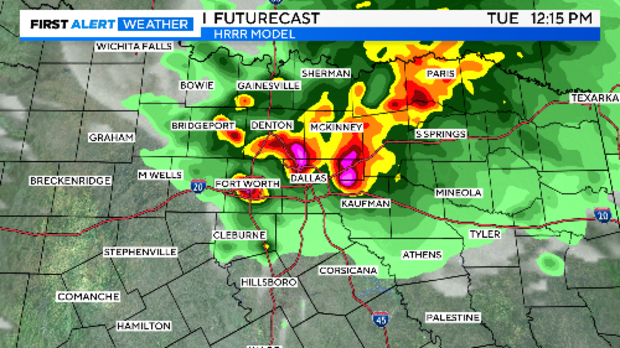
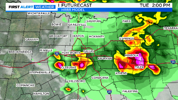
There will be a break in the afternoon hours before we see development off the dryline to the west make a run for North Texas in the early evening hours. The main concern is large hail, damaging winds and isolated tornado threat.
It will be a long night with the potential line of storms not clearing North Texas until the early morning hours. Make sure you have a way to get warnings throughout the day and in the evening hours.


