One more spring-like day before rain returns
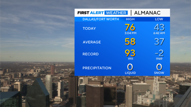
NORTH TEXAS - We are getting spoiled with the weather this week! A high of 76° was reported at DFW Wednesday afternoon.
Thursday will be our last day with highs across the area in the 70s but don't worry, it won't cool down too much into Friday.
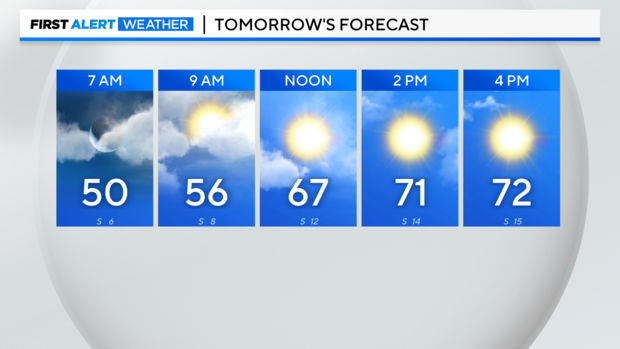
You will notice more clouds around Thursday morning, but we should see more sunshine in the afternoon.
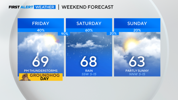
For your Groundhog Day, cloudy skies and isolated showers are around during the day. But late in the afternoon, we'll start to watch for a few stronger storms moving in from the west. Most of the storms aren't expected until after sunset Friday, but once they arrive a few could be on the stronger side with winds and hail as the main threats.
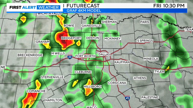
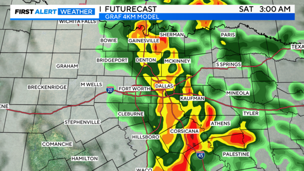
Once the rain/storms move east in the overnight hours, it'll likely be more of a rain/minor flooding event.
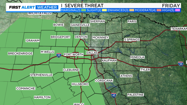
For now, the SPC has some of our areas under a level 1/marginal risk for the Friday evening storms.
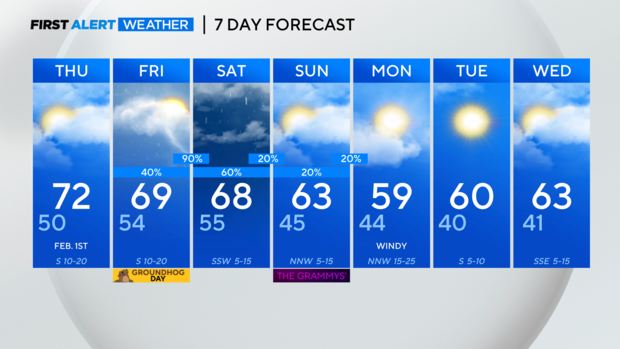
It'll cool off Sunday into Monday, but that just brings us back to near normal. Highs return to the 60s on Tuesday!


