Mild winter day ahead for North Texas with rain chances on the horizon

Thursday was a day dominated by sneaky sunshine. Temperatures were below normal, and north/northwest winds kept wind chills at play, though everything was well above freezing Thursday afternoon.
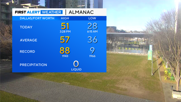
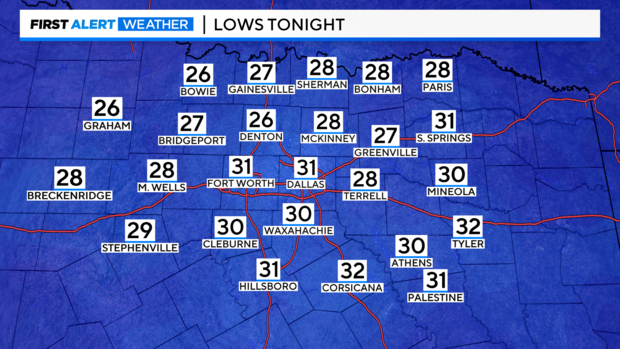
We do have another cold morning expected on Friday, with temperatures dropping to freezing or below. There will be wind chills briefly in the teens and low 20s. Sunshine and southwest winds will warm us up to near/at normal in the afternoon.
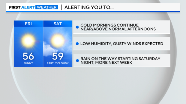
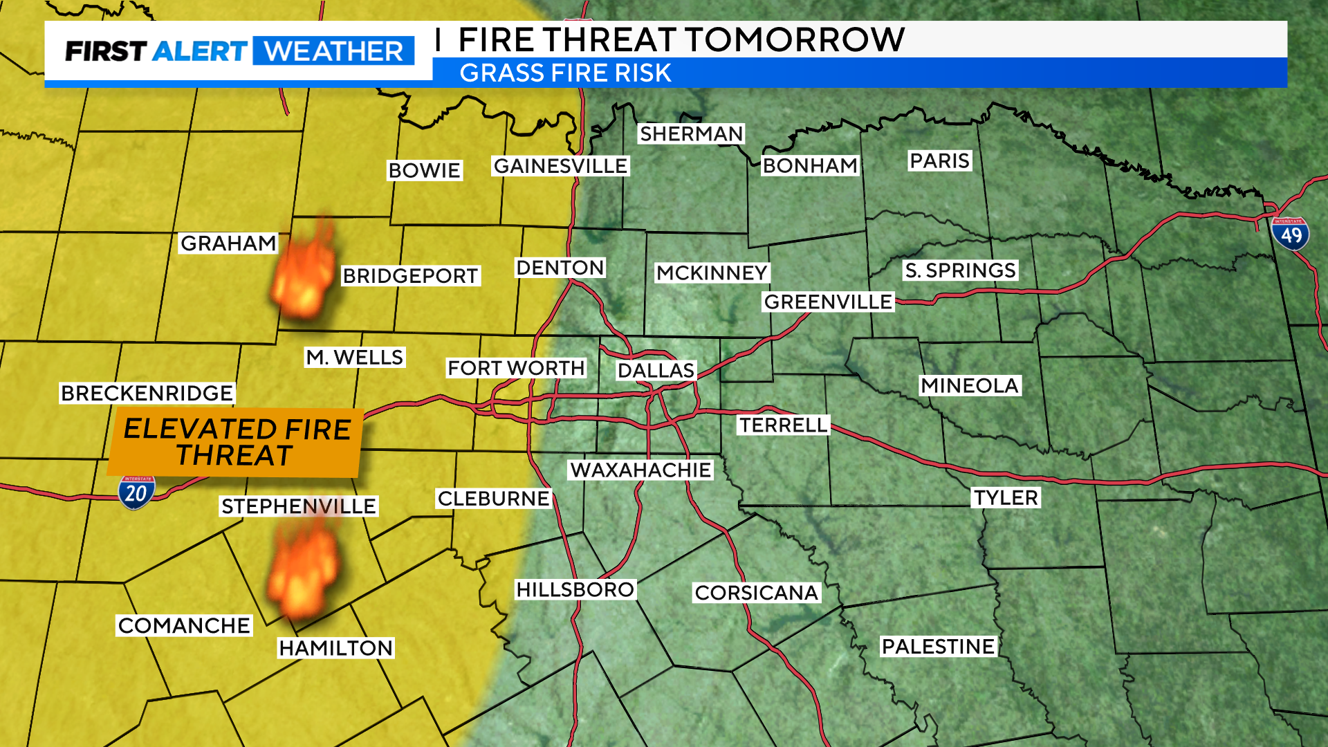
We do still have very dry air in place. Relative humidity Friday afternoon will range from 10-20%. This factor, along with gusty south winds, will lead to an elevated (but still low) fire risk to the south and west on Friday afternoon. It's just a good reminder to not do any outdoor burning at this time.
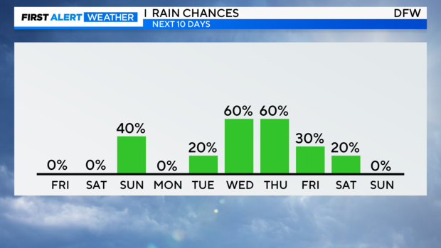
We've been alerting you to the fact that rain chances return to the forecast this weekend. Most of the day Saturday is dry, but scattered showers and a few storms will pick up overnight into Sunday. Monday and Tuesday are trending drier, but rain coverage increases heading into Wednesday and continuing through the work week.
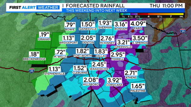
Starting late Saturday and continuing through late Thursday, models are looking at decent rainfall – especially to the east of 35.
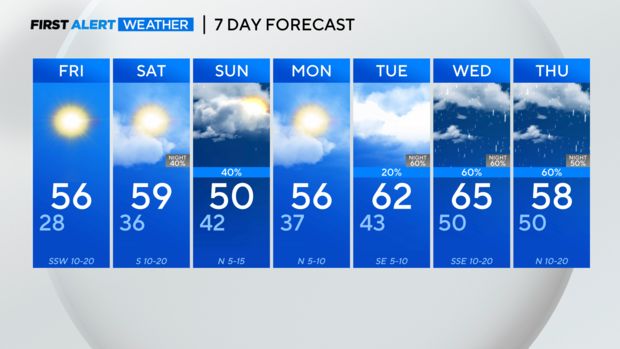
If we have to end the month with cloudy, rainy weather, at least it stays warmer.


