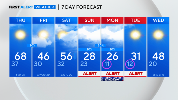
Mild Thursday before Arctic air this weekend
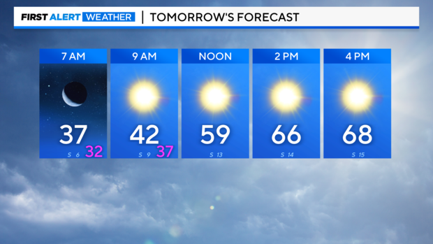
NORTH TEXAS - If you liked Wednesday's weather, enjoy it one more time on Thursday! A cool start followed by a lovely afternoon with highs in the 60s for most!
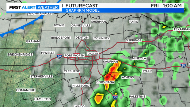
Thursday night into early Friday morning we're tracking a cold front that could bring a few storms to our area – particularly to the east of 35.
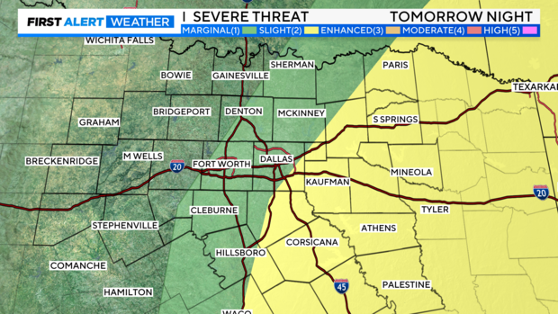
You can see the level 2 slight risk for parts of North Texas. I think the timing of this is midnight – 4 a.m., and I'm more concerned about counties south and east of the metroplex.
These storms are ahead of a front that cools things off for Friday, but the real arctic air arrives this weekend.
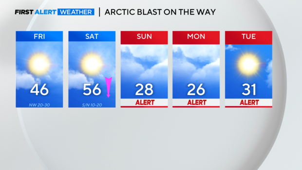
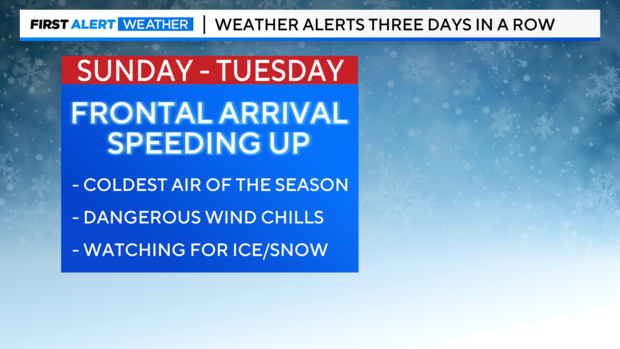
The timing of this front has sped up based on model trends today. That means it'll get colder faster, and it also increases the chance we have of seeing some winter precipitation.
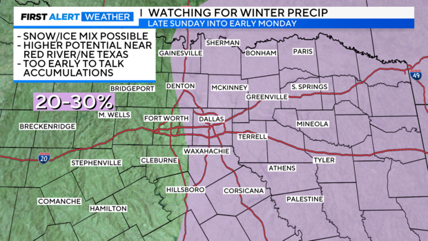
As of Wednesday night, we're watching basically along and east of 35 for the potential of an ice/snow mix. The higher likelihood is areas along the Red River and northeast of the metroplex would see the greatest chance of winter precip, but with the system arriving faster this is something we'll be watching closely.
While there's still a lot to watch with the potential for winter precip, we remain confident that these temperatures and wind chills Sunday through Tuesday will be dangerous.
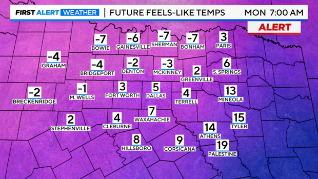
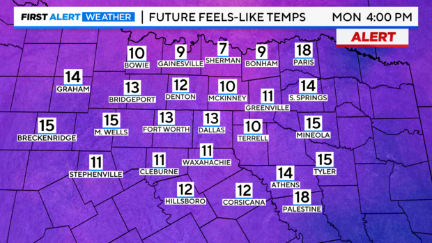
From a high of 68° Thursday to a low of 11° Monday and everything in between…we've got a lot going on over the next week.