Some areas of North Texas likely to see more snow than originally forecast

NORTH TEXAS - It has been a cold day. Brutally cold. Colder than we forecast kind of cold. So cold, in fact, we've had to adjust our forecast a bit…
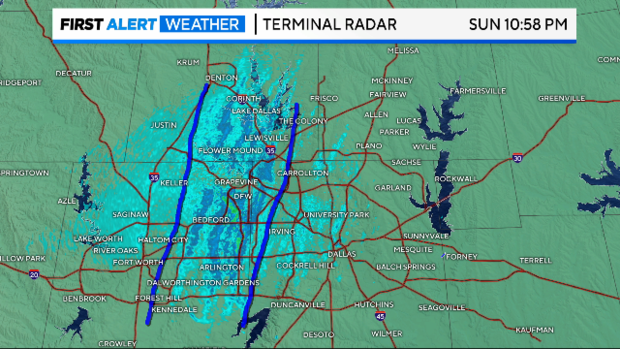
With a strong northerly wind blowing over the "warmer" waters of Ray Roberts, Grapevine and Lewisville lakes, there's been a decent showing of lake effect snow across parts of the metroplex. It hasn't amounted to much more than a dusting, but it gave us our first clue that some areas were likely going to see more snow than we were originally forecasting.
This is our new thinking. The cold temperatures are winning out. From the surface to higher up in the atmosphere, the temperatures are colder and support more of a snow profile than a freezing rain/drizzle profile. It's actually a good thing – while not everyone feels comfortable driving in a little snow, it's easier to do than ice.
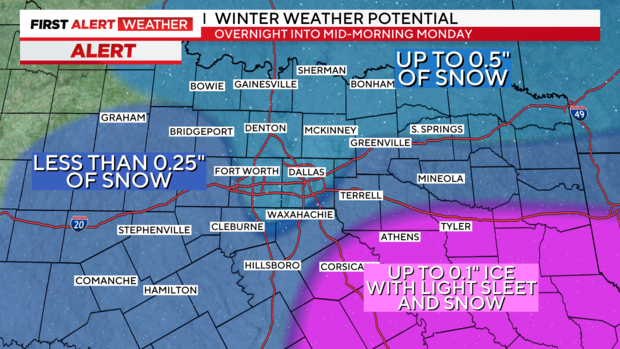
To the southeast, however, we're still going with more of an icing than a dusting of snow. First Alert Radar is already showing the coverage of freezing rain/drizzle expanding in parts of Henderson, Anderson, and Navarro counties. These are the areas that will need to be watched for icy spots heading overnight into Monday morning.
We are under a winter advisory until noon Monday and a wind chill advisory until Tuesday.


