Dangerous cold and light wintry mix headed to DFW
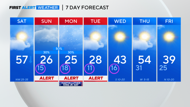
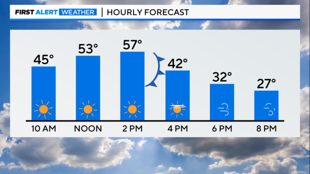
NORTH TEXAS - Today is the day to finish up your winter weather preparations as the Arctic front plunges through DFW around 3:00 p.m. Before the front arrives, it will be sunny and mild with temperatures climbing into the upper 50s. Once the front arrives, you will know as temperatures sharply drop off and fall below freezing by 7:00 p.m.
RELATED STORY: Gov. Abbott discusses preparations for incoming winter weather
RELATED STORY: Preparing your home for the Arctic blast coming through North Texas
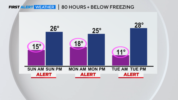
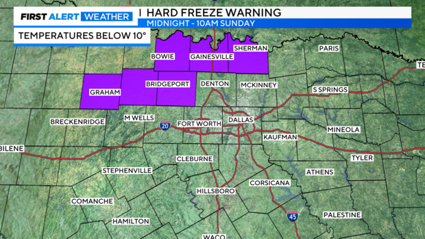
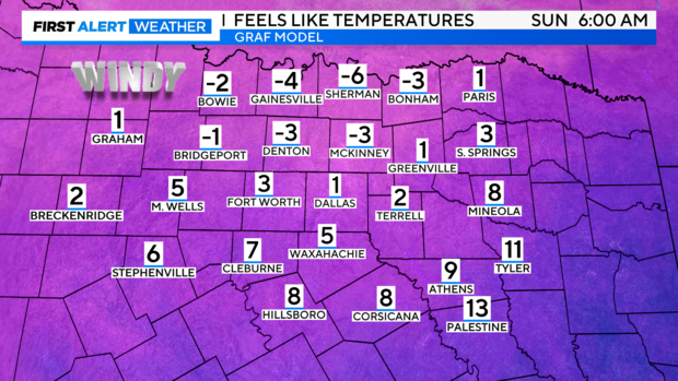
Temperatures will continue to plunge overnight even below 10 degrees in some of our northern counties. A hard freeze warning has been issued for these areas starting at midnight through 10:00 a.m. Sunday. Even though the Metroplex is not included in the warning, it will still be dangerously cold with temperatures in the 10s overnight.
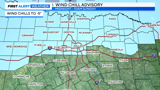
A wind chill advisory has also been issued for most of North Texas including the Metroplex. Strong northerly winds behind the front will make it feel 10-15 degrees colder than the air temperature. Wind chills to -5 are possible across the area.
It will be dangerously cold all of Sunday and right through Wednesday morning. Additional wind chill advisories are likely for Monday and Tuesday mornings. Minimize your time outdoors and dress in layers. Make sure to bring your pets inside.
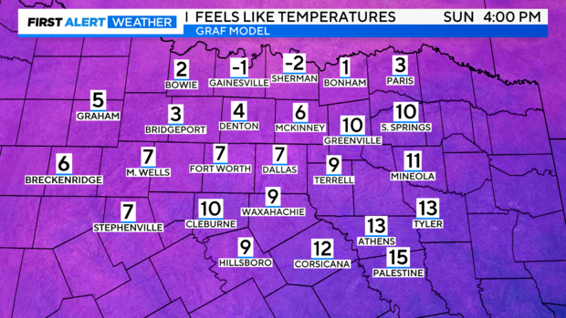
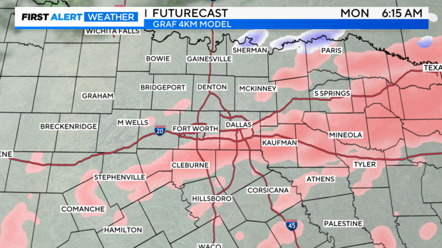
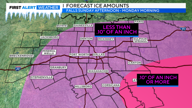
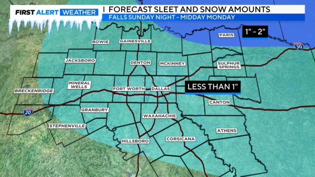
Not only will it be dangerously cold for several days but we are also tracking the potential for a wintry mix of precipitation Sunday into Monday. Freezing drizzle is possible starting early Sunday afternoon and will expand in coverage as we head into the overnight hours. Precipitation rates also increase with precipitation transitioning from freezing rain, to freezing rain/sleet, and then finally sleet/snow Monday morning. By midday Monday we are drying out but left with wind chills in the 10s.
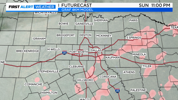
Accumulations are expected to be light but any precipitation that falls will have an impact with the Arctic air in place. If possible, stay off the roads Sunday evening through midday Monday as even a small amount of ice can make for hazardous travel. Use extra caution on bridges and overpasses where ice accumulations are most likely.
Accumulations will likely stick around until Wednesday when temperatures climb back into the 40s. The sunshine Tuesday may allow for some melting but anything left wet will refreeze overnight. Please take precautions to stay safe.