Above-normal highs through Monday for North Texas
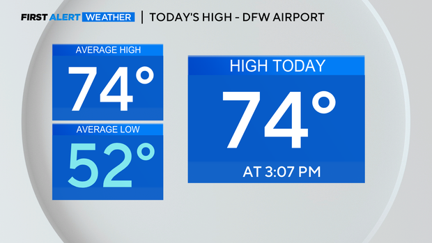
NORTH TEXAS — After a chilly start Wednesday morning with many spots in the 40s (DFW dropped to 50°), highs in the afternoon warmed into the low/mid-70s for most. We were right on track with where we should be for this time of year!
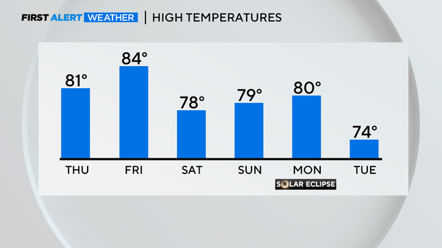
It'll be another cool start to the day Thursday, but highs should actually get to near 80°! Some will be in the upper 70s, others in the low 80s; all above normal!
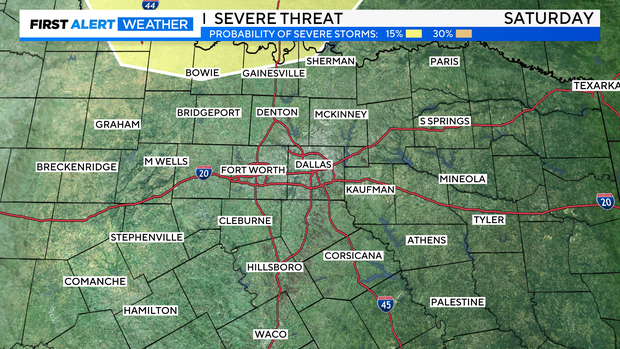
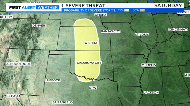
As we head into the weekend, we'll have to watch for some storms late Saturday/overnight into early Sunday morning.
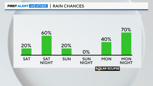
The SPC has parts of Cooke and Montague counties highlighted for the threat of severe weather Saturday night, but it appears the dynamics will be better for severe weather up into Oklahoma and Kansas.
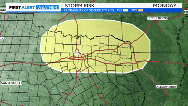
Monday is a different story though – the Storm Prediction Center has almost all of North Texas highlighted for the threat of severe weather. Given what we're seeing now, this would be after eclipse time and into the evening. This is six days out though, which is why we haven't issued a weather alert yet. We'd like to see how this evolves for another day or two, but with so many people expected to be here, it's something we'll be more aggressive with when it comes to alerting people several days out.
As Dominic mentioned in his update Wednesday morning, the cloud cover is looking more and more like an issue as we get closer to Monday.
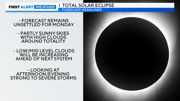
At the very least, it appears likely that we'll have high clouds during totality Monday. One thing that bears watching…we expect drier air to push in on Sunday behind Saturday night's storms. If drier air can move farther south on Sunday, it would delay the return of low/mid clouds a little longer on Monday.
Low and mid-level clouds will be increasing ahead of the active weather expected in the afternoon and evening Monday. But if the drier air on Sunday can hold the cloud cover return off on Monday a little longer, that is something to hope for…
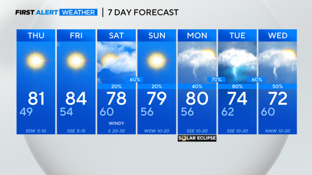
It's been a while since we've had several days in a row of unsettled weather. Of course, it would happen for a once-in-a-lifetime solar eclipse. Temps should be able to get to near 80° Monday before the bulk of the rain arrives. Then we're stuck with cloudy, rainy, and stormy conditions through mid-week.


