3rd Drought Year Feared As Extremely Dry Winter Sends Sierra Snowpack To 63% Of Average
PHILLIPS STATION, El Dorado County (CBS SF) – State water officials are warning Californians to brace for a third year of drought conditions after the driest January and February on record - dating back over 100 years - erased an early surplus in the Sierra snowpack.
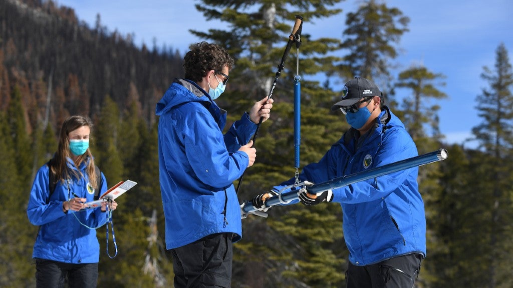
According to the Department of Water Resources, Tuesday's snow survey at Phillips Station recorded 35 inches of snow depth and a snow water equivalent of 16 inches, which is 68% of average for the location on March 1.
"The snowpack that we are standing on here today is basically the same snow that fell during December. There hasn't been much that has fallen ever since," said Sean de Guzman, Snow Survey and Water Supply Forecasting manager with the Department of Water Resources. "Since it really hasn't snowed in practically two months with really the only snow coming later this week - we are well below normal conditions."
Statewide, the snowpack sits at 63% of average for the date, with warmer spring weather looming. Officials said regionally, the Northern, Central and Southern sierra snowpacks are between 59% and 66% of the March 1 average.
"With only one month left in California's wet season and no major storms in the forecast, Californians should plan for a third year of drought conditions," agency director Karla Nemeth said in a statement.
Two months ago, water officials expressed jubilance as a series of early season storms pushed the snowpack at Phillips Station to over 200% of average and the statewide snowpack to 160% of average.
"We could not have asked for a better December in terms of Sierra snow and rain," Nemeth said on December 30.
Since then, record dry conditions have set in, including a stretch of over a month without measurable snow in some areas. The gains from the atmospheric rivers in October and December have all but been wiped out by the high-pressure system parked in the Pacific Ocean, keeping any storms from unleashing precipitation and bringing unseasonably warm temperatures.
"As the weather continues to warm, we are seeing average conditions become rarer. Precipitation is moving toward extremes," said Jeremy Hill of DWR.
Alvar Escriva-Bou, Senior Fellow with the Public Policy Institute of California's Water Policy Center, told KPIX 5 last month he wasn't surprised by the extreme precipitation variability. There are drier than average periods, and wetter than average periods.
"It totally fits the pattern. We are being less and less surprised from these climatic extremes. This is really kind of sad, and it puts a lot of stress and challenges in the ways that we manage our system," Escriva-Bou said. "What we are seeing is that we have the same amount on average, but the variability – both within a year, but also across years – is changing a lot."
In the wake of a mostly dry 2022 so far, water officials reiterated calls by Gov. Gavin Newsom urging Californians to cut back water use at least 15% compared to 2020 levels.
"A significantly below-average snowpack combined with already low reservoir levels make it critical that all Californians step up and conserve water every day to help the state meet the challenges of severe drought," Nemeth said Tuesday.
Andria Borba contributed to this report.


