Magnitude 3.0, 2.7 Earthquakes Strike Near Gilroy Overnight
GILROY (CBS SF) -- Two minor earthquakes struck near Gilroy early Monday morning, according to the U.S. Geological Survey.
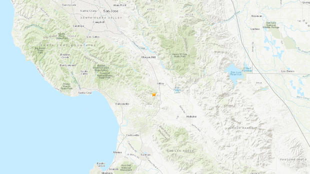
The first earthquake, a magnitude 3.0, struck 3 miles southwest of Gilroy around 1:37 a.m. Nearly four hours later, at 5:36 a.m., a magnitude 2.7 earthquake struck the same area.
Visitors to the USGS website, mostly in southern Santa Clara County and the Santa Cruz area, reported feeling light shaking from the earthquakes.
There are no immediate reports of damage or injuries.
This article will be updated as information warrants, and follow KPIX 5 on Twitter at @KPIXtv for updates on breaking news anytime.
DID YOU FEEL IT?: USGS Shake Map For Northern California
LIVE QUAKE MAP: Track Real-Time Hot Spots
BAY AREA FAULTS: Interactive Map Of Local Faults
Strong earthquakes with an epicenter off the coast can trigger tsunamis, depending on the size and type of the fault movement. The Pacific Tsunami Warning Center tracks earthquake data for the West Coast.
WEST COAST TSUNAMI TRACKING:

Tsunami Alerts & Maps