Chance of snow showers this evening ahead of slow warming trend

PITTSBURGH (KDKA) - After several days of bitter cold, temperatures are trending upward across Western PA and Northern WV. So far, this January is the 14th coldest on record in Pittsburgh thanks to several weeks of below average temperatures.
WEATHER LINKS:
Current Conditions | School Closings & Delays | Submit Your Weather Photos
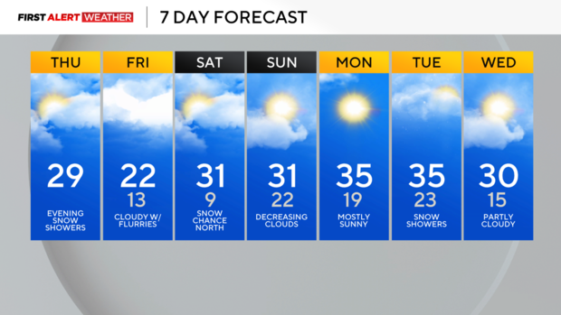
This morning's low of 10 degrees in Pittsburgh was almost 20 degrees warmer compared to Wednesday morning, but still well below normal for this time of year. Southwest flow ahead of an approaching clipper system and cold front will allow temperatures to peak in the mid to upper 20s for most of this afternoon. A few spots may even come close to 30 degrees. Mid and high level clouds are spreading in from the west in association with another cold front associated with this evening's clipper system. This will bring a few scattered snow showers during evening hours between 6 p.m. and midnight. A quick dusting to 1 inch is possible, but this will not be a big or prolonged snow event for most.
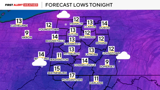
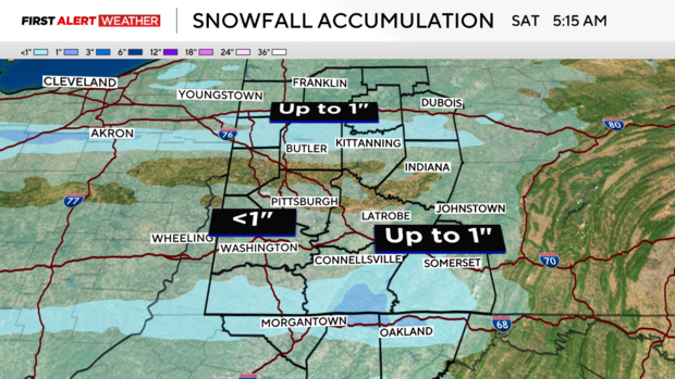
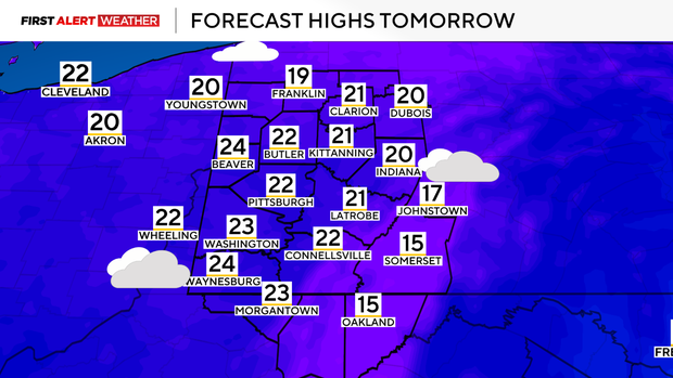
Cloudy skies and a few lingering flurries are expected to continue into Friday. A reinforcing shot of cooler air will only allow temperatures to peak in the low to mid 20s, as opposed to the upper 20s to almost 30 we're expecting today. We will have one more night with temperatures nearing the single digits for Saturday morning as high pressure moves overhead. This will move east through the upcoming weekend allowing southwest flow to return and temperatures to warm back into the lower 30s. Another fast-moving clipper system may graze our northern counties Saturday afternoon into Saturday night with a chance of snow, but the majority of our region appears to miss out at the moment. Skies will begin to clear out on Sunday with mostly sunny conditions to start next week.
Outside of a small chance of snow on Tuesday, the majority of the next week looks fairly dry across our region with no major weather systems to speak of.
Stay up to date with the KDKA Mobile App – which you can download here!


