NASA
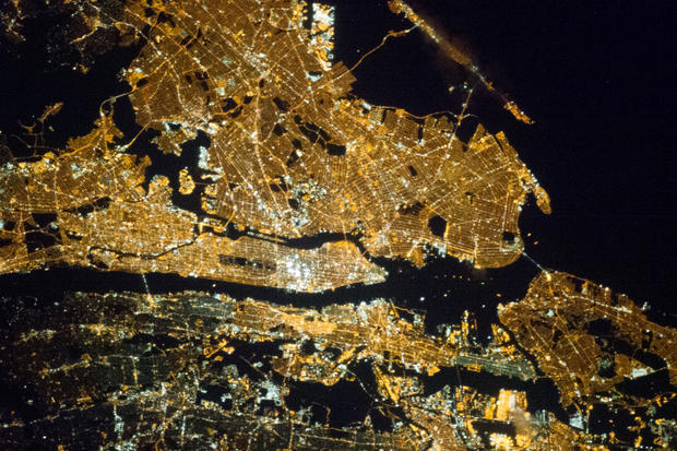
One of the Expedition 35 crew members aboard the Earth-orbiting International Space Station exposed this 400 millimeter night image of the greater New York City metropolitan area on March 23, 2013.
Central Park is just a little to the left of frame center.
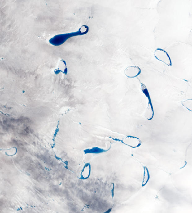
Greenland Melt Ponds
NASA
Each spring and summer, as the air warms up and the sunlight beats down on the Greenland ice sheet, sapphire-colored ponds spring up like swimming pools. As snow and ice melt atop the glaciers, the water flows in channels and streams and collects in depressions on the surface that are sometimes visible from space. These melt ponds and lakes sometimes disappear quickly - a phenomenon that scientists have observed firsthand in recent years.
This image was acquired on July 4, 2010, by the Advanced Land Imager on NASA
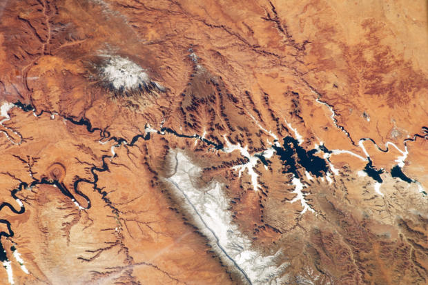
An Astronaut's View of the Colorado Plateau
NASA
The Colorado Plateau spans northern Arizona, southern Utah, northwestern New Mexico, and southwestern Colorado. This physiographic province is well known for its striking landscapes and broad vistas
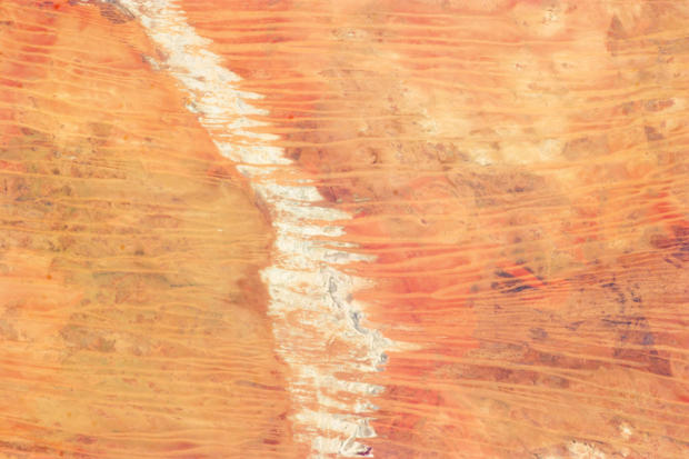
Great Sandy Desert, Australia
NASA
In northwest Australia, the Great Sandy Desert holds great geological interest as a zone of active sand dune movement. While a variety of dune forms appear across the region, this astronaut photograph features numerous linear dunes (about 80 feet high) separated in a roughly regular fashion (0.3 to 1 mile apart). The dunes are aligned to the prevailing winds that generated them, which typically blow from east to west. Where linear dunes converge, dune confluences point downwind. When you fly over such dune fields
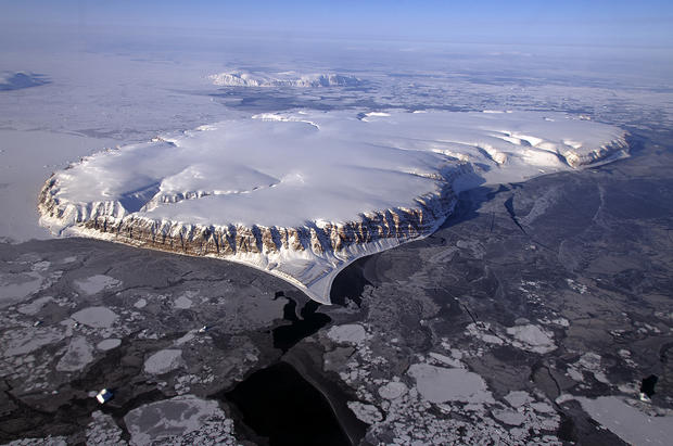
Saunders Island and Wolstenholme Fjord
NASA
This image of Saunders Island and Wolstenholme Fjord with Kap Atholl in the background was taken during an Operation IceBridge survey flight in April, 2013. Sea ice coverage in the fjord ranges from thicker, white ice seen in the background, to thinner grease ice and leads showing open ocean water in the foreground.
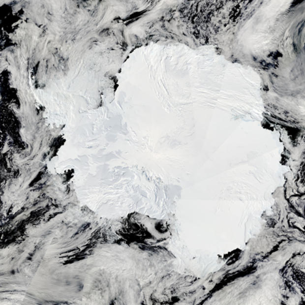
Antarctica
NASA
Relatively few people have seen Antarctica. A myth until the early 1800s, the ice-covered southern continent is difficult to get to and hostile to most life. But now, the MODIS Rapid Response System at NASA's Goddard Space Flight Center is producing daily photo-like images of Antarctica. The images are valuable to scientists studying everything from ice to penguins, as well as to the crews of ships navigating through the southern ice pack.
The Moderate Resolution Imaging Spectroradiometer (MODIS) on NASA
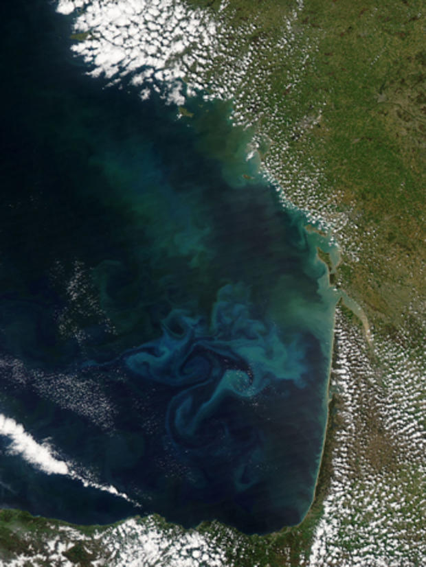
Springtime in the Bay of Biscay
NASA
Springtime in the Bay of Biscay, off the coast of France, as in most places, is a season of abundant growth. On April 20, 2013, the Moderate Resolution Imaging Spectroradiometer (MODIS) aboard NASA's Aqua satellite captured this true-color image of the dynamic growth of a springtime phytoplankton bloom.
The swirling colors indicate the presence of vast numbers of phytoplankton
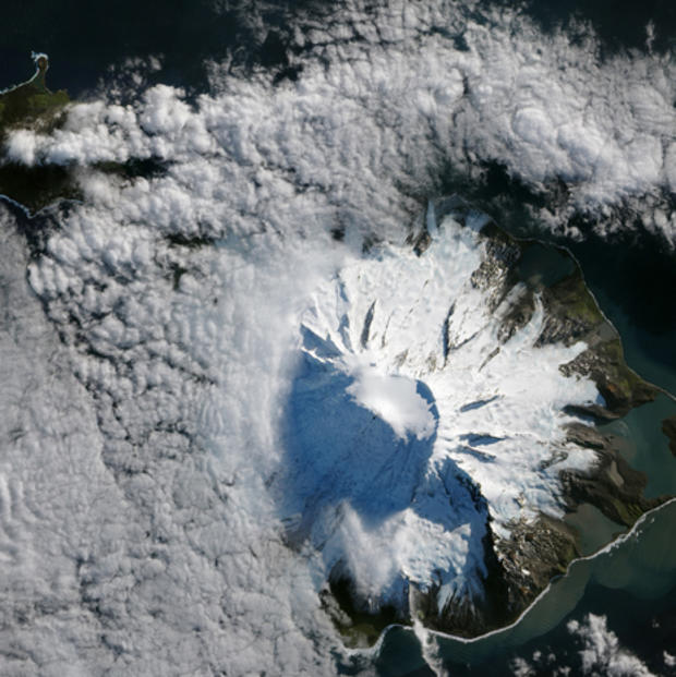
Lava Flow on Mawson Peak, Heard Island
NASA
In October 2012, satellites measured subtle signals that suggested volcanic activity on remote Heard Island. These images, captured several months later, show proof of an eruption on Mawson Peak. By April 7, 2013, Mawson's steep-walled summit crater had filled, and a trickle of lava had spilled down the volcano