Philadelphia weather: Arctic blast settles in, tracking two chances for snow this week

PHILADELPHIA (CBS) -- A NEXT Weather Alert is currently in effect through Sunday as the Delaware Valley braces for a long stretch of dangerous cold and some accumulating snow.
What we're tracking
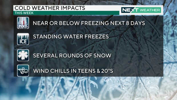
A blast of arctic air has settled over the region, and another round of frigid air is set to move in later in the week. Breezy conditions will eventually let up midweek, but prepare to dress for dangerous wind chills Friday into the weekend.
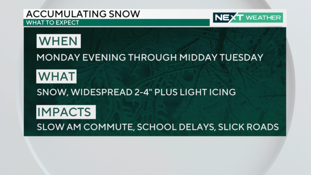
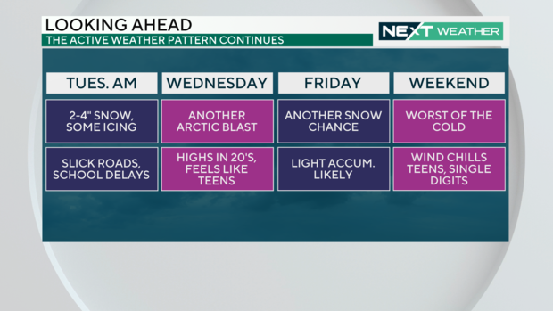
We're also looking at accumulating snow Monday night into Tuesday, and then again on Friday.
A Winter Weather Advisory went effect for the entire region Monday night until Tuesday afternoon.
Dangerously cold temperatures
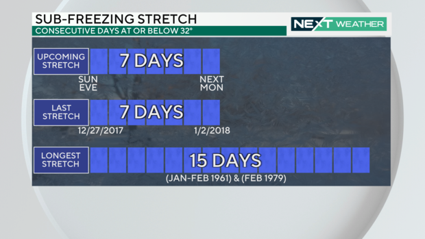
If you prefer warmer weather, this won't be welcome news. This week the region will experience some of the coldest temperatures we've seen in several years. Monday through Thursday temps will struggle to make it above freezing, with wind chills making it feel like the teens and single digits. Up in the Poconos, it'll feel like below zero at times.
The coldest days of the week are Wednesday, high of 23 and low of 16, and Saturday, high of 27 and low of 18 degrees.
Air this cold can lead to frostbite, burst pipes, frozen standing water, car issues, and even fires from improper use of space heaters or stoves.
RELATED: Code Blue issued across Philadelphia region: What you need to know
First round of snow
The first round of snow started at around 7 p.m. Monday along the Jersey Shore, with the heaviest amounts falling there closer to 10 p.m.
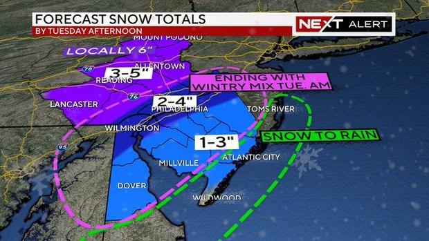
Around Philadelphia, snow picks up overnight and continues until midday Tuesday.
Across South Jersey, Delaware and the I-95 corridor, we're looking at about 2-4 inches of snow. Areas to the north and west could see 3-5 inches with up to 5 inches in higher elevations.
Parts of South Jersey that are closer to the shore are looking at 1-3 inches and a mix of snow and rain.
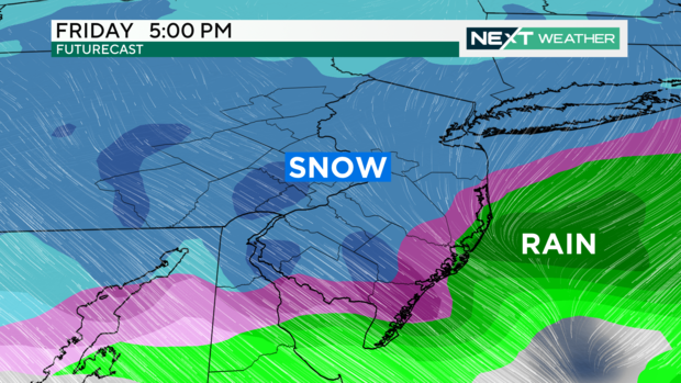
Second round of snow
The next batch of snow will mostly happen later in the day Friday. According to Meteorologist Kate Bilo, this system is "very complicated" and could end up just being snow showers, but there's also a possibility for more significant snow.
The storm track and timing could change before Friday night, so keep an eye on CBS Philadelphia for the latest forecast updates.
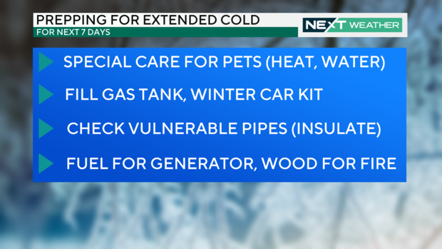
How to prepare for extended cold
- Special care for pets (heat, water)
- Fill gas tank, winter car kit
- Check vulnerable pipes
- Fuel generator, wood for fire
7-day forecast:
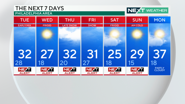
Monday: High of 31
Tuesday: High of 35, low of 28
Wednesday: High of 28, low of 17
Thursday: High of 32, low of 21
Friday: High of 31, low of 27
Saturday: High of 26, low of 18
Sunday: High of 29


