NEXT Weather: Winter Storm Warning, scattered showers & wind
UPDATE: Brace for wind gusts as high as 50 mph Tuesday
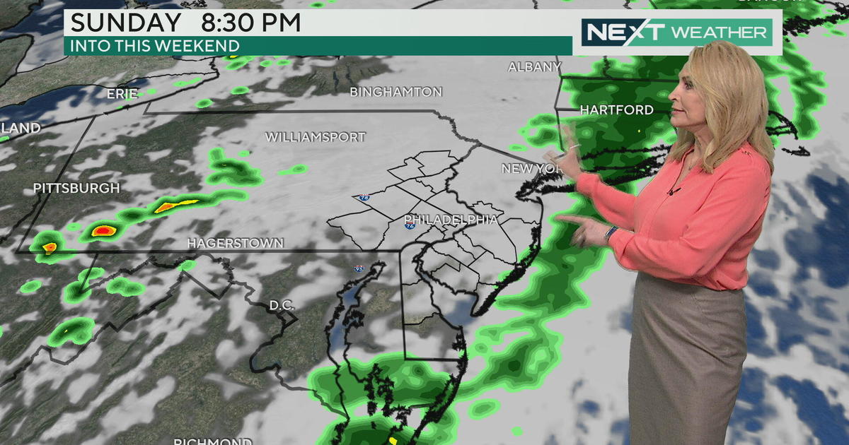
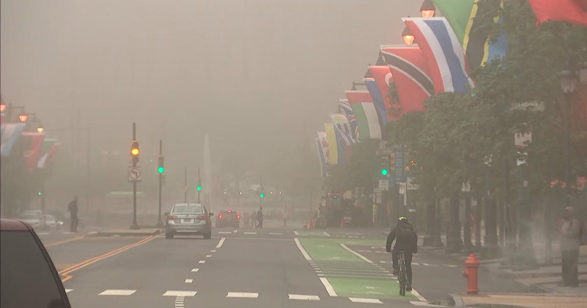
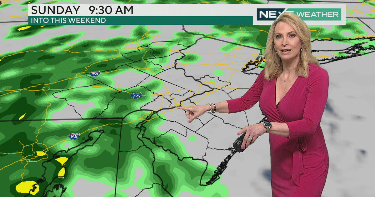
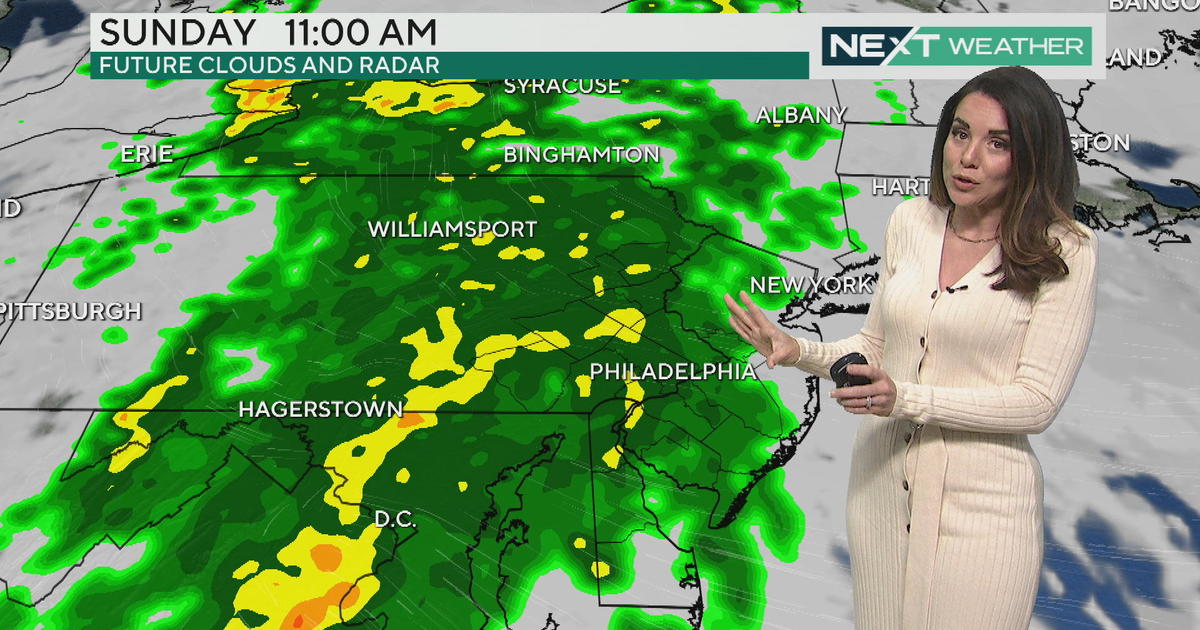
PHILADELPHIA (CBS) – The new week begins with a winter storm for the Poconos, fog and scattered showers for the city and shore, and a whole lot of wind for everyone come Tuesday and Wednesday.
A NEXT Weather Alert is in effect through Tuesday afternoon across the area for weather that has the potential to impact your evening and morning commutes.
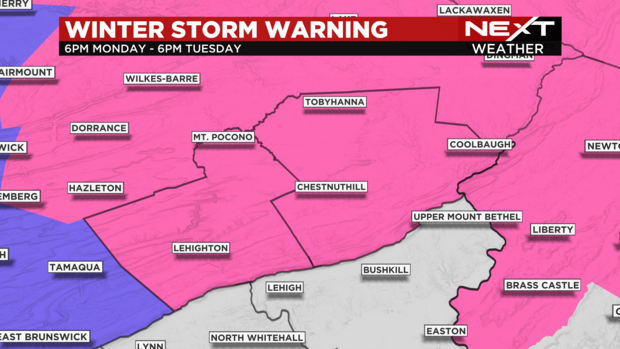
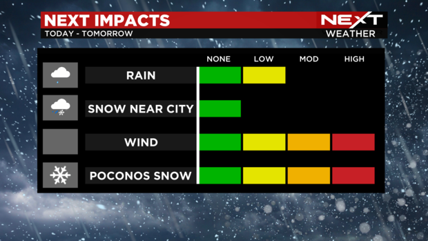
A Winter Storm Warning will go into effect Monday evening and last through Tuesday evening for Carbon and Monroe Counties. Here, 6-12" of snow may accumulate, with rates as high as 1" per hour late tonight into Tuesday. South of the Lehigh Valley, expect a few snowflakes but little accumulation. For Philadelphia, expect just light scattered showers from this system, with a few flakes flying around Tuesday (again, little to no accumulation).
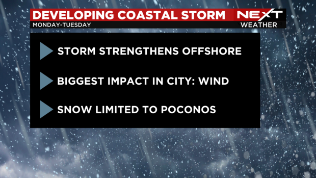
This is a complex system that will give snow. Similar to Friday night's storm, it will strengthen offshore, but this one is expected to stick around longer and grow stronger just offshore, leading to a prolonged period of impacts through Wednesday.
Here's the timing of the impacts as of now in our area.
Monday evening: scattered light showers for the city and the shore; steadier snow in the Poconos
Monday night: rain may mix with a little wet snow near Philadelphia; steady snow in the Poconos
Tuesday morning: Becoming windy everywhere. A few light snow showers in the city; accumulating snow continues in the Poconos
Tuesday afternoon: snow diminishes, winds gust over 45 mph
Wednesday: sun returns, winds gust over 40 mph
Most precipitation should be out by Tuesday evening, but we'll be watching closely.
Due to the prolonged nature of this system, snow will be able to pile up in the Poconos. Snowfall rates will pick up throughout the day and night in the higher elevations and then continue with varying degrees of intensity right into Tuesday afternoon. This will allow for 6-12" of snow when all is said and done. Further south, we aren't looking at much in the way of significant accumulation as this will predominantly rain until late tonight or Tuesday, but can't rule a half an inch or so, especially just north of Philadelphia.
Winds may be the bigger threat in the city and surrounding suburbs - gusts will exceed 30 mph early Tuesday and then increase to over 45 mph by late Tuesday. A Wind Advisory is likely for the area. Even with the sun returning Wednesday, the blustery conditions persist.