"Unprecedentedly strong" typhoon heads for Japan
TOKYO -- Japan was bracing for destructive winds and huge waves as a powerful typhoon churned Monday toward the southern islands of Okinawa after sparing the Philippines.
Typhoon Neoguri is expected to reach Okinawa early Tuesday, packing sustained winds of 123 miles per hour and gusts up to 168 mph, the Japan Meteorological Agency said. It said the storm could be one of the strongest to hit Japan in decades, generating waves up to 46 feet high.
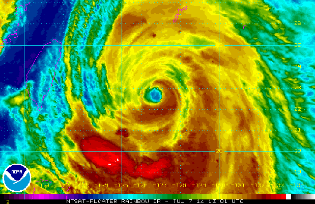
"There is a risk of unprecedentedly strong winds and torrential rains. Please refrain from nonessential outdoor activities," Meteorological Agency official Satoshi Ebihara told reporters at a news conference.
The agency issued a special warning for violent winds and flood tides.
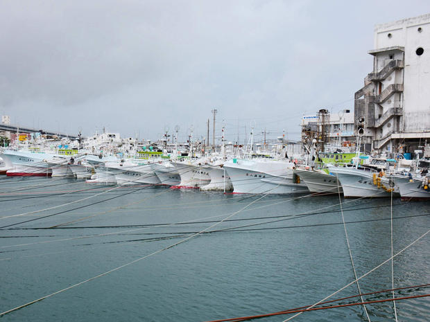
Television reports showed workers in Okinawa tying braces onto palm trees to help minimize damage.
Government leaders held an emergency meeting and urged local governments and residents to take maximum precautions.
Forecasts show the storm tracking toward Kyushu island and then across Japan's main island of Honshu. It is forecast to lose some power over land, but winds and heavy rains could cause landslides and other damage, Ebihara warned.
The typhoon comes on the tail end of Japan's summer rainy season, and landslide warnings already are in effect for some areas due to those seasonal downpours.
The Philippines was spared from the ferocious winds of Neoguri, which blew closest to land late Monday when it roared about 298 miles east of the northernmost province of Batanes, government weather forecaster Gladys Saludes said.
While the typhoon did not make landfall, it intensified the southwest monsoon, dumping heavy rains to some western Philippine provinces, she said.