Severe cold persists as forecasters track another potential East Coast storm
Another winter storm may be headed toward the East Coast this weekend, on the heels of the powerful and deadly system that blanketed huge swaths of the country in snow and ice and killed dozens. The effects of that storm have lingered for many areas in its path and will likely remain as repeated bouts of Arctic air plunge downward from Canada and keep temperatures below freezing.
This could ultimately mark the longest stretch of cold the Eastern and Southeastern U.S. have experienced in decades, according to the National Weather Service.
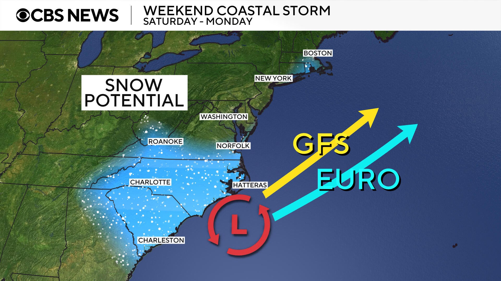
Alongside the next wave of frigid air is a potential storm brewing off the coast of the Carolinas. Its forecast remained somewhat uncertain, although meteorologists anticipated it would at least affect stretches of the coastline and sections of surrounding mid-Atlantic states. Maps created by CBS News meteorologist Nikki Nolan illustrate possible forecast outcomes based on the latest weather modeling.
Maps show potential storm track
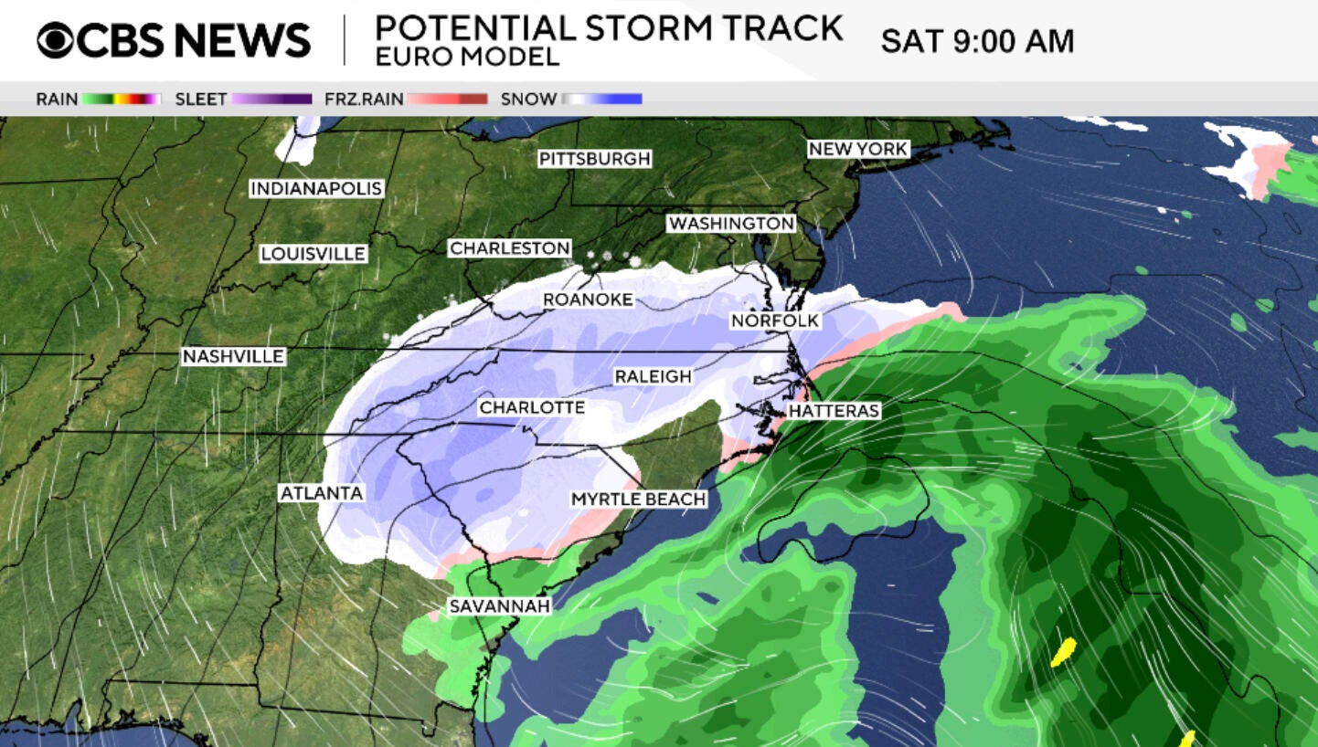
A coastal low-pressure storm system seemed poised to form off the Carolina coast on Friday, potentially laying the foundation for another winter storm this weekend, the National Weather Service said.
Different forecast models plotted diverging paths for the storm after its expected turn northward, at which point some indicate that the system will veer slightly toward the east, while others suggest its track will tilt westward instead. In the first scenario, the storm — and the snowfall that could accompany it — would largely avoid land. In the second, its westward lean could bring wintry weather, including more snow, to parts of the Northeast.
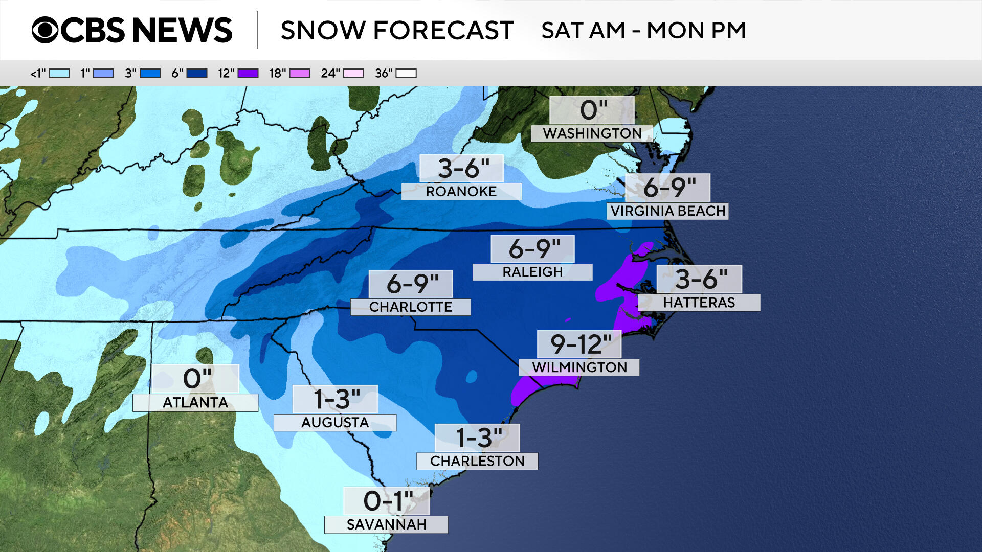
Meteorologists have become fairly confident that snowfall will affect southern Mid-Atlantic states, the Carolinas and Southern Appalachia, but the forecast was still variable for places farther up the coast.
"There does remain some uncertainty as to where this storm will track," said Allison Santorelli, a meteorologist at the National Weather Service's Weather Prediction Center. "At this point, though, we have high confidence in a significant winter storm for the Southern Appalachians and southern Mid-Atlantic. Confidence is lower farther up the coast towards New England and is more dependent on the exact storm track."
Regardless of the track, Santorelli said meteorologists expected "significant" impacts" for a solid portion of the East Coast this weekend, including high winds. That echoed a warning from the National Weather Service in a bulletin Thursday morning, cautioning that the storm "will produce powerful onshore winds along the Mid-Atlantic Coast from the North Carolina Outer Banks northward," with some gusts strong enough to produce coastal flooding.
Winter storm warnings and watches have been issued for parts of the Carolinas, Georgia, Illinois, Massachusetts, Tennessee, Virginia and West Virginia. Most are set to remain in place until Sunday, although some will be more brief.
In Virginia and the Carolinas, which are expected to feel the brunt of the storm, meteorologists have forecast blizzard conditions bringing "sharply reduced visibilities" and "making travel extremely treacherous. They also predict heavy snowfall in those states, possibly as much as 16 inches in some areas.
Dangerous wind gusts could materialize as well, some of which may approach hurricane force. The National Weather Service forecast office in Newport, North Carolina, warned people in the area to brace for gusts of up to 65 mph.
Another Arctic blast
An upcoming surge of Arctic air will keep temperatures below freezing, likely creating a prime environment for snow to stick and potentially pile up on roads and other surfaces.
Temperatures on Friday morning could drop to record lows in a number of eastern cities, including Baltimore, Buffalo, New York City, Philadelphia and Pittsburgh.
At New York's LaGuardia Airport, forecasts indicated the temperature could sink to 4 degrees Fahrenheit, tying a record set nearly 80 years ago — in 1948. A similar freeze was expected in New Jersey, where the temperature around Newark Airport could fall to 3 degrees, tying an even older record set in 1935. The coldest conditions would likely materialize farther inland, with forecasts showing temperatures dropping to -8 degrees in Pittsburgh and -5 degrees in Buffalo. Each would break record lows for those cities set in 2019.
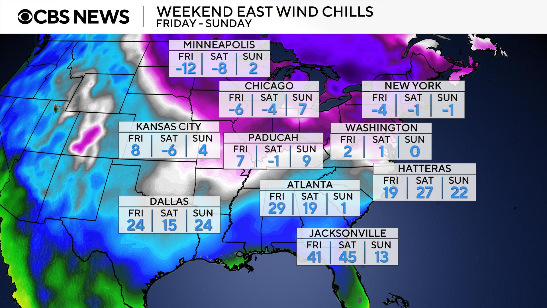
The addition of the developing storm off the Carolina coast will create severe wind chills well below zero degrees across the eastern U.S. and parts of the South, including areas experiencing ongoing power outages since last weekend.
A possible "bomb cyclone"
Despite variations in the storm forecasts, meteorologists have been discussing the possibility that a "bomb cyclone" could form if the storm escalates quickly. Nolan said the conditions forecast for this weekend potentially lend themselves to this phenomenon, which is also called "bombogenesis" and involves a winter storm undergoing rapid intensification, but she also emphasized that its development is not guaranteed.
Santorelli said a storm classified as a "bomb cyclone" while traveling up the coast was becoming increasingly plausible, based on the latest forecast models. She added that the storm would be more likely to go through the rapid intensification process if it tracks farther away from the coast "with less interaction with land masses" as it moves northward.