"Bomb cyclone" bearing down on central U.S.; winter storm expected to bring blizzard conditions
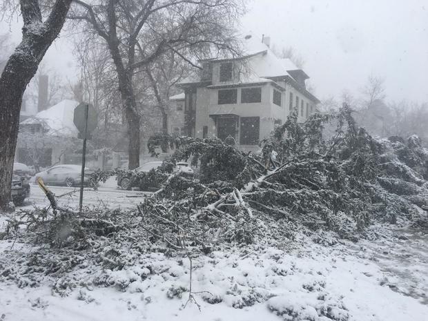
Denver — A powerful and deadly winter storm that has been bearing down on the central U.S. slammed Colorado on Wednesday, bringing blizzard conditions and winds equal to a Category 2 hurricane to Colorado Springs, CBS Denver reports. Denver's weather was so severe that police were unable to respond to the high volume of motor vehicle accidents, according to a tweet by Denver's Emergency Management Office.
A Colorado State Patrol corporal died after being hit by a vehicle in Weld County, state police tweeted. Cpl. Daniel Groves, 52, was on the scene of a vehicle that slid off the road when a 2001 Volvo lost control and struck Groves. Police said "high-speed driving in poor driving conditions" is being investigated as a possible cause.
Meanwhile, more than 100,000 customers are without power in Colorado as of Wednesday afternoon, according to Xcel Energy. Travelers are also facing headaches at Denver's airport, where some are stranded because of Mother Nature.
First responders in the Denver area reported Wednesday that "conditions continue to deteriorate."
"I can't say I've seen a storm with such intensity this far west in the Plains," said CBS News climate and weather contributor Jeff Berardelli.
The storm is being called a "bomb cyclone" because the pressure in the center of the storm was expected to drop quickly as it raced toward Colorado. There have been reports of so-called "thunder snow" as lightning mixed with heavy bands of snow.
What is a "bomb cyclone"?
In the Northern Hemisphere, areas of low pressure are called cyclones, and rapidly developing storms are often called bombs or weather bombs. To qualify as a "bomb cyclone," an area of low pressure must drop at least 24 millibars in 24 hours or less. Weather models show the center of Wednesday's low pressure dropping anywhere from 24 to 30 millibars in less than a day as it gains strength over Colorado's eastern plains, CBS Denver reported.
Other terms you may hear in meteorology when dealing with a storm like this include "explosive," "cyclogenesis," or "bombogenesis." Explosive refers to the rapid growth, and cyclogenesis means you have an area of low pressure that is gaining strength.
"A set of unique factors are all coming together for a rapid drop in pressure," Berardelli said. "The definition of bombogenesis is a pressure drop of 24 millibars in 24 hours. This will far exceed that."
So far, this storm has dropped 33 millibars since Tuesday morning and continues to strengthen, CBS Denver reports.
Winter storm forecast
The storm was expected to keep intensifying Wednesday in the Central Rockies, push eastward through the Central Plains Wednesday and into the Upper Mississippi Valley and Upper Great Lakes region Thursday.
The National Weather Service Denver/Boulder said, "Blizzard conditions are likely across the northern mountains, northern foothills, Palmer Divide and adjacent plains. Travel across the region will be difficult, if not impossible," because of "white-out conditions and drifting of snow especially across the Plains."
Weather officials said a wind gust of 97 mph was recorded in Colorado Springs.
The NWS said Wednesday afternoon there was an 80 mph peak wind gust recorded at the Denver International Airport. CBS Denver reported more than 1,300 flights have been canceled there because of weather conditions.
Several passengers were stranded at DIA after some airlines didn't have a representative to help them navigate a re-booking.
"Nobody is here, every other airline has a representative. So, I'm stuck here with two small children and I don't know when I'll get home," one passenger told CBS Denver.
The storm could be historic in terms of the minimum pressure that could be measured in the Colorado region, CBS Denver reported. In other words, the storm is an aberration, which is part of the reason a laundry list of weather watches, warnings and advisories were in place across the state.
Meanwhile, thunderstorms were expected to keep pushing eastward Wednesday from the Southern Plains to the lower to middle Mississippi Valley. "Heavy rains ... isolated flooding and severe weather will accompany these thunderstorms as they march fairly quickly eastward," the weather service said.