Next Weather: More storms possible early Monday
MINNEAPOLIS -- The risk of severe storms has diminished for late Sunday evening and into the overnight, but more storms may be on the way Monday morning.
Storms that started to roll through the state Sunday morning led to several reports of hail, downed trees and even some downed powerlines in parts of northern and northwestern Minnesota. Wind gusts were also clocked in at up to 65 mph.
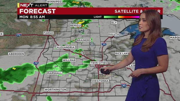
Monday morning holds our next chance for some scattered thunderstorms beginning during the morning commute and lingering throughout the day. Southern Minnesota, including the Twin Cities, appear to be the areas that will be most impacted, but northern and central Minnesota may also see some sprinkles.
Monday's high temperatures will be in the low 80s in the metro and most of southern Minnesota, while the northern part of the state will be in the low 70s.
Dew points will start to fall early Monday morning, and it will feel comfortable humidity-wise through Tuesday.
Tuesday through Thursday will be dry, slightly warmer and mostly sunny. Temps will rise back into the 90s by the end of the work week, and it will stay hot through the weekend. Friday morning is the next chance for rain and storms