More light snow arrives today, with an arctic blast to follow

MINNEAPOLIS — The next weak clipper arrives today bringing another dose of light snow.
Most of the snow looks like it'll fall this afternoon through tomorrow morning around the metro. Amounts will be minor, with 1"-3" expected before ending by Sunday afternoon.
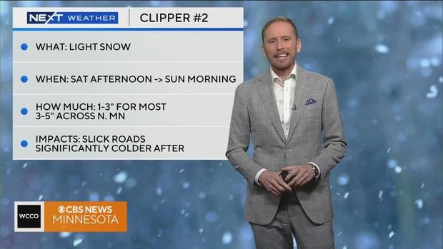
There is a winter weather advisory in effect for central and northern Minnesota until 3 p.m. on Sunday. These areas may see as much as 3-5" of snow.
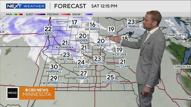
Highs will be in the 20's on Saturday and Sunday, but that won't last very long.
Behind this system, temperatures drop off again Sunday afternoon as arctic high pressure returns.
Coldest will be Sunday night through Wednesday morning, with wind chills pushing -20° each morning.
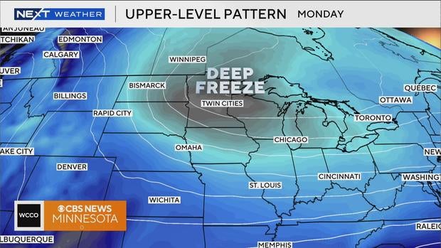
Actual highs will be in the single digits above 0° with lows below 0°.
It looks like there's another warm up toward the end of next week, with highs back near 32° and no significant chances for snow.


