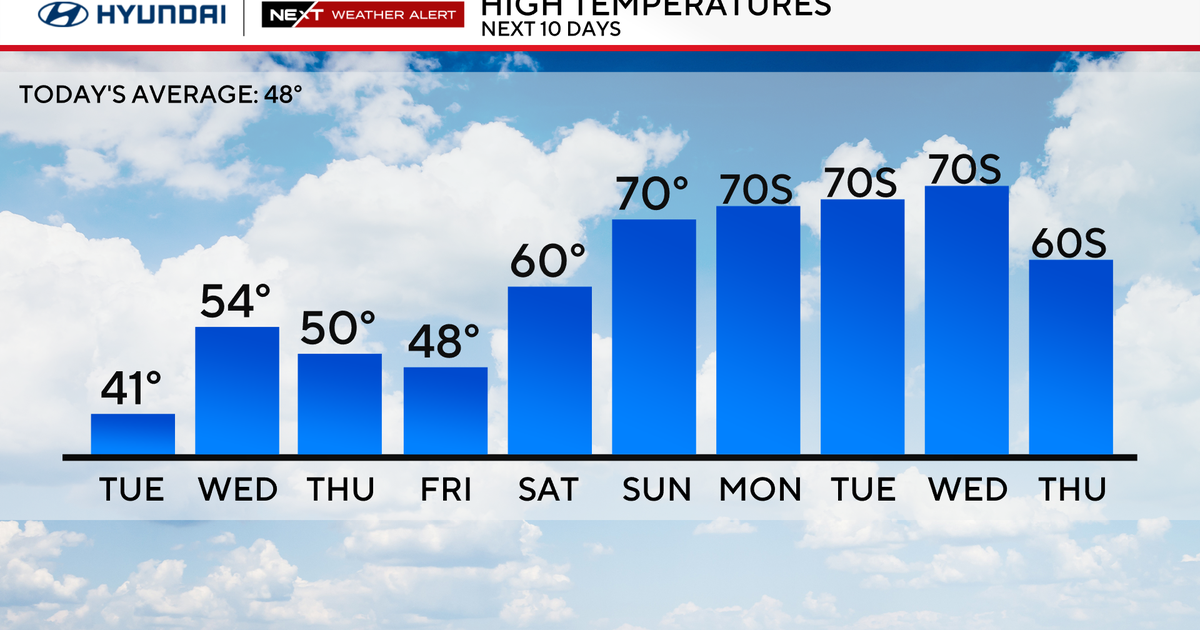
Josh Rubenstein's Weather Forecast (December 1)
STUDIO CITY (CBS) — The winds were howling all night long, and I'm sure many of you are waking up to a mess this morning, but we are not done with this system yet.
The area of low pressure has dropped south and is cutting off. High pressure is building in from the Pacific and there is a strong surface high in the Great Basin. This is the recipe for fierce winds.
Winds have been peaking at 60 to 80 miles per hour, but sustained winds have been holding strong at 20 to 30 miles an hour.
The San Fernando Valley, Santa Clarita Valley, and the Inland Empire were hit the hardest overnight, but trees, utility poles and power lines were knocked down across the Southland.
The winds will stay strong through the morning hours before pulling back a bit Thursday afternoon. Another round will kick in late Thursday night through Friday afternoon.
As far as temperatures go, the cold air came riding in on these winds. Temperatures will be topping out in the mid 60s Thursday, but with the wind blowing in your face, it might feel a little cooler.
We are still expecting breezy conditions into Saturday and the off-shore flow remains in effect through Tuesday, which means you can expect high fire danger throughout the weekend.
Here are some peak gusts:
LAX 38 mph
Saugus 67 mph
Acton 76 mph
Palmdale 45 mph
Whitaker Pk 97 mph