Incoming Storm Could Bring Rain And Snow To Southland
LOS ANGELES (CBS) — Another in a series of small but mighty winter storms is about to unwind over Southern California, but exact predictions about this storm are again dicey, a meteorologist said Sunday.
A cut-off low is the weatherman's woe, "and we are doing a lot of crying right now," joked National Weather Service meteorologist David Sweet.
Such a description defines the weather pattern that deposits a spinning storm system over Southern California, cut off from the high-altitude jet stream winds that generally sweep from west to east across this continent.
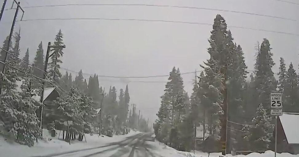
The latest cut-off low storm should bring rain and snow, starting late Sunday night or early Monday. Snow could affect travel along the Grapevine section of Interstate 5 by Monday afternoon, Sweet said.
By late Sunday night or early Monday, snow is expected at elevations of about 5,000 feet and higher, lowering to about 3,500 feet by the time the weather system moves east later Monday.
The two major freeway passes into and out of Los Angeles -- El Cajon Pass and the Tejon Pass -- both top out at more than 4,000 feet.
"By Monday afternoon we could be looking at some snowflakes falling on the Grapevine, and then by Monday night there is a chance for some significant accumulations," Sweet said.
The Antelope Valley (14) Freeway over 3,258-foot-high Escondido Summit at Acton should escape the snow, according to the NWS. But in the high country, as much as 10 inches of snow could fall.
A couple of early season rains has put Los Angeles ahead of its seasonal rainfall norm, with about 2.75 cumulative inches at the USC weather station since July 1. The basin historically averages about 15 inches of rain per year.
(©2011 CBS Local Media, a division of CBS Radio Inc. All Rights Reserved. This material may not be published, broadcast, rewritten, or redistributed. Wire services contributed to this report.)