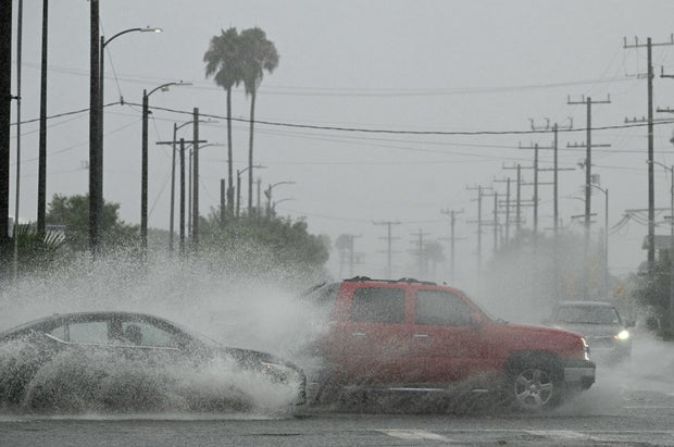
Flash flood watch issued for much of Los Angeles and Ventura counties ahead of back-to-back rainstorms
A flash flood watch has been issued for much of Los Angeles and Ventura counties ahead of two rainstorms that will increase the potential of debris flow in burn scar areas.
KCAL News Meteorologist Amber Lee said back-to-back storms will tap into the atmospheric river increasing the chances of intense rain.
The flash flood watch will go into effect Thursday afternoon through late night. Weather officials said the greatest risk of flooding is within the Eaton, Palisades, Franklin and Bridge burn scars.
A geological survey from the California Department of Conservation found that neighborhoods in Pasadena, Altadena and Sierra Madre are particularly vulnerable to heavy debris flows because of the Eaton Fire. The report outlined the belief that without adequate preparations this could lead to a significant number of deaths.
"The Eaton Fire has a high likelihood of generating large magnitude postfire flood and debris flow events," officials wrote in the report.
Lee said the first storm will make its appearance Wednesday evening going into Thursday morning. The second storm will begin Thursday into Friday.
Los Angeles and Ventura counties could get 1.50 to 3 inches of rain while the mountains and foothills could get 3 to 6 inches, the NWS said.
Forecasters said the storm will start as an atmospheric river over the middle of the state and then morph into a classic winter storm with a warm and cold front.
If rain totals become more than the predicted amounts, very dangerous situations may develop.
Potential impacts from the storms:
- Moderate risk – significant flooding and burn scar debris flow
- High risk for urban flooding of some roads and parking lots
- High-risk swift water rescues
- Highest risks on Thursday
The storm will clear heading into the weekend, but cloudy conditions will remain Saturday and Sunday.