More showers and storms possible across North Texas Friday
NORTH TEXAS (CBSDFW.COM) - There's been some beneficial rain out to the west this morning.
It's likely some spots picked up one or two inches of rain with the storms just this morning, but as you can see this was well to the west of I-35.
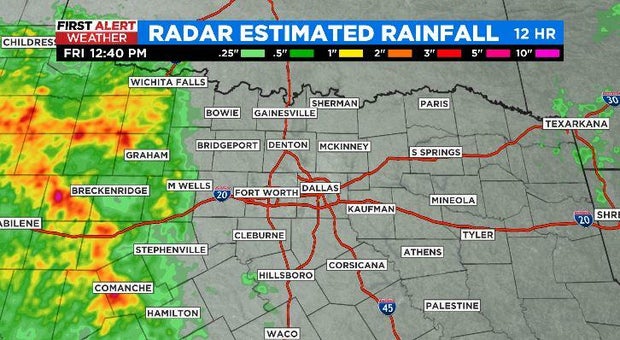
Temps are much cooler where the rain fell earlier today – the intensity has definitely lessened, but the clouds are still persistent.

When you put this rain into motion on the map, an interesting feature stands out. We actually have what's called an MCV ongoing, or mesoscale convective vortex. It's a little area of low pressure that has developed from a larger system.
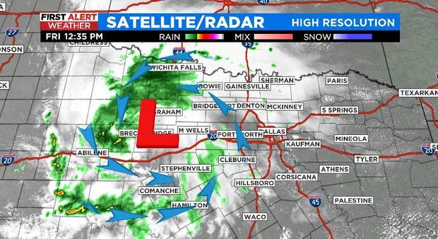
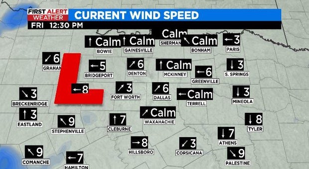
The MCV is not just identifiable from counterclockwise motion on radar; it's visible from winds as well.
I think what we're going to have to watch for is some redevelopment this afternoon of showers and storms along the I-35 corridor.
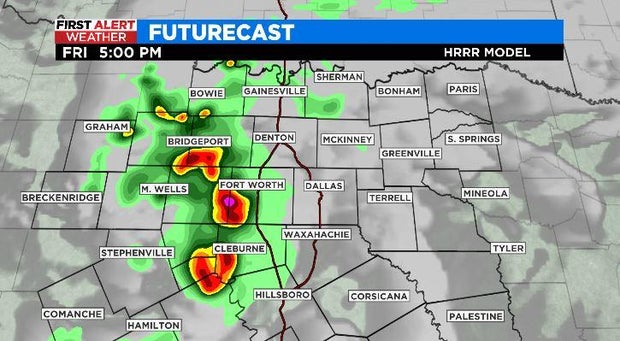
As this MCV continues moving east, we could see the storms pulse up where the warmer temperatures -- and greater instability -- are.
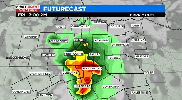
Brief heavy rain, gusty winds and some small hail would be possible with these storms, but I think the overall threat is low. Once we lose the daytime heating, the rain and storms should fizzle out.
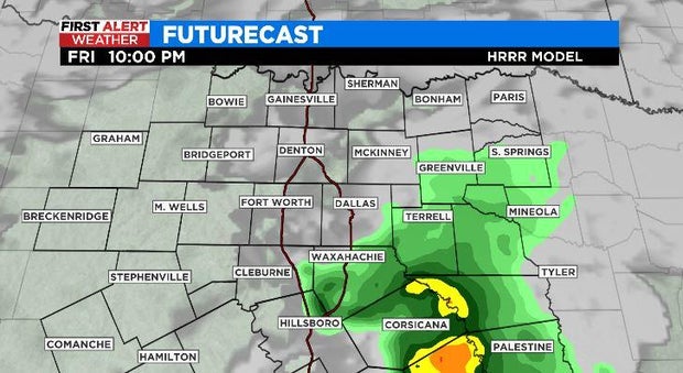
Tomorrow morning, there will likely be a few showers and storms mainly south of I-20 through the early morning hours. In the afternoon it'll be partly sunny, but I think the rain and storm chances are limited by then. By Sunday and into next week it's sunny and hot. Period. #stayhydrated