Heat Wave Starting Soon
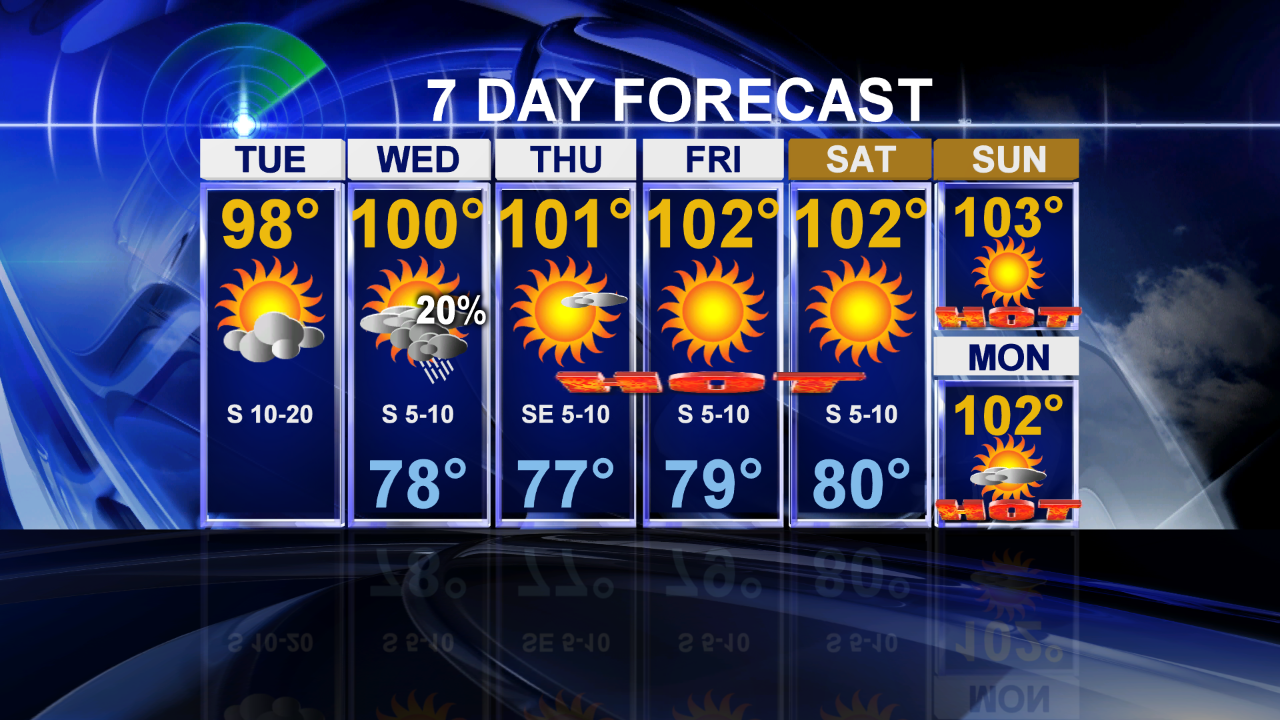
For the second morning in a row we had showers moving across areas north of the metroplex. This afternoon all that will be left from this will be some clouds. Highs will reach into the uppper 90's. This will quailfy for the coolest day in the forecast as we start ramping up the temperatures.
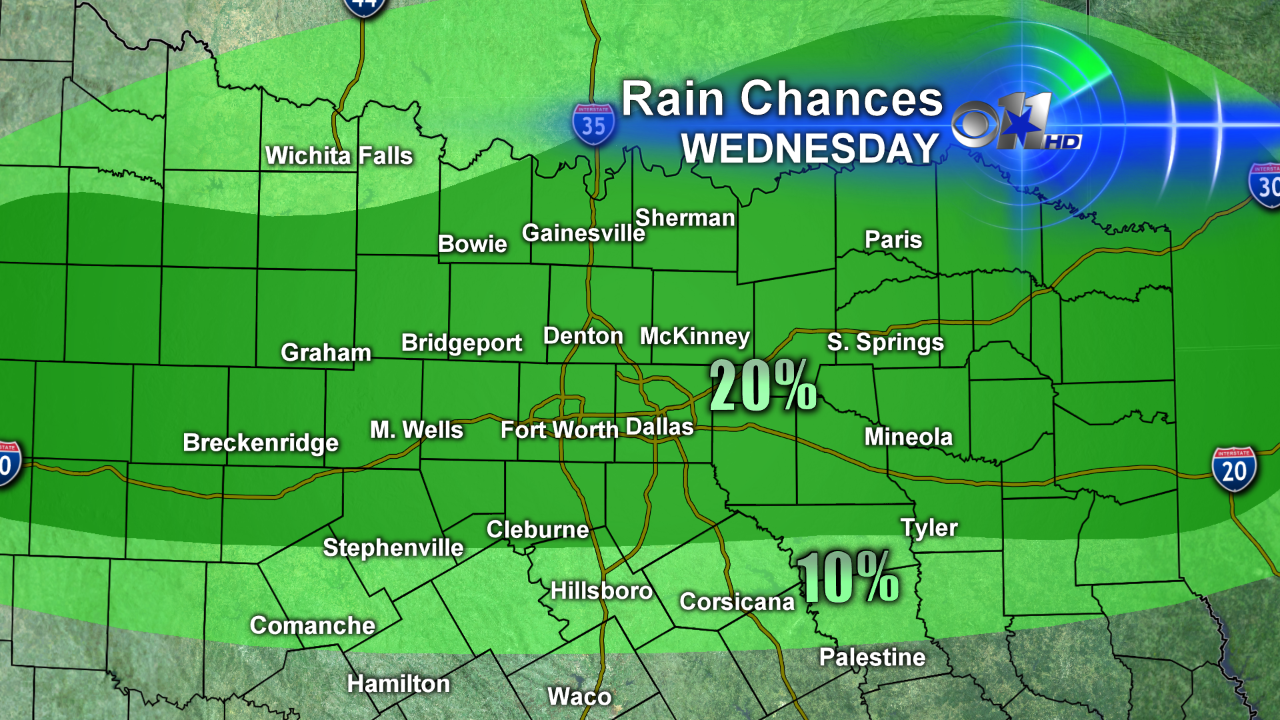
There is going to be a weak cold front come towards north Texas tomorrow. It's driven by a low pressure system bringing heavy rains to the central plains. This brings in storm chances for us on Wednesday:
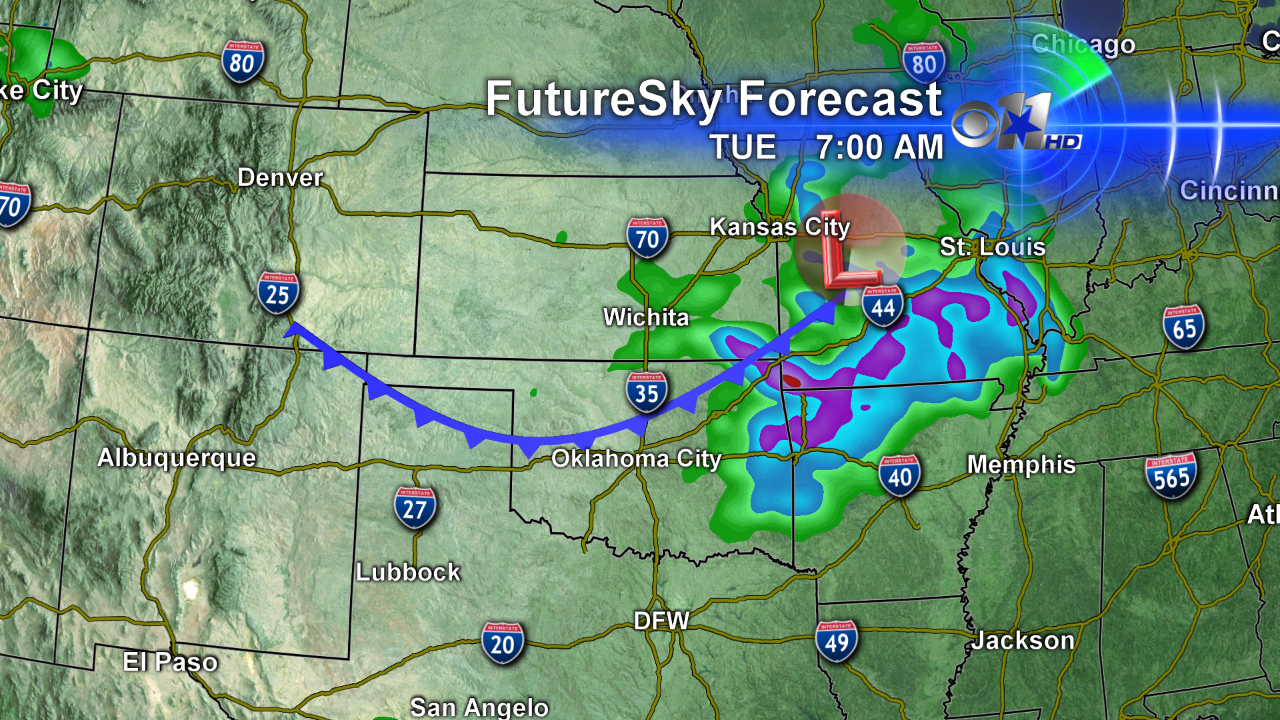
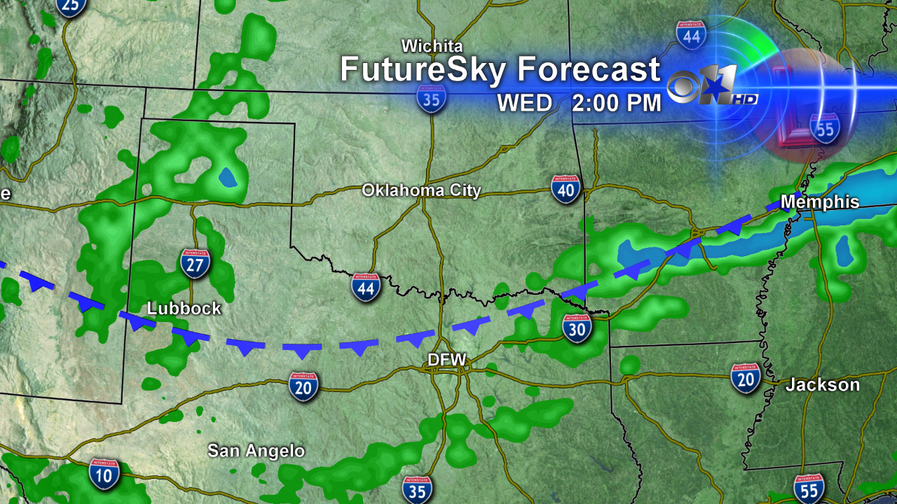
There is little agreement with the forecast models on when the front arrives; if it is indeed in the afternoon as the RPM Model above shows we'll have cooler weather. Right now the thinking is that the front arrives in the evening. Regardless of the timing it could easily produce strong to severe storms. Damaging winds and large hail would be the main threat:
Tomorrow is looking like our best chance of rain over the next week. A heat wave kicks off tomorrow if the front holds off to evening allowing the afternoon highs to peak in the 100 degree range.
We had a nice cool weekend. The same won't be said about next weekend; the temperatures both days will be in the low 100's just like Friday:
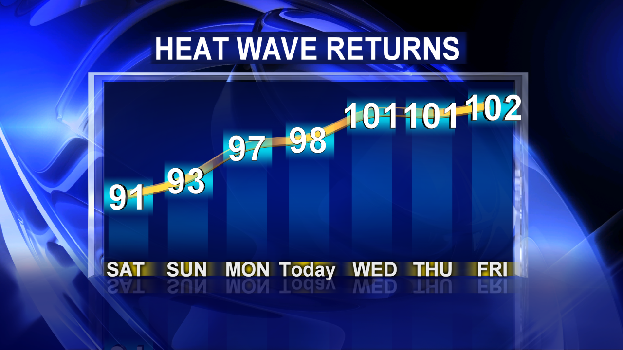
We are really going to rack up the count on the 100° weather. This is traditionally our hottest part of the year and the first week of August looks to deliver some of our hottest temperatures. We logged the typical number of 100° for June and possibly July if we hit the mark tomorrow:
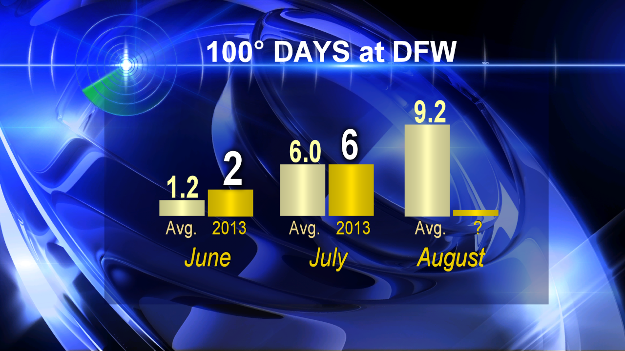
Right now the forecast is calling for the first five days in August to be triple-digit. If the trend of "normal" continues we should end up with nine days at that mark (or higher) for the month.
Larry Mowery will update our storms chances tomorrow later this afternoon.


