Enjoy the warm, breezy weather before a cold front moves in Wednesday
NORTH TEXAS (CBSDFW.COM) – Don't let the sunshine and 70s fool you, North Texas! A cold front is on the way and will have us reaching for the layers after today!
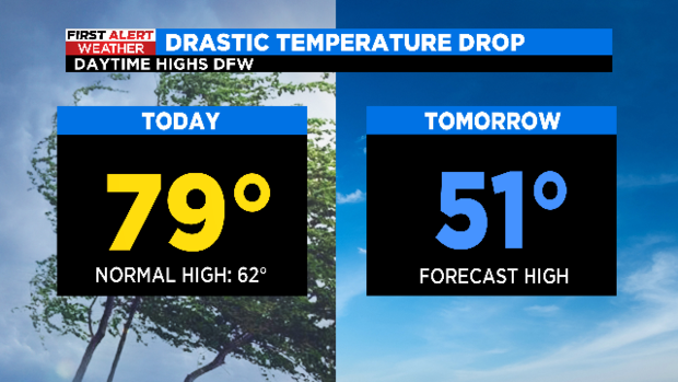
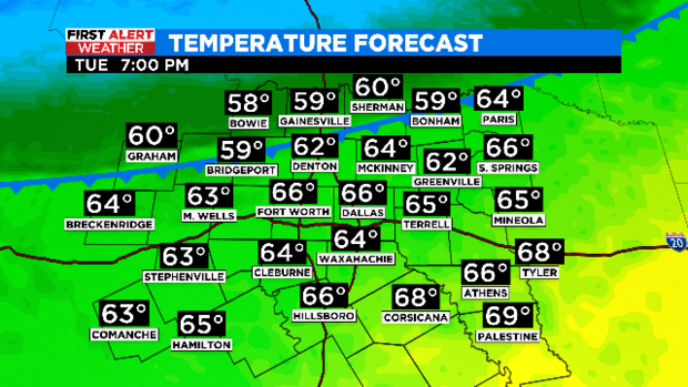
After a cloudier start, the sunshine and southwest winds are warming us into the mid and upper 70s this afternoon. But this unseasonable warm weather can't last too long – it is North Texas after all!
Our next cold front should start to move into our Red River counties after sunset. Those warm southwest winds will quickly shift around to the north, and cold and dry air will overtake the region overnight.
This front is not expected to bring rain or storms to North Texas, but the same can't be said for our friends to the east. Severe weather is expected Tuesday afternoon through the late evening hours across parts of the southeast. Nearly 40 million people are at risk for severe storms that could produce tornadoes, large hail, localized flash flooding, and damaging wind gusts.

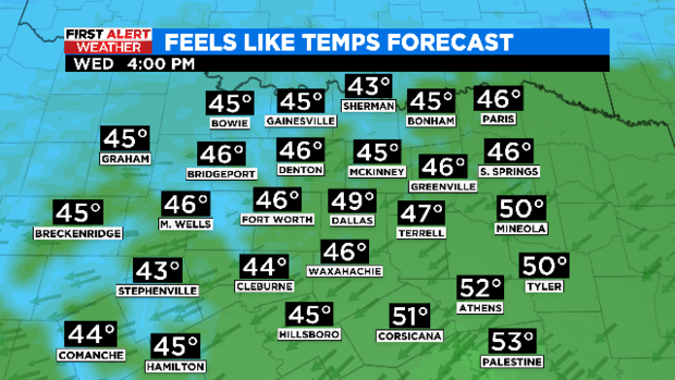
Our local impact will be the dramatic temperature swing. Not only are temperatures expected to be 20+ degrees cooler on Wednesday compared to Tuesday, but breezy north winds will have it feeling significantly cooler!
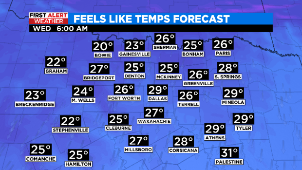
Dress for mornings in the 20s and afternoons in the 40s!