Arctic Air Set To Arrive In North Texas Next Week -- Winter Isn't Over After All
NORTH TEXAS (CBSDFW.COM) — Weather across North Texas for Super Bowl Weekend will be mild and highs on Monday will even reach the mid-60s, but then the bottom falls out next week.
CBS 11 Meteorologist Anne Elise Parks said, "It's really tough to say this far out what we will be looking at middle-to-late next week."
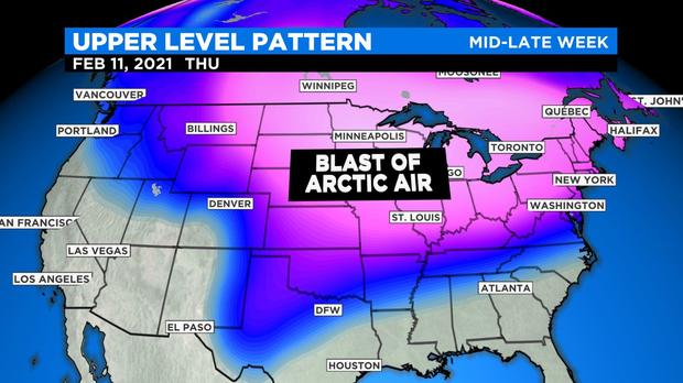
With the temperature forecast far from rock solid, the main focus this Friday is on the blast of arctic air that will impact much of the country next week.
"We will also have to watch a couple of disturbances that swing through and tap into this cold air, providing the chance for precipitation," Parks said.
So far this winter North Texas has been spared from the worst of winter cold. At DFW Airport (the official climate site for the Metroplex) the lowest temperature so far this winter is a mere 27°.
In case you were wondering, it has been a while since the 'real chill' has been with us. We have to go back three winters to see a low at DFW in the teens. And for a low in the single digits it's 25 years.
This is a La Nina Winter, so overall one would expect it to be mild and dry. But this doesn't mean it stays warm and dry every day across the winter. It only means that after you tally up all the cold days and all the warm days you'll end having more warm ones, and the average temperature ends up above normal.
There's a slight chance for rain on Wednesday, February 10 with scattered showers possible Thursday. There is the potential for Winter Weather in the middle to late parts of next week -- but it's more likely to be cod rain -- but any exact predictions made this far out would be unreliable.
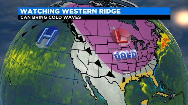
As it stands, chances are very high that the much colder temperatures will remain in place through next week and next weekend.
When temperatures are very cold, for several days in a row it increases the possibility for wintery precipitation. If a low pressure system gets going to the southeast, over the Gulf of Mexico, and rotates Gulf moisture over the top of the freezing cold air the likelihood for snow or ice increases greatly.
But the best advice is to keep an eye on the forecast as we get closer to next week.