Water Close To A Record At Dam Built After 1965 Denver Flood
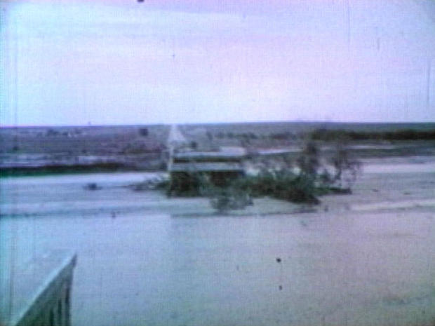
DENVER (CBS4) - June 16 marks 50 years since a deadly flood tore through the South Platte River Basin of Colorado's Front Range and Eastern Plains, killing 21 people and causing more than $540 million in damage.
The flood was the result of days of slow-moving thunderstorms that produced widespread heavy rain.
One storm produced a tornado southwest of Castle Rock and dropped over a foot of rain, sending a wall of water through Douglas County along Plum Creek.
The high waters eventually flowed into the South Platte River and unleashed a catastrophic flood in the heart of Denver.
CHATFIELD IS BUILT
Construction of a new dam began in 1967 in response to the devastating floods.
Chatfield Reservoir was designed to store flood waters from both the South Platte River and Plum Creek.
It works in conjunction with Bear Creek Dam and Cherry Creek Dam to protect the Denver metropolitan area from floods.
NEAR RECORD WATERS AT CHATFIELD
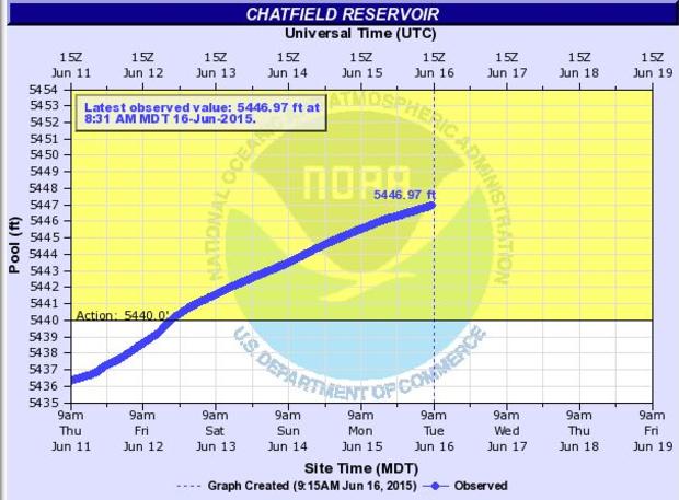
Recent heavy rain combined with the melting of above-average snow pack in the South Platte River Basin have pushed water levels at Chatfield Reservoir to near historic readings.
As of 8:31 a.m. on June 16 the gauge at Chatfield was less than a foot shy of the highest crest on record.
That was 5,447.60 feet measured on May 25, 1980.
While the high water is causing some flooding at the park and has closed some boat ramps, it is still far from compromising the dam.
The water would have to reach 5,500 feet to top the flood control pool and crest the spillway.
It'd have to reach 5,527 feet to top the dam.
Click here to see the latest reservoir levels at Chatfield Dam.
Meteorologist Chris Spears writes about stories related to weather and climate in Colorado. Check out his bio or follow him on Twitter @ChrisCBS4.
