Denver Forecast: Morning Drive Could Be Similar To Last Thursday
DENVER (CBS4) - A strong cold front will move into northern Colorado by early Monday morning and it will bring more wind, much colder temperatures and a quick burst of snow.
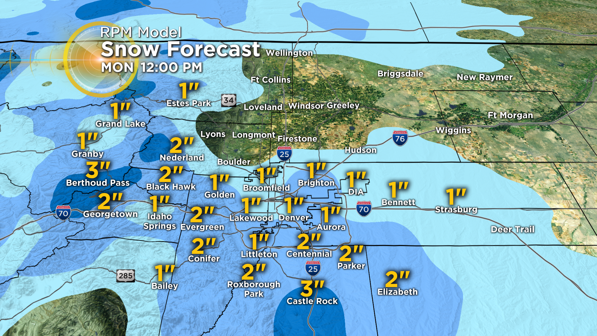
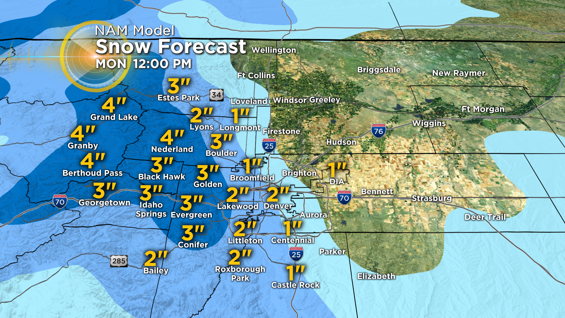
Snow accumulations shouldn't amount to much because the storm system will be moving too fast to produce large totals. But the storm may still pack quite a punch on the roads due to the wind. The snow band should hit metro Denver sometime just before or during the Monday morning rush hour.
Most places will see anywhere from a trace of snow to a few inches. There is the possibility for a few bands of snow to set up along the foothills west of Denver and along the Palmer Divide south of the city. If this happens 3 to 4 inches of snow could fall in a few areas.
The storm will wrap up and move away quickly with clearing skies anticipated by Monday evening. Temperatures by Tuesday morning could fall into the single digits around the area.