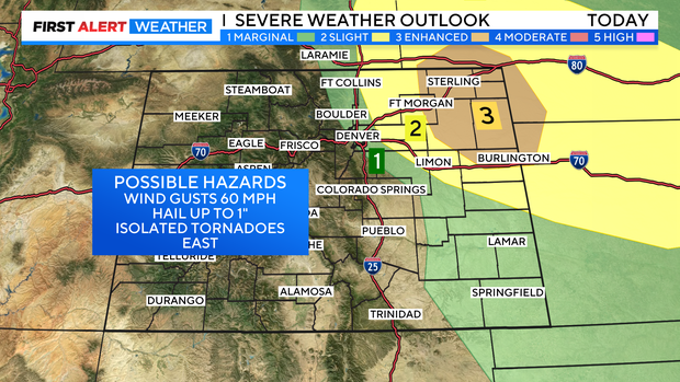
Severe storms may ramp up for Denver and Eastern Colorado
A cold front is pushing into our state and should move thru eastern Colorado in the late afternoon or early evening on Tuesday. This will be a spark for stronger thunderstorms to get going over Denver and eastern Colorado.
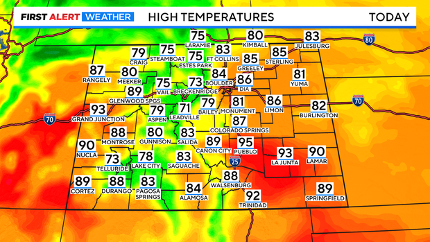
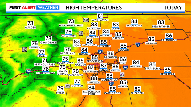
Before it arrives highs should rise into the 80s and 90s over the lower elevations of the state with 70s to low 80s in the mountains. Denver's high should be close to 85 degrees.
There may be two rounds of storms that affect the Front Range and eastern plains during the day. The first wave will see high-based gusty t-storms in the mountains around lunchtime and those storms should track across the plains between 2pm and 5 pm.
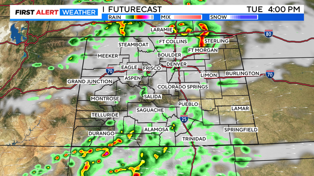
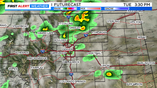
The second, stronger storm wave will move thru from 6pm to 10pm for the Denver metro area and may go thru midnight in the northeastern corner of Colorado.
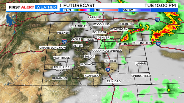
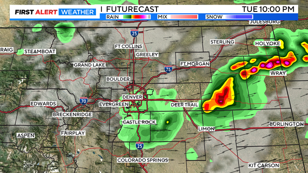
There is a chance for severe storms along with the system pushing thru. For the northern Front Range Foothills and the Denver metro area there is a chance for 1 inch hail and 60 mph winds. From Greeley, DIA and eastern Aurora out to Fort Morgan and Limon the greatest threat is 1.5 inch hail and over 60 mph gusts. Then from Fort Morgan down to Limon out to Kansas and Nebraska along with the hail and strong winds there is a chance for isolated tornadoes.
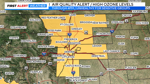
Hopefully, the storms will help to clear the air. We have an Air Quality Alert for high ozone levels thru Tuesday afternoon. The air is unhealthy for sensitive groups.