Denver Forecast: Mild But Windy With Elevated Fire Danger
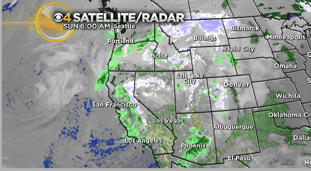
DENVER (CBS4) - A large storm system spinning off the coast of California and Oregon will keep Colorado's forecast unsettled over the next few days. It's associated with a big trough of low pressure and a pattern change for the western side of the nation.
In Denver today we anticipate mostly cloudy skies with windy conditions developing by the afternoon and evening. The primary wind direction will be out of the west and that will help push temperatures well above average along and east of Interstate 25. Highs in the 60s and 70s are anticipated this afternoon on the eastern plains.
A few stray rain showers can't be ruled out in the foothills, metro Denver or on the eastern plains but the chance is extremely low due to a donwslope wind in the forecast. Most of the rain and snow today will stay along and west of the Continental Divide.
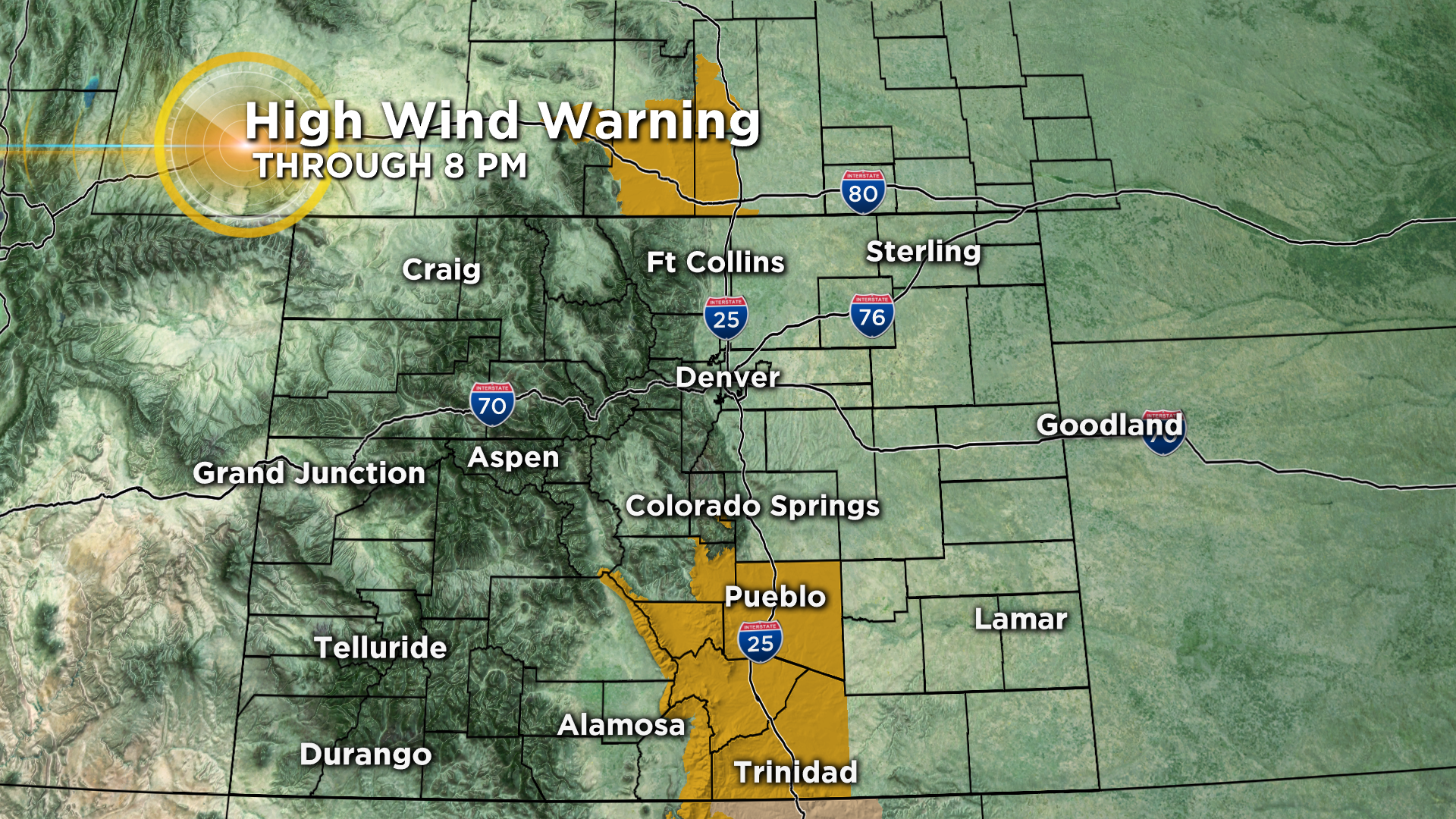
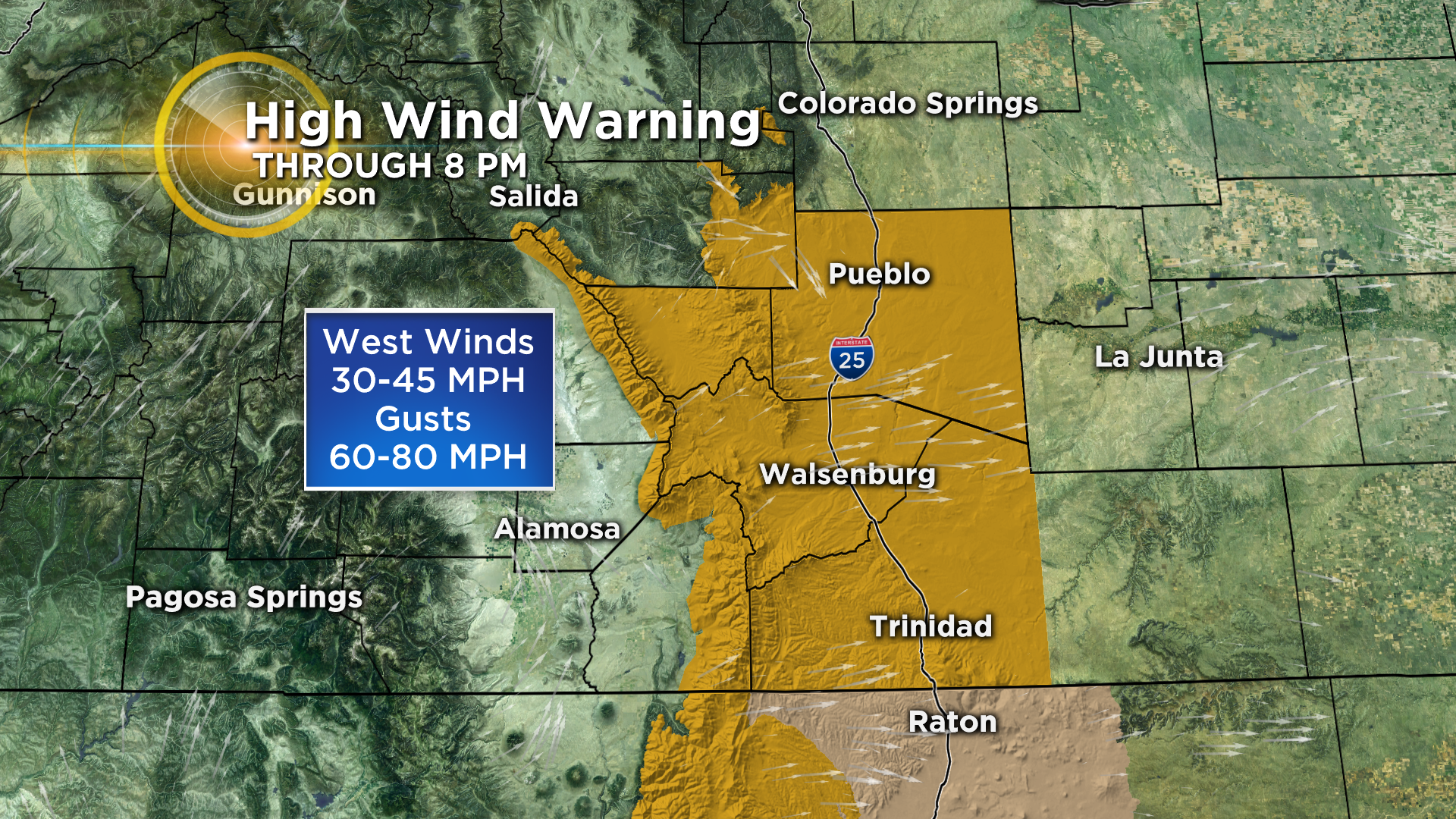
While it should turn quite windy statewide the strongest wind gusts are expected in south-central Colorado along and west of the Interstate 25 corridor between Colorado Springs and the New Mexico state line. Wind gusts could approach 80 mph in that part of the state.
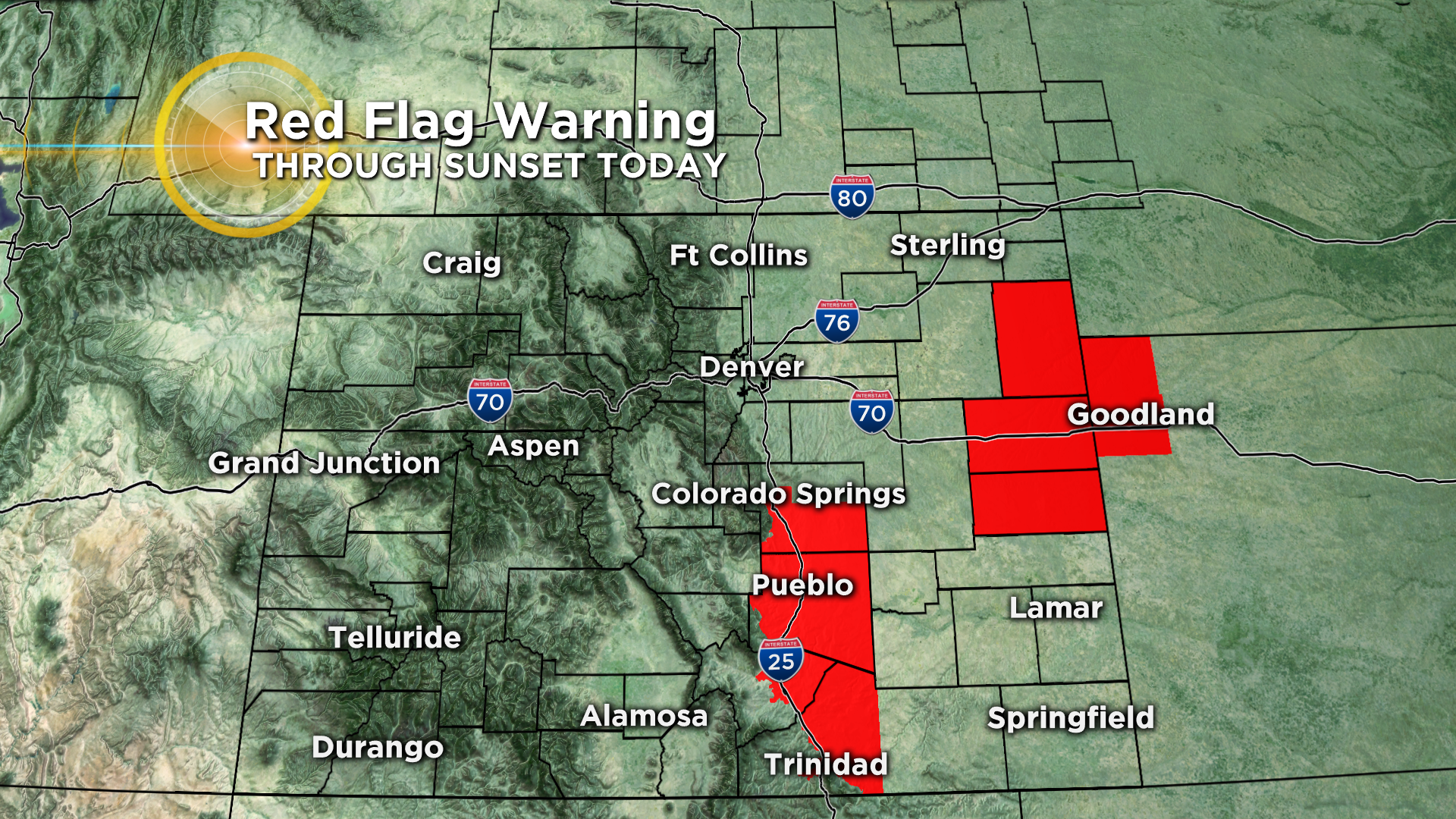
Because it has been so dry over the past few months, the wind and unusually warm temperatures will combine to create elevated fire weather conditions today on the plains. Red Flag Warnings have been issued until sunset for some areas of eastern and south-central Colorado.
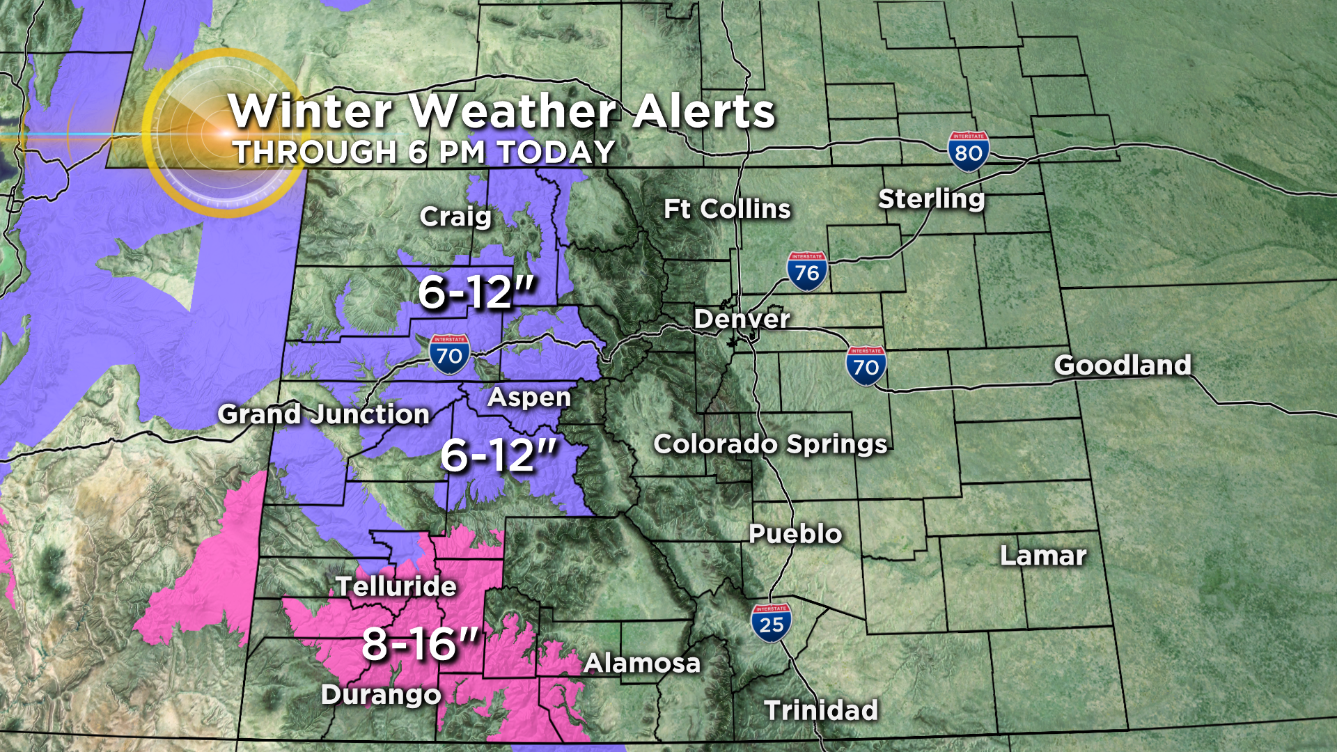
Mountain snow and valley rain is expected off and on all day today in western Colorado. The heaviest snow should fall in the San Juan Mountains where a Winter Storm Warning is in effect.