Colder Temperatures To End 2016
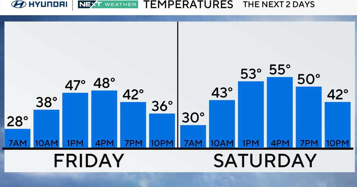
DENVER (CBS4) - A warm Friday ahead of our next cold front moving in. Temperatures hit 65 degrees, while that is warm is it short of the 71 degree daily record high. This is our warmest day since the day after Thanksgiving.
We'll see more clouds overnight into Saturday, with the southern mountains getting a shot of a little snow. Our temperatures drop about 20 degrees or more with this cold front coming through. We'll be down into the lower 40s on Saturday.
If you're making New Year's Eve plans, almost everyone should be dry across our beautiful state. The mountains may have a little snow, but that should mainly stay into the southern mountains. Temperatures will be in the upper 20s for the fireworks downtown. Bundle up if you're heading out to see the show!
We get even colder next week with a major blast of Arctic air moving our way. We'll drop to the 30s on Monday, the teens Tuesday, and the single digits Wednesday. We could see snow in Denver Monday night through Thursday. Temperatures will stay cold into next weekend.


Watch meteorologist Lauren Whitney on CBS4 News on weekday evenings at 5, 6, 6:30 and 10 p.m. Check out her bio, connect with her on Facebook or follow her on Twitter @LaurenCBS4