A Little Heat Relief Monday
DENVER (CBS4) - We have another big high pressure ridge over the mid-section of the nation along with a strong storm system moving in on the Pacific Northwest. Colorado is locked in between these two features with a strong south-westerly pressure gradient bringing in drier and warmer air along with gusty winds through the weekend.
This set up warmed Denver up to 102 degrees on Sunday! Breaking a 60 year old record of 99 degrees. Pueblo also had a record high of 105 degrees!

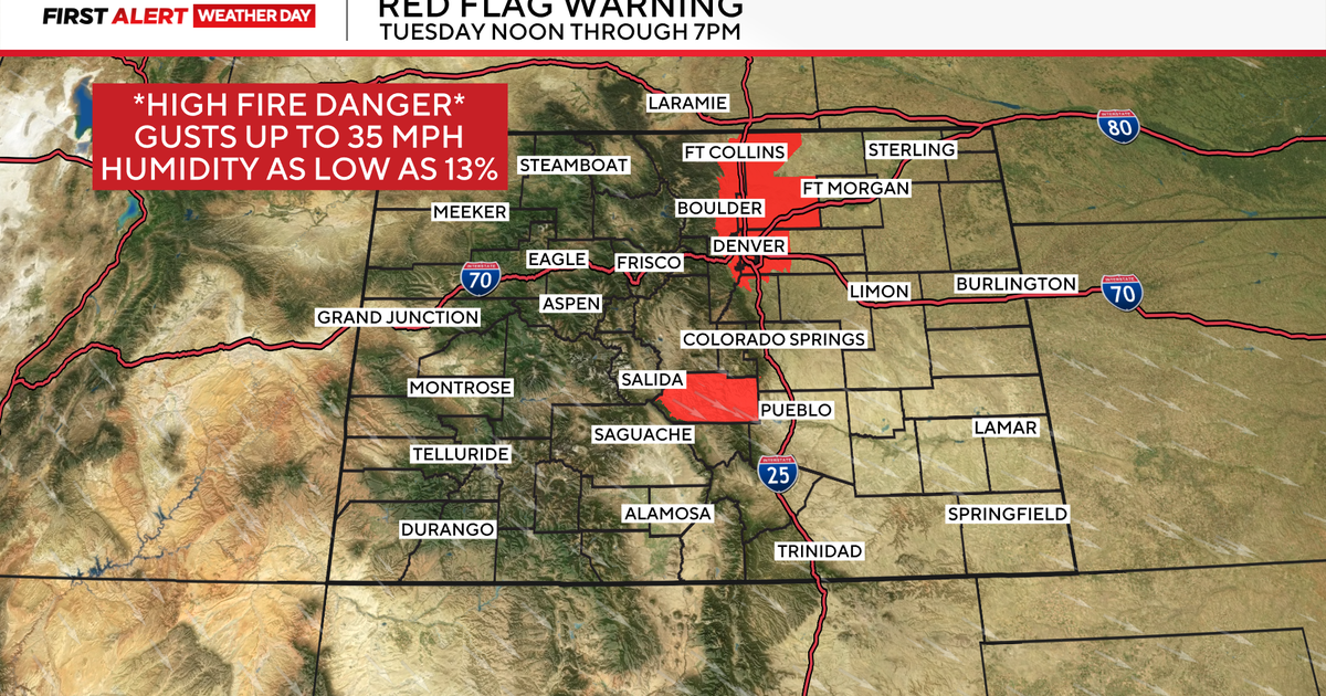
As a result of the extremely hot and dry weather pattern the fire danger is extremely high across the state. There is a Red Flag Warning for all of the eastern foothills and a big chunk of western Colorado through 8pm Sunday. A Red Flag Warning is issued when critical fire weather conditions are either occurring now or will shortly. With the combination of strong winds, extremely low relative humidity and hot temperatures can contribute to explosive fire behavior.

A cold front will swing through on Monday cooling temperatures by about 10 degrees overall. Fire danger may still stay high as gusty winds may accompany the front to start the week. There is a Fire Weather Watch posted for the northern Front Range all day Sunday.

Next chance for rain in Denver may arrive on Thursday.

Meteorologist Dave Aguilera is a Colorado native and has been forecasting weather in the Rocky Mountain region for over 25 years! Connect with Dave on Facebook and on Twitter @DaveAgCBS.