Heavy Mountain Snow Chilly Week Ahead
DENVER (CBS4)- A Pacific storm system is blasting through the Rockies bringing heavy snow and strong winds to the mountains and foothills of the Front Range.
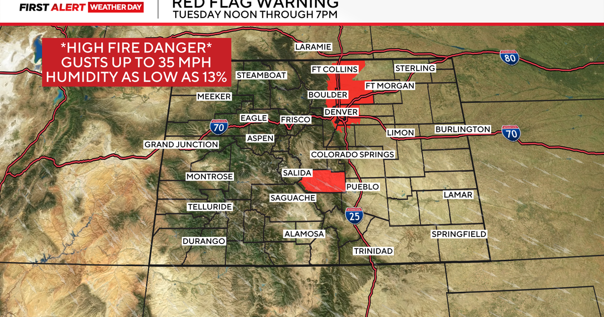
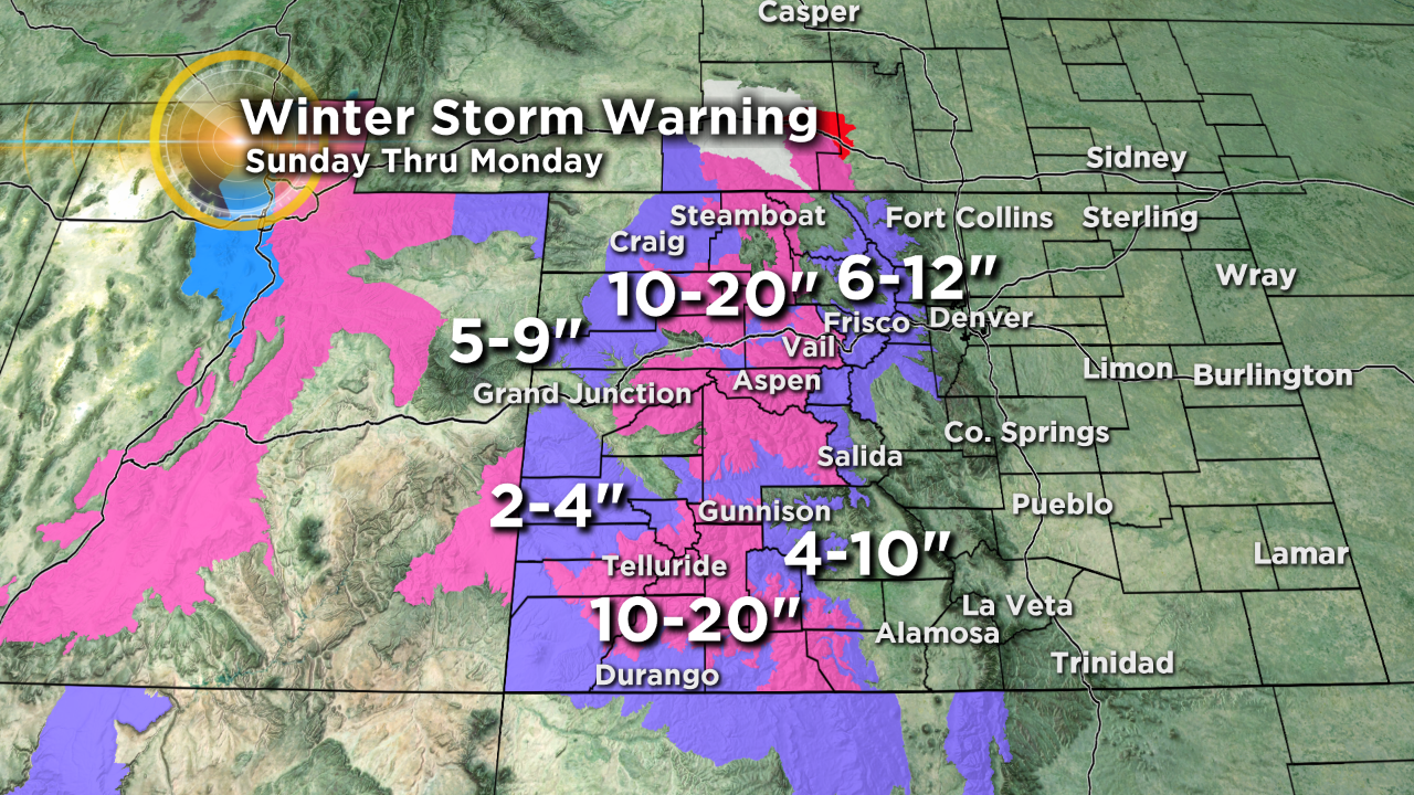
In our mountains along and east of the Continental Divide, in spots like Summit County into Rocky Mountain National Park there is a Winter Weather Advisory for 6 to 12 inches of snow Sunday into Tuesday morning. At the same time there is a Winter Storm Warning for the western mountains for 10 to 20 inches of snow by Tuesday morning.
This system will not bring much moisture to the Denver metro area. But will open the door for a big time cool down in the overall weather pattern for the week ahead.
Wind is going to be an issue with this fast moving storm system and strong overhead jet stream flow. There is a High Wind Watch for the Front Range Foothills and Mountains for Sunday evening where winds will be gusting as high as 70 mph in areas from Estes Park down through Deckers.

As this low pressure trough passes through it will open the door for cold air to start flowing into the Rockies. So get ready for some much colder temperatures in the week ahead. The Mile High City should only get into the 40s on Monday with highs in the 30s for the rest of the week starting on Tuesday.

Meteorologist Dave Aguilera is a Colorado native and has been forecasting weather in the Rocky Mountain region for over 25 years! Connect with Dave on Facebook and on Twitter @DaveAgCBS.