Nearly 1,000 aftershocks followed Indonesia earthquake that killed at least 53, officials say
A 7.7-magnitude earthquake that struck eastern Indonesia on Saturday, killing at least 53 people, was followed by nearly a thousand aftershocks, disaster management officials said Sunday.
Rescuers raced to find survivors after the powerful earthquake shook the Flores region at 5:58 a.m. local time Saturday and it was quickly followed by a second, 6.4-magnitude quake that struck the country's western Sumatra island.
Authorities said more than 130 residents were injured and warned that the death toll would almost certainly rise.
The U.S. Geological Survey said the first quake's epicenter was 42 miles north-northwest of the city of Ende in East Nusa Tenggara province. It triggered a tsunami warning that forced coastal residents to move to higher ground, but authorities later lifted the alert after monitoring showed no significant sea-level changes.
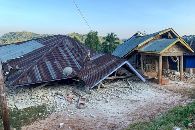
The head of the National Disaster Management Agency, Suharyanto, said rescuers recovered at least 47 bodies Saturday immediately following the quakes, mostly in Sikka, Manggarai and East Manggarai.
Rescue teams in eastern Indonesia recovered six more bodies Sunday, raising the death toll to 53, authorities said, as many of the thousands of displaced people spent the night outdoors in fear of aftershocks.
Authorities have since recorded at least 995 aftershocks, but only 46 were felt by residents, said Abdul Muhari, the National Disaster Management Agency's chief for disaster prevention. The largest recorded aftershock had a magnitude of 6.2.
More than 900 homes were destroyed and 450 more damaged in East Nusa Tenggara province, forcing about 5,000 people into temporary shelters. At least 241 homes were damaged in the Flores region alone, Muhari said.
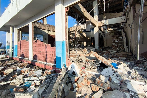
East Nusa Tenggara Police Chief Rudi Darmoko said the earthquake caused severe damage and collapsed buildings. He said power outages in cities and villages have hampered the flow of information and complicated search and rescue efforts.
"We are continuing to collect reports of damage and casualties, but there are communication disruptions," Darmoko said. He said that landslides in Ende regency triggered by the earthquake also cut off the Trans-Flores highway, a roughly 435-mile paved mountain road spanning Flores Island, from Labuan Bajo to Larantuka.
The powerful tremor also destroyed more than 100 public facilities, including schools, medical centers and churches.
"I have never felt an earthquake this big," Yulian Juita Ekalia, who lives in Ruteng city, more than 60 miles west of the epicenter, told AFP.
"It felt like we were on a trampoline; it was really scary," said the 37-year-old university lecturer. "As I rushed to get outside, everything in the house fell down: the television, my son's trophies, the dish racks, suitcases on top of the wardrobes. When I got outside, my son and neighbors were already there, screaming in fear."
The death toll could rise because landslides triggered by the earthquake buried or cut off many remote villages across six regencies on Flores Island, said Fathur Rahman, who heads the Search and Rescue Office in Maumere, the capital of Sikka.
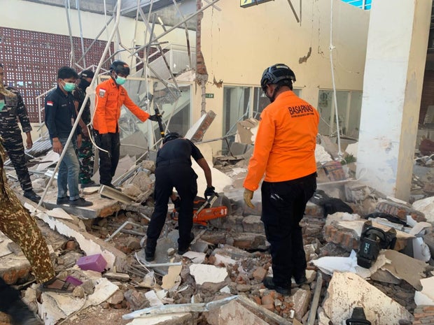
Footage on local television showed patients at several hospitals being evacuated from buildings as a precaution following the quake. Hospital staff moved equipment outdoors, including beds, IV stands and oxygen cylinders, and set up temporary treatment areas to adapt to emergency conditions.
The National Disaster Management Agency deployed a helicopter to assist with logistics and support emergency response operations, including possible evacuations if needed, the agency said in a statement.
The air support is considered crucial given East Nusa Tenggara's geography, which consists of numerous islands and presents significant transportation and access challenges.
Indonesia, a vast archipelago of more than 17,000 islands, is prone to earthquakes and volcanic activity because of its location on the "Ring of Fire," an arc of volcanoes and fault lines in the Pacific Basin.
Most notably, a powerful earthquake caused a tsunami in 1992 that killed about 2,500 people on Flores, part of a group of islands in the eastern half of Indonesia, while in 2018, a magnitude 7.5 quake spawned a large localized tsunami that wiped out coastal areas, killing more than 4,400 people.
In December 2004, a massive magnitude 9.1 earthquake off Sumatra in western Indonesia triggered a tsunami that killed 230,000 people in a dozen countries.