Denver Weather: Warming Trend Ahead After A Chilly Saint Patrick's Day
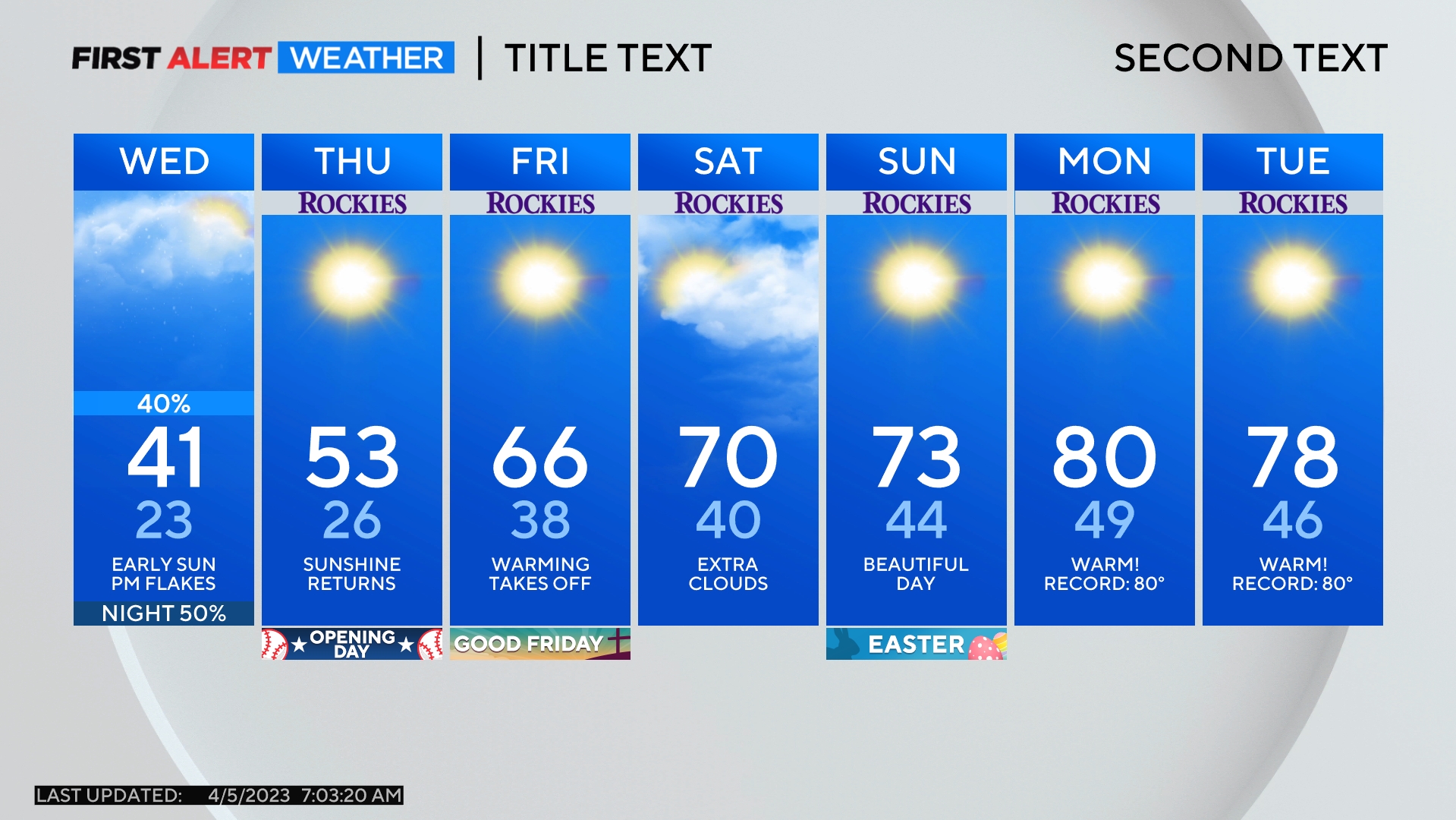
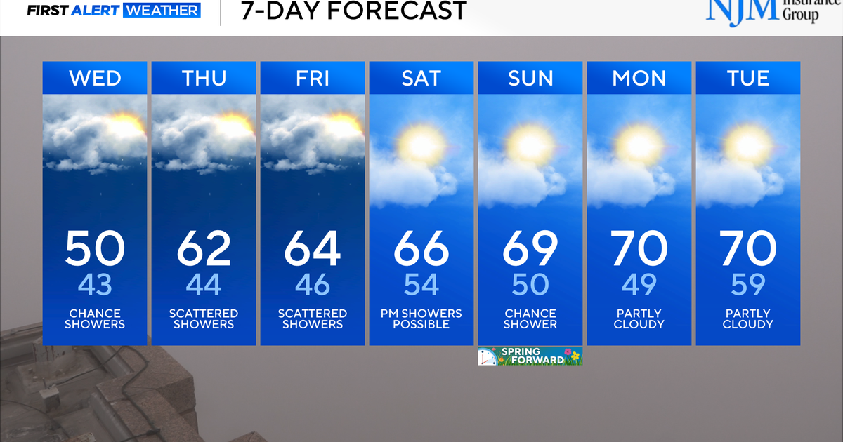
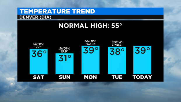
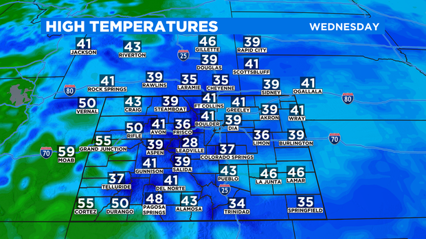
DENVER (CBS4) -Wednesday will be the fifth and final consecutive day with high temperatures stuck in the 30s in the Denver metro area. A return of full sunshine on Thursday will allow for a gradual warming trend into the weekend.
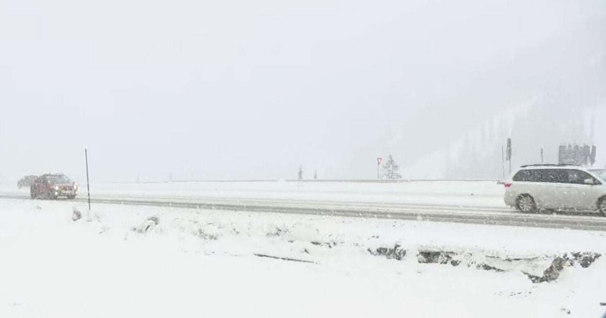
Morning light snow is also in Denver and along the Front Range on Saint Patrick's Day. Any accumulation will be minor (generally under 1/2 inch) and most areas will get nothing more than a trace of snow early Wednesday.
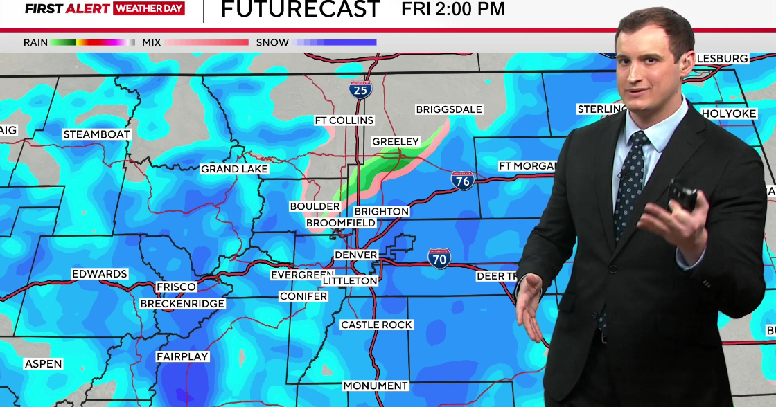
A chance for light snow will also continue into the afternoon on Wednesday for the mountains but additional accumulation in the high country will be limited to 1 inch or less.
Meanwhile, temperatures will remain chilly highs staying below 40 degrees across most of Colorado.
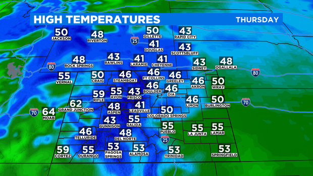
Thursday will start cold with temperatures near 20 degrees in the Denver metro area. But with full sunshine all day, high temperatures will reach into at least the mid 40s.
Similar sunshine on Friday and most of Saturday will allow for the warming trend to continue with highs reaching at least 60 degrees for the first day of Spring on Saturday.
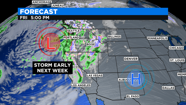
Then a storm that will be on the West Coast this weekend will move to the Rocky Mountain region starting Sunday. Temperatures will turn much cooler, rain showers are possible Sunday, and a good chance for more snow could develop on Monday.
We'll keep you posted! Stay with CBS4 for the latest on next week.