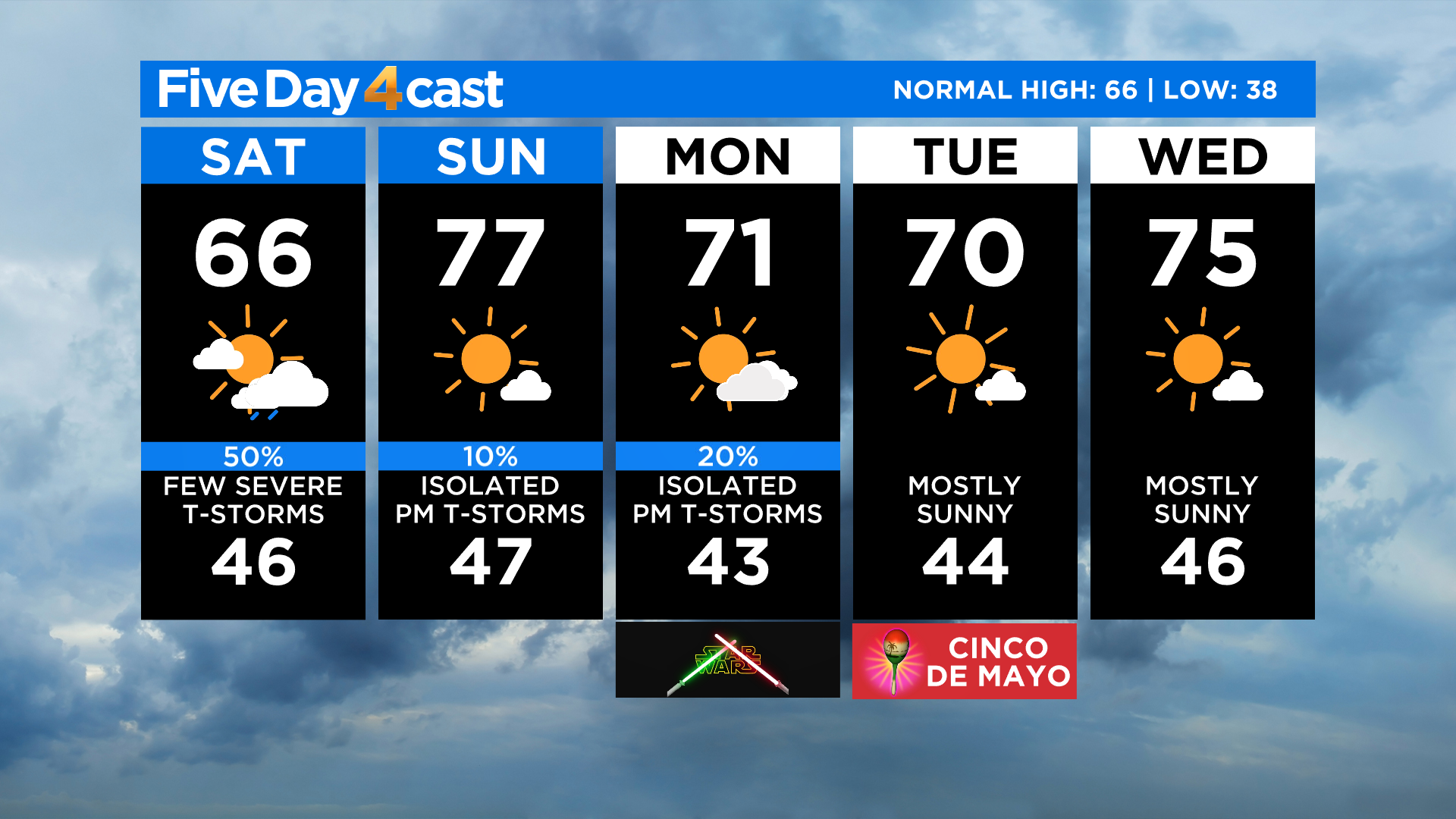
Denver Weather: Morning Clouds Give Way To Scattered T-Storms, Some Severe After 3 PM
DENVER (CBS4) - Northern Colorado woke up to a different air mass early Saturday thanks to a cool front that moved in late Friday. It's currently stationary across the middle of the state with much cooler air and higher levels of humidity on the north side.
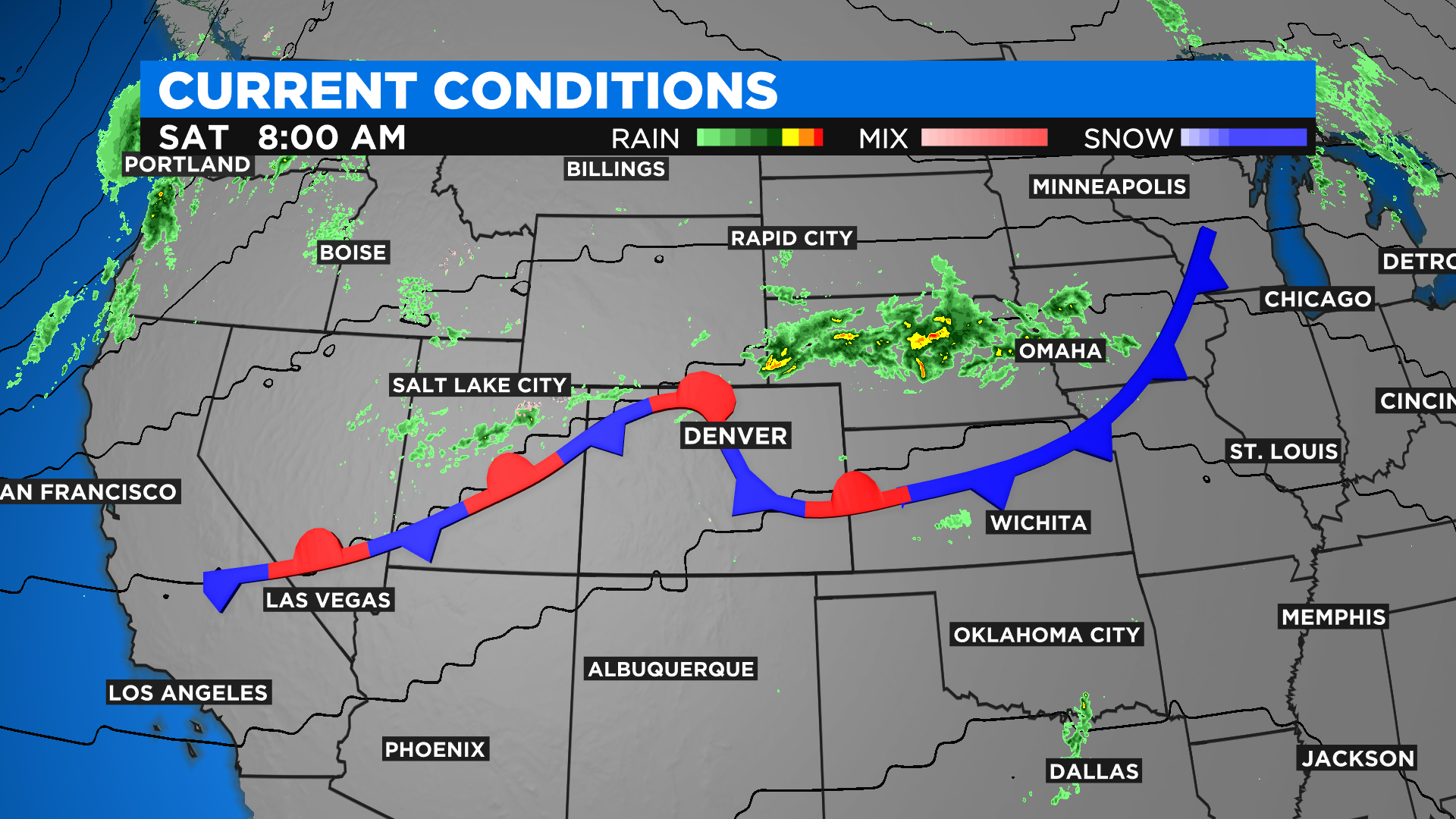
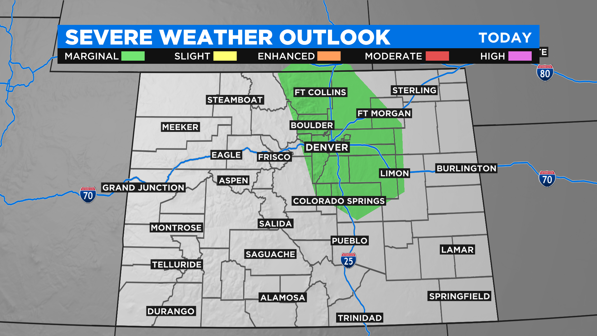
That air mass is going to help focus scattered showers and thunderstorms later this afternoon. A few of the thunderstorms could become strong to severe after 3 p.m. in areas along and east of the foothills. The main threats will be damaging wind gusts and large hail but an isolated short-lived tornado can't be ruled out.
Locations with the highest risk for seeing a severe storm include Denver, Fort Collins, Greeley, Limon and Fort Morgan. The Storm Prediction Center may see the need to issue a severe thunderstorm watch for the area so stay tuned to see how the day unfolds.
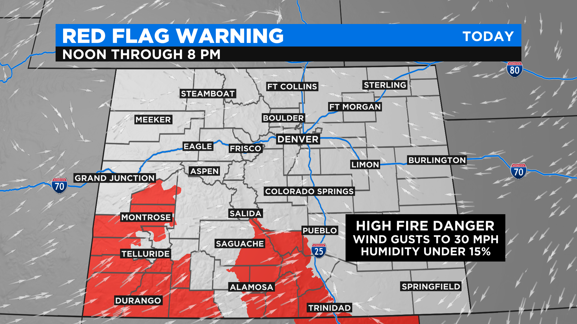
Meanwhile in southern Colorado it will remain dry along with warm and windy conditions. That will keep the fire danger high for many areas including the southwest corner and the San Luis Valley.
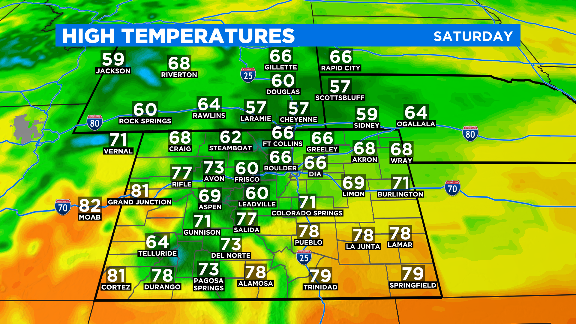
Highs today across Colorado will range from the 60s in the north to 70s and lower 80s in the south. It will even be warm in the mountains with widespread 60s.
Looking ahead we will see temperatures warm back up for Sunday across the northern half of the state. Denver should get back into the mid and upper 70s. There will be a daily chance for isolated showers and storms through Monday with daytime heating.