Denver Weather: Fire Danger At A Rare Extremely Critical Level For Friday
We cannot stress enough how dire the fire danger will be on Friday for all of eastern Colorado, including the Foothills and Denver area. The Storm Prediction issued a very rare, Extremely Critical risk for fire on Friday. They have only issued one of these for the Denver areas since 2010. This shows just how intense the danger is for fire on Friday. Dry lighting is also a major concern for the plains as it could spark fires.
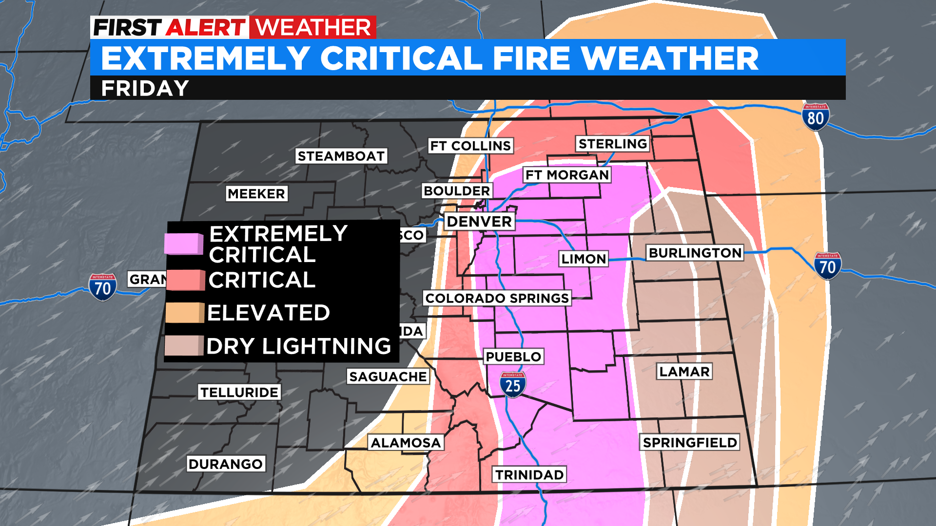
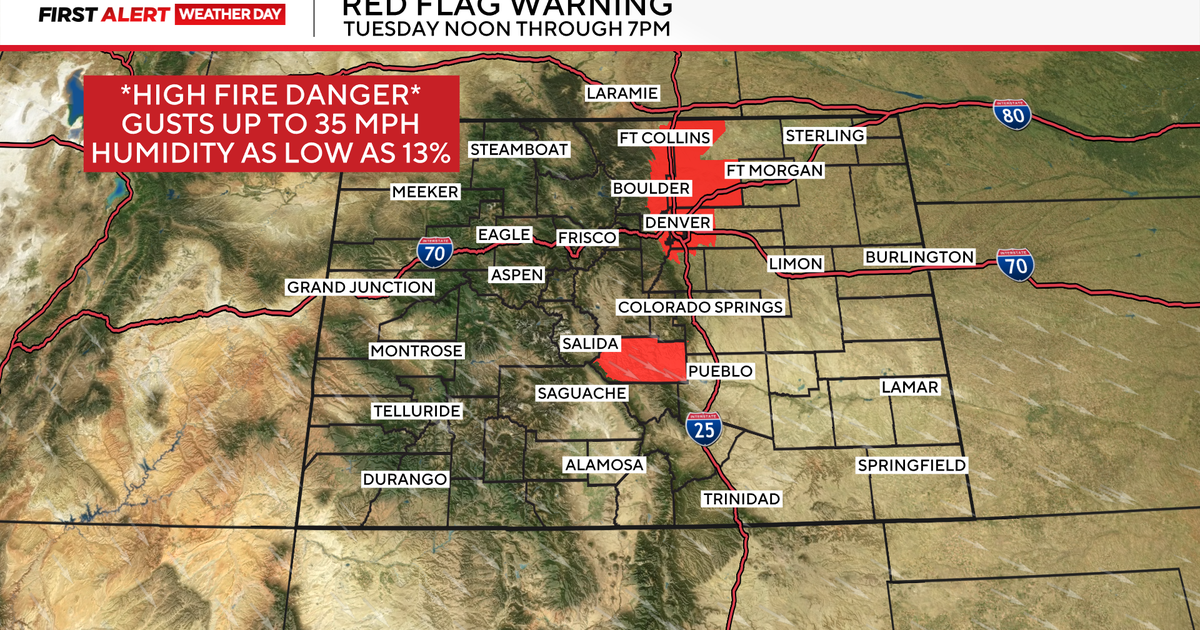
Red Flag Warnings start at 8:00 am for all of the areas in red below. We expect gusts up to 65 mph for these areas. Fire danger is not only elevated because of this wind, but also the dry vegetations and warm temperatures. Our humidity levels could also drop to 6%. All of these ingredients are the perfect recipe for fires in our state.
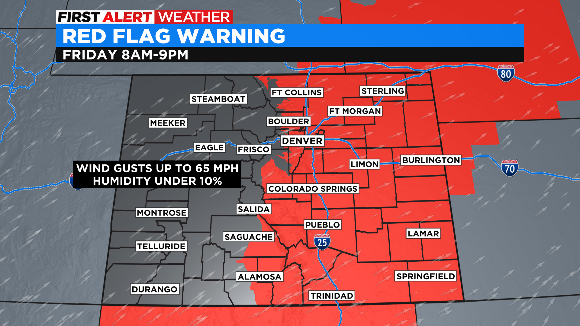
Another concern will be difficult travel, especially on the plains. Not only will the wind be dangerous for our high profile vehicle drivers and agriculture equipment, but blowing dust will create low visibility that could potentially shut down roads.
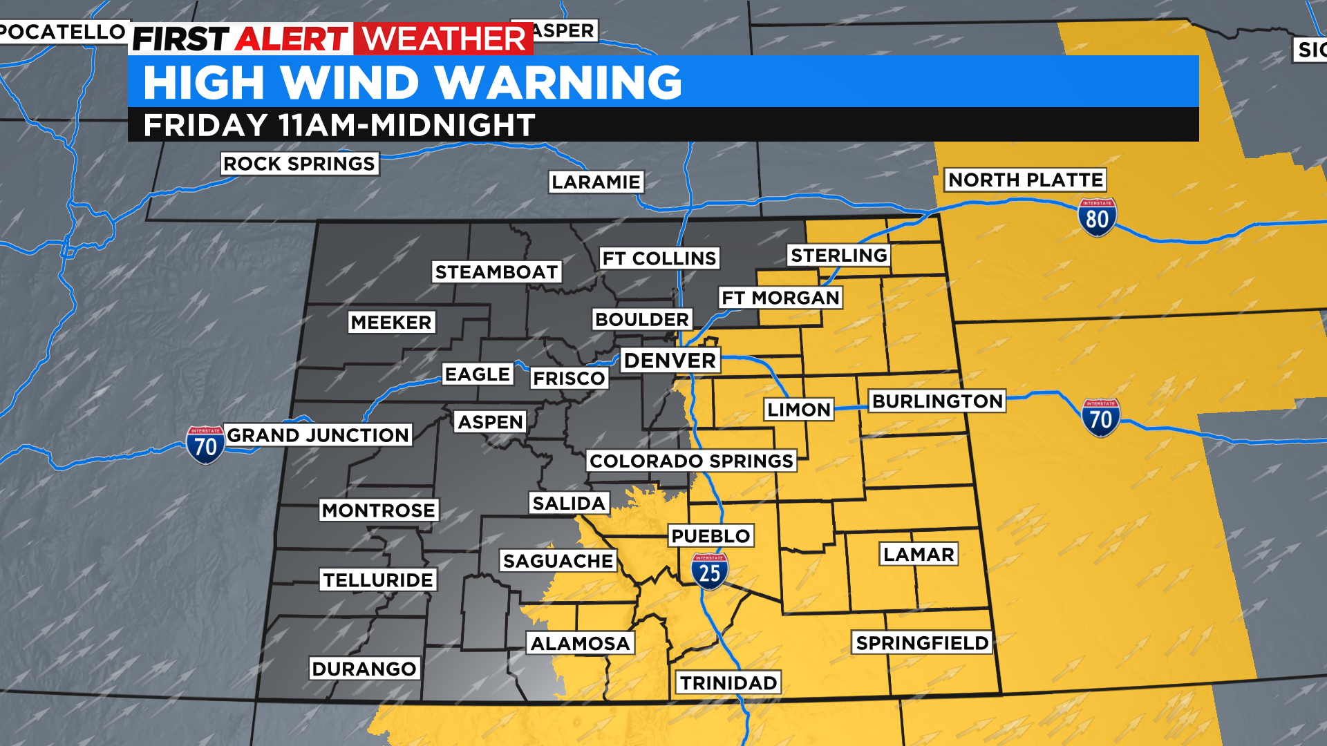
We also have a High Wind Warning for the Denver area and plains. Even when fire danger levels improve in the evening in terms of heat and humidity, the wind will continue to howl well past midnight.
Temperatures on Friday are also quite warm for this time of year. We will reach the mid 80s in Denver, with highs on the plains reaching the mid 90s.
Behind the powerful cold front on Saturday, we will see a few spotty showers around the Denver area and Front Range. The mountains will start to see snow on Friday afternoon, which will last through the weekend.
Friday will be a very tough day with fire danger, we may sound like a broken record but Friday is going to be rough. Please be very weather aware and have a go bag ready if you live in a fire prone area.