Denver bracing for dangerous cold wave with snow, winter weather advisory posted with the dangerous below-zero blast


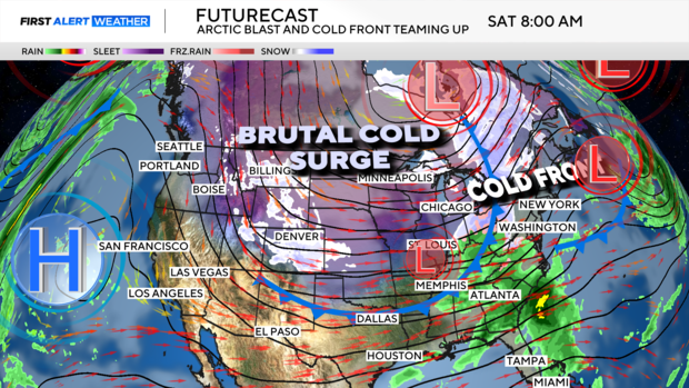
Colorado is getting ready to drop into a dangerous multi-day deep freeze. A surge from the Polar Vortex will be pushing below-zero temperatures across the region with several bursts of snow beginning Friday night.
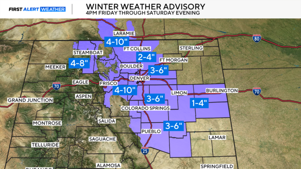
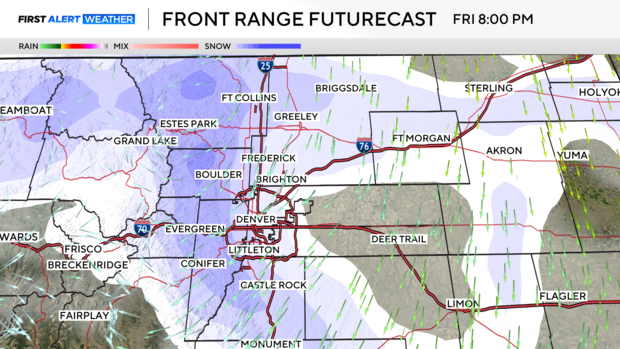
A Winter Weather Advisory has been posted for Friday night through Saturday evening for heavy areas of snow with the initial punch of Arctic cold.
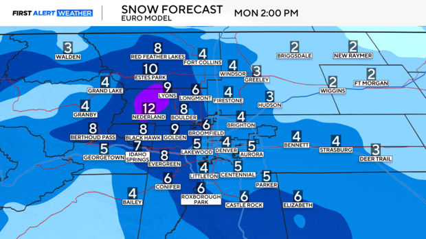
The Denver metro area could see 3 to 6 inches of snow with 4 to 10 inches in and near the foothills.
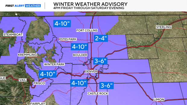
Snow will extend into southern Colorado during the day Saturday.
Dangerously cold temperatures are still forecasted to give the area several days of sub-freezing temperature for the Martin Luther King Jr. Holiday weekend.
Arctic front arrives Friday afternoon, snow arrives by evening
An arctic front approaches Friday afternoon and sweeps through the state from northwest to southeast. You'll feel it as the front passes as temperatures will plummet in the matter of an hour.
The snow that arrives with the afternoon system will have travel impacts for the Friday evening commute. Flash freeze potential will be high at the onset of snow across both I-25 and the mountains.
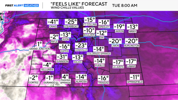
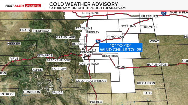
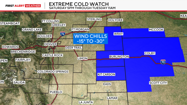
First Cold Weather Advisory and Extreme Cold Watch Posted
A Cold Weather Advisory is in place from midnight Saturday night to Tuesday morning. Temperatures from 10 below zero with very cold wind chills as low as 25 below are expected. If you must go outside, avoid staying outside for extended periods and dress in layer of warm clothing, including a hat, face mask, and gloves.
An Extreme Cold Watch is in effect from Saturday afternoon through Tuesday morning for dangerously cold wind chills ranging from 15 to 30 below. Wind chills as low as 20 below zero could cause frostbite on exposed skin in as little as 30 minutes, so if you must go outside make sure to cover all exposed skin.
On-and-off snow will linger through Saturday evening. With 3 to 6 inches across the metro area and 4 to 10 inches in and near the foothills and portions of I-70.
Snow will be dry and fluffy, which means it can accumulate quicker, and these types of systems tend to have a better chance of overperforming. Additionally, banding will be involved. This means a few bands of heavier snow only a few miles wide develop. Those under the heavier bands will pick up a lot of snow, while those outside the band get robbed of moisture and typically end up on the lower end.
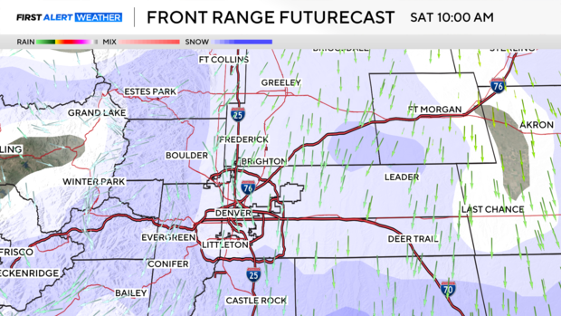
Reinforcing shot of cold air arrives Sunday, more snow
Another arctic front will surge across Colorado on Sunday bringing downright bone-chilling air. This is where things get interesting temperature-wise. As of now we are forecasting 15 degrees as the high in Denver, along with another shot of snow into Monday morning. With the final totals around 3 to 6 inches over 3 days in the Denver metro area.
Frigid Monday and Tuesday morning
Monday will continue to get colder. The combination of light snow and life-threatening wind chills will make it rough for the MLK Marade which starts at 10am on Monday downtown.
As of now, 6 degrees is the forecast high. Wind chills will be below 0 degrees all day, reaching a peak Monday night into Tuesday. Wind chills could plummet to minus 20 to 30 degrees.