Colorado's snowpack off to one of its worst starts since 2017 as drought expands

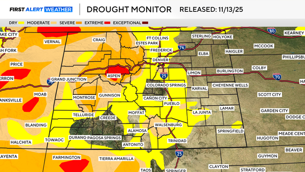
The latest U.S. Drought Monitor shows that while extreme and severe drought areas in Colorado remain unchanged, moderate drought and abnormally dry conditions have expanded across the Front Range and Eastern Plains following another week of warm, dry weather.
At the same time, Colorado's snowpack is off to one of its weakest starts in recent years, the third-worst on record and the lowest since 2017.

"We're not doing well. A lot of the snow measuring stations are at 10 or 20% of normal; things are really dry," said Steven Fassnacht, a snowpack expert at Colorado State University. "The central and northern parts of the state had a really dry summer and fall, meaning there's even less water in the soil. That really compounds our problem with snowpack."
Despite the slow beginning, Fassnacht says it's too early to declare the season a loss. A few strong storm systems in December and January could still help Colorado make up ground.
"There's not always a direct link between a slow start and a slow finish," Fassnacht said. "But we'd like to see those storm systems start picking up soon."
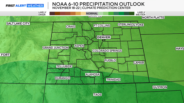
Long-range forecast models are showing a chance for wetter weather returning by Sunday and into next week, offering a glimmer of hope for both snowpack and drought relief.
"We are early in the season, we could get one big storm and we're back in the game," Fassnacht said. "But if it's the middle of January and we're still at 50%, then we really need to rely on those big spring storms, those March and April systems that can dump one to two feet of snow on the Front Range and even more in the mountains. Right now, being in a weak La Niña pattern, it's not looking that good for getting the snow we need."
While the state waits for a pattern change, water experts will be watching closely. The amount of snow that falls over the next several months will play a major role in Colorado's water outlook heading into spring and summer.