Severe storms are possible again for Denver and the Front Range
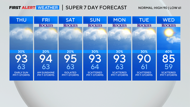
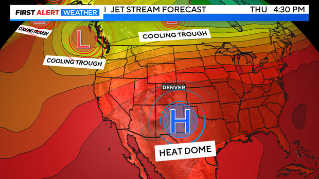
Happy Thursday! It will be a thermal Thursday with the hot and stormy combination staying alive and well. The high pressure heat dome is still in place thru the end of the month.
High temperatures will be in the low 90s for Denver and most of the surrounding suburbs.
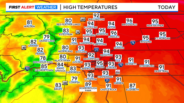
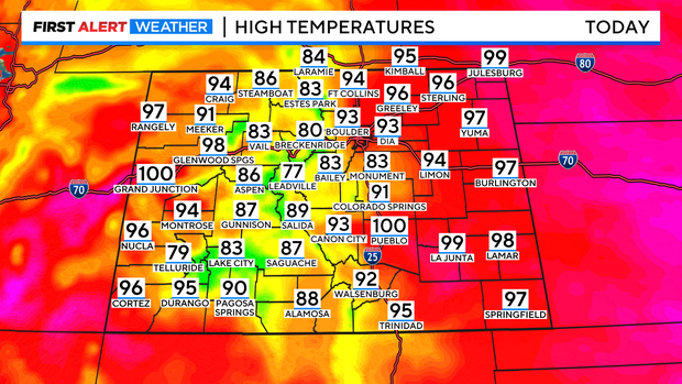
Statewide we are again looking at 90s and 100s across the southeast and western slope with mostly 80s in the Colorado high country.
There will be another round of afternoon and evening thunderstorms for the afternoon drive into the night.
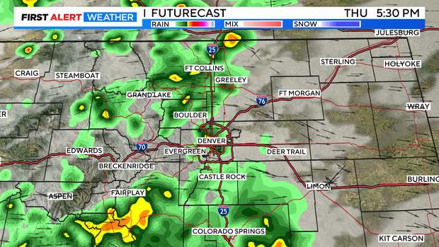
Showers and thunderstorms will also be popping late in the day in the mountains and the eastern plains.
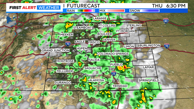
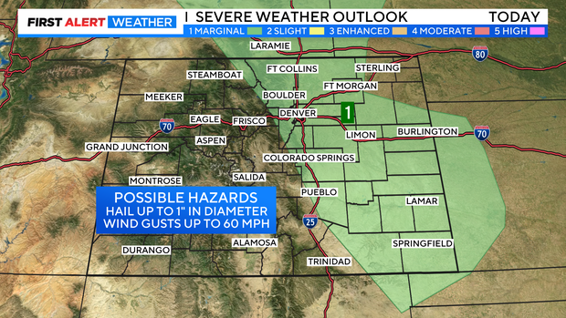
There is a marginal chance for severe storms for the Denver Metro area, northern Front Range and the eastern plains for Thursday afternoon. Hail 1 inch diameter and 60 mph winds possible.
More mid 90s expected thru the weekend with 80s still in the picture for the first few days of August with the continued chance for late day storms from monsoon flow.