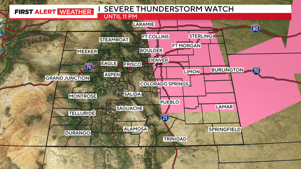
Fourth of July Forecast: Severe T-storm Watch thru 11 pm
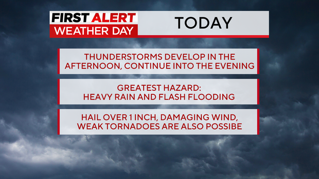
Tuesday is a First Alert Weather Day because of severe thunderstorms that could impact firework displays, drone shows, and other holiday outdoor activities. There is a Severe Thunderstorm Watch thru 11pm for Denver and 2/3rds of the eastern plains.
Greatest threat for the Denver metro area is heavy rain, large hail and damaging winds.
Moisture flowing in from the west along with a cold front dropping south across Colorado will team up for a cooler and more storm filled day on Tuesday.
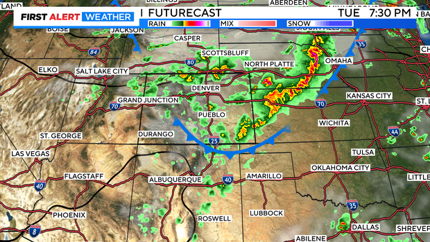
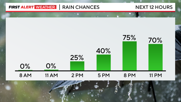
The chance for thunderstorms will start shortly after 12 p.m. and will continue through the evening hours. The best chance for thunderstorms in the metro area will between 4 p.m. and 10 p.m. which means the storms could impact several planned events.
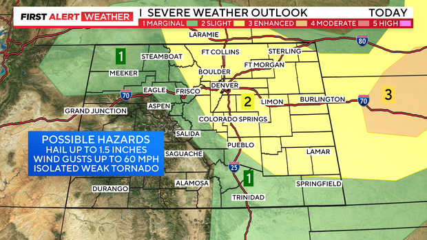
There is a "marginal risk" (level 1 of 5) for 1 inch diameter hail and 60 mph winds from northwest Colorado into the central mountains. For Denver and the Front Range plus most of the Eastern Plains there is a "slight risk" (level 2 of 5) for severe storms. Along with the threat for large hail, isolated damaging wind and a weak tornado or two is also possible.
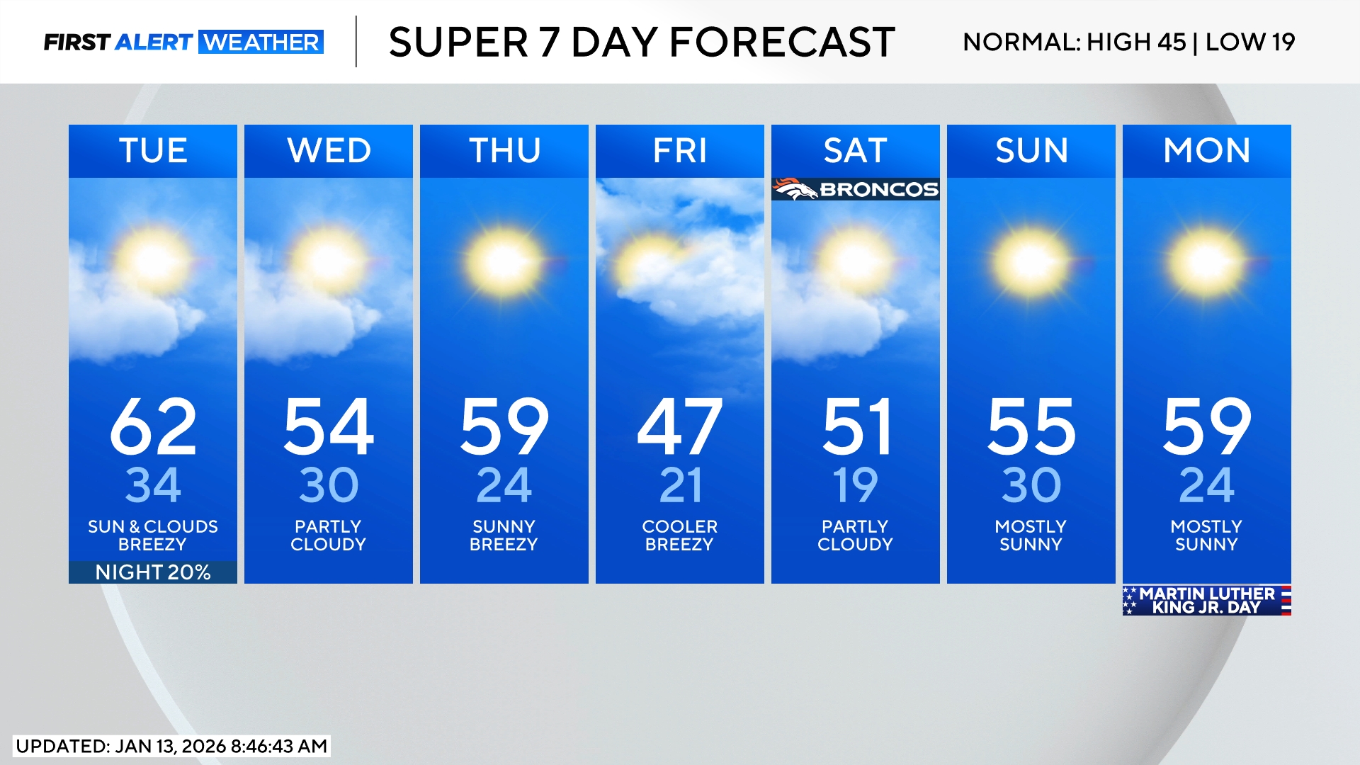
There is also a good chance for showers and thunderstorms on Wednesday as well but the threat for severe weather should be less in the Denver metro area thanks to cooler temperatures. High temperatures will only be in the mid 60s on Wednesday which about 25 degrees below normal for the first week in July.