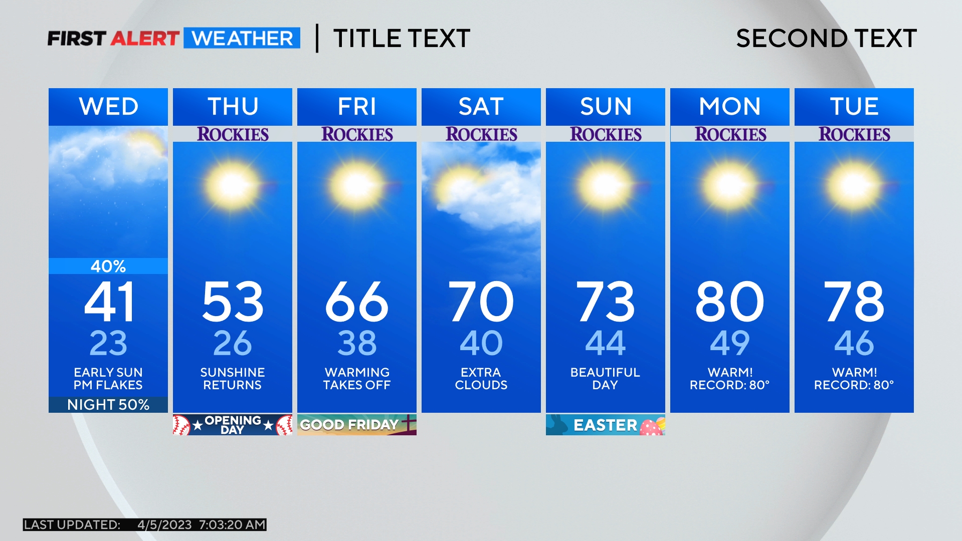
Colorado Weather: Big weekend snow in the mountains, not much for Denver

Friday will be the warmest day in a couple weeks for Denver and the Front Range while at the same time heavy snow starts falling in the mountains.
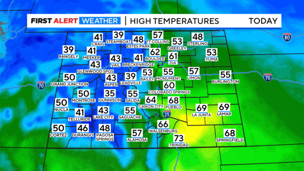
High temperatures in the metro area will be in the lower 60s Friday afternoon making it the warmest day since February 26. It stays a bit cooler in the northern Colorado with 50s around Fort Collins, Loveland, and Greeley. Some areas in southern Colorado could top 70 degrees!
Friday will also include a lot of cloud cover across much of Colorado including in the metro area. The clouds will stay low to the ground causing fog and limited visibility through late morning. Then higher clouds will take over in the afternoon.
Then, we turn our attention to another "Atmospheric River" that has been drenching California. This is aided by a stubborn trough of low pressure that has been hanging off the west coast all week. The low will finally start to break free on Friday into Saturday and will move toward Colorado.
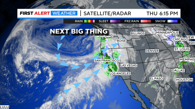
This will open the door for heavy snow to develop in the Colorado high country Friday into the weekend. There will be travel issues in the mountains starting Friday afternoon. Snow will begin in the morning and really get going by afternoon and evening. Heavy snow and wind are expected to take over heading into the weekend.
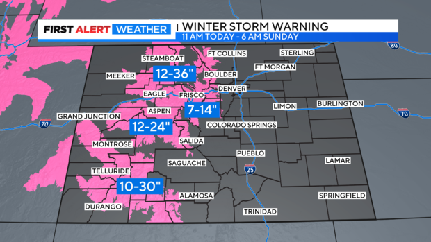
There are Winter Storm Warnings for most mountain areas in Colorado for up to 3 feet of snow in some areas. The heaviest snow will likely be Friday night. The mountains of Summit County and the Winter Park area will likely see 7-14 inches of snow (less below 9,500 feet) while the Rabbit Ears Pass area could get the heaviest snow in the state.
The main energy of the the storm system will be north of Colorado over the weekend. As a result, Denver and the eastern plains will see cooler temperatures with a few light rain showers Saturday with highs in the 50s. Sunday will be cooler in the 40s with a slight chance for a shower or even a light mix of rain/snow. With little to no accumulation expected.