Colorado braces for intense heat and high fire risk this week

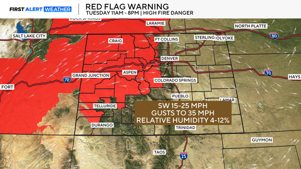
The National Weather Service has issued Red Flag Warnings for numerous mountain areas and portions of the Western Slope, including parts of Larimer, Park, Jackson, and Chaffee Counties. These warnings are in effect from 11 a.m. to 8 p.m. Tuesday, and could be extended into the coming days as similar weather patterns persist.
The combination of gusty winds (up to 35 mph), single-digit humidity, and extremely dry fuels means that if a fire were to start, it could spread quickly.
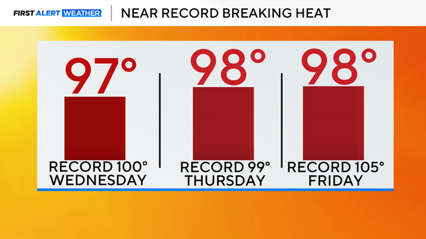
Adding to the concern is the intense heat gripping the state. Daytime highs will be in the mid to upper 90s and possibly reach 100 degrees by Thursday and Friday across portions of the Denver metro area. In Denver, the all-time high for Thursday, Aug. 7 is 99 degrees, set in 1980.
Thursday is expected to be the peak of the heat wave, and a Heat Advisory may be issued if conditions continue to worsen. The First Alert Weather Team has issued a First Alert Weather Day possible on Thursday due to the extreme heat that is expected both during the day and overnight.
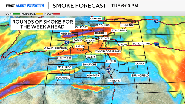
In addition to fire concerns and heat, many communities — especially along the Front Range — are dealing with increasing wildfire smoke in the atmosphere. The smoke, coming from fires burning both in-state and across the west, could limit visibility during the morning and evening hours.
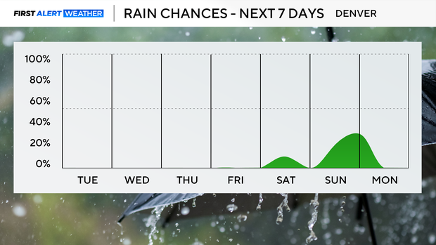
A backdoor cold front is expected to arrive late Friday or early Saturday, dropping daytime highs by about 10 degrees and bringing temperatures closer to normal for August. Along with the cooldown, there's a chance of isolated storms this weekend, offering a small but welcome break from the otherwise bone-dry pattern.