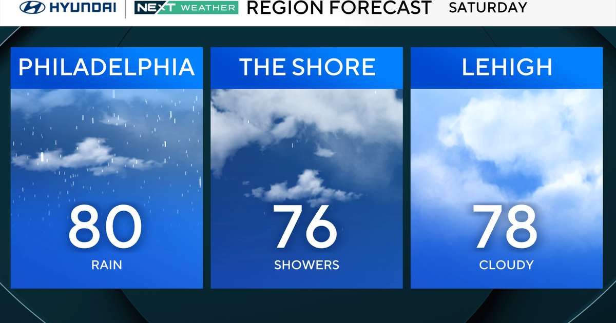
Denver Weather: Possible Blizzard On Wednesday
DENVER (CBS4) - A very strong storm spinning over the coast of southern California Monday morning will race northeast toward Colorado in the coming days. The storm track should bring the center of the storm directly across southeast Colorado and into western Kansas on Wednesday which is the ideal position for heavy snow along the Front Range and especially on the Eastern Plains.

A Winter Storm Watch has already been issued for most of the Denver metro area as well as the all of the northeastern plains for Wednesday afternoon and evening.
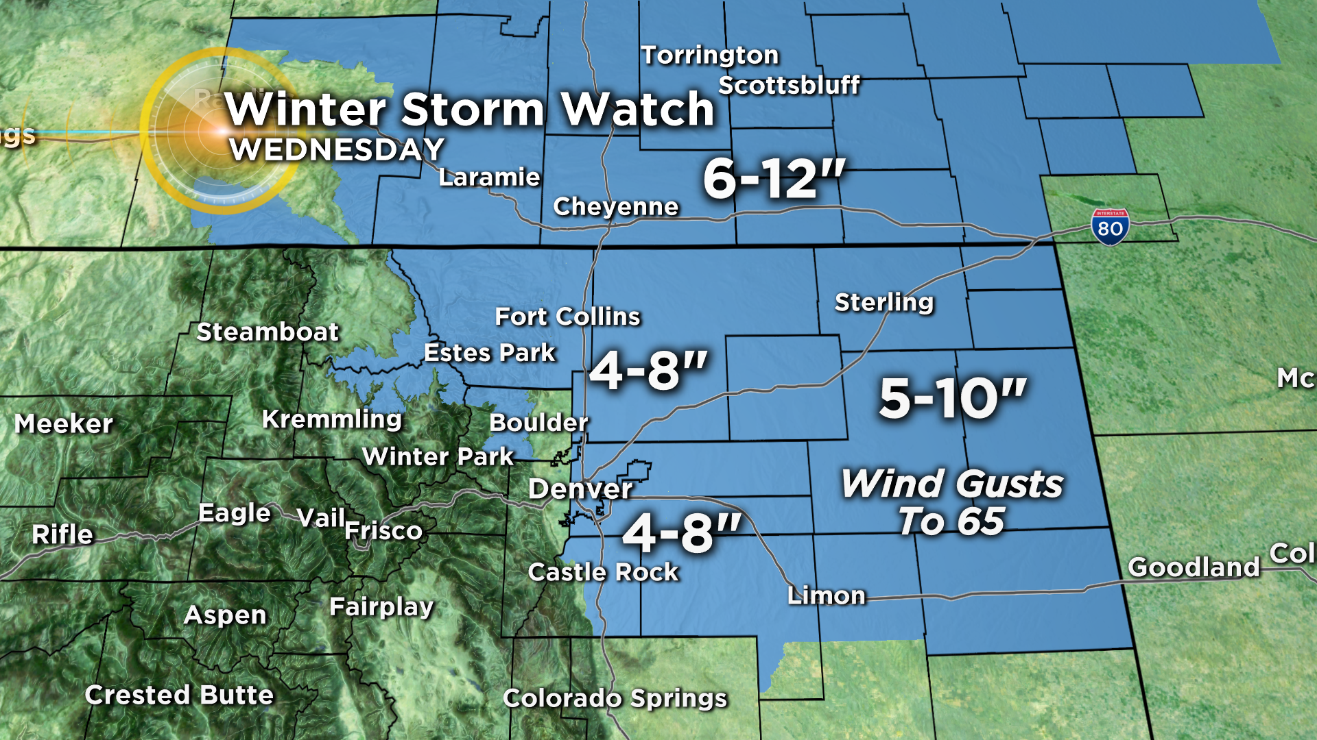
The storm will initially hit Denver and the Front Range Tuesday night with a chance for rain. Rain showers will continue through Wednesday morning before the rain changes to snow in the late morning or early afternoon on Wednesday. This is where the forecast gets complex because the exact time of the transition will determine snow totals. That being said, 4 to 8 inches of snow in the metro area seems reasonable (with the highest amounts likely east of I-25).
The heaviest snow and worst conditions in the watch area should be on the Eastern Plains where 5-10 inches of snow will combine with wind gusts up to 65 mph. This will cause blizzard conditions in some areas with near zero viability and possibly road closures. Travel east of the urban corridor could be extremely difficult if not impossible by late Wednesday including along I-76 and I-70.
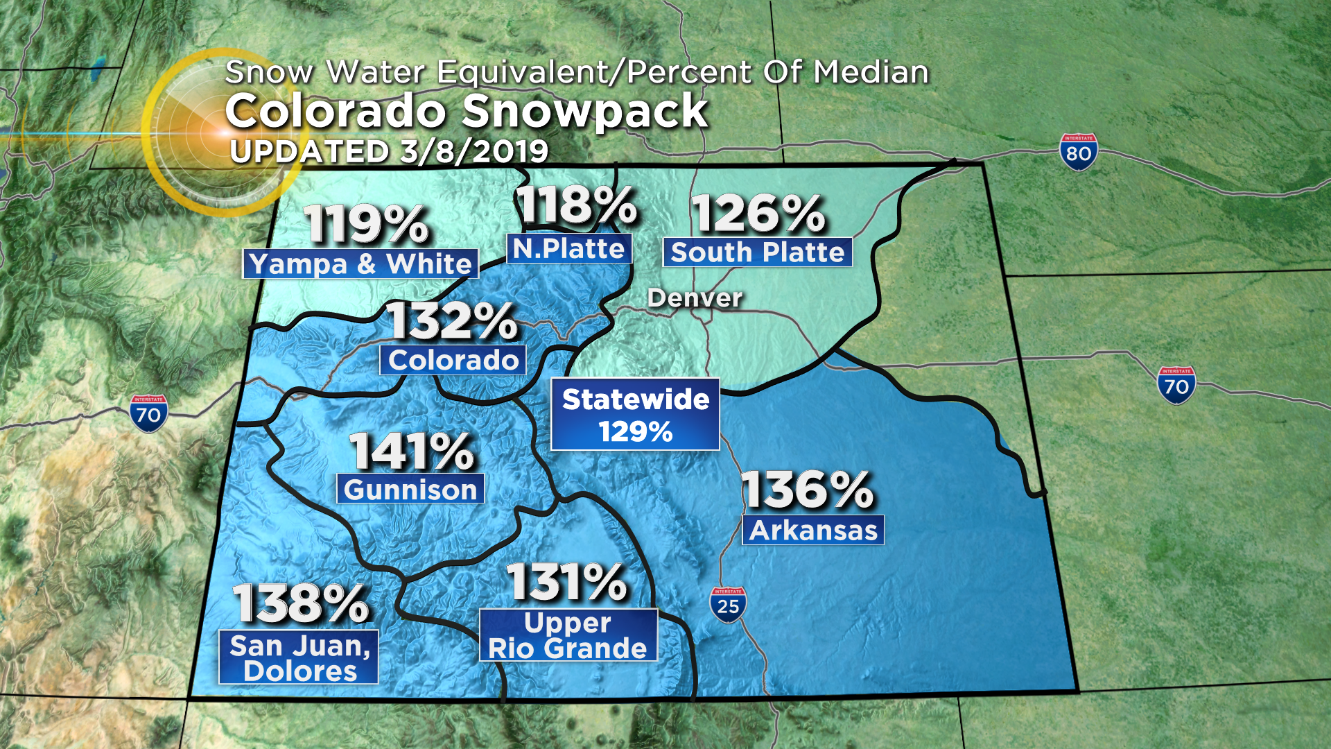
Meanwhile, the mountains will also see snow but totals on the plains could exceed mountain totals. For example, the mountains of Summit County should see no more than 3-6 inches of snow on Wednesday. Regardless, mountain snow this week will continue to cause an elevated threat for avalanches and even higher snowpack.