Storms weaken as they move into Chicago after causing damage elsewhere


CHICAGO (CBS) -- Storms gradually weakened as they worked their way toward the Chicago area Tuesday night, after causing damage in areas to the west.
A tornado watch was issued until 10 p.m. for LaSalle and DeKalb counties west of Chicago.
Later Tuesday evening, severe thunderstorm warnings were issued for Ogle, Winnebago, Henry, Bureau, Whiteside, Carroll, Jo Daviess, and Stephenson counties west and northwest of Chicago.
By 10 p.m., all severe thunderstorm warnings had ended, as had the tornado watch. Storms were still passing through the Chicago area and were expecting to linger late into the night, but were not expected to be severe.
The Chicago White Sox game against the Kansas City Royals Tuesday evening was postponed due to the rain. It will be made up as part of a straight doubleheader beginning at 1:10 p.m. Wednesday.
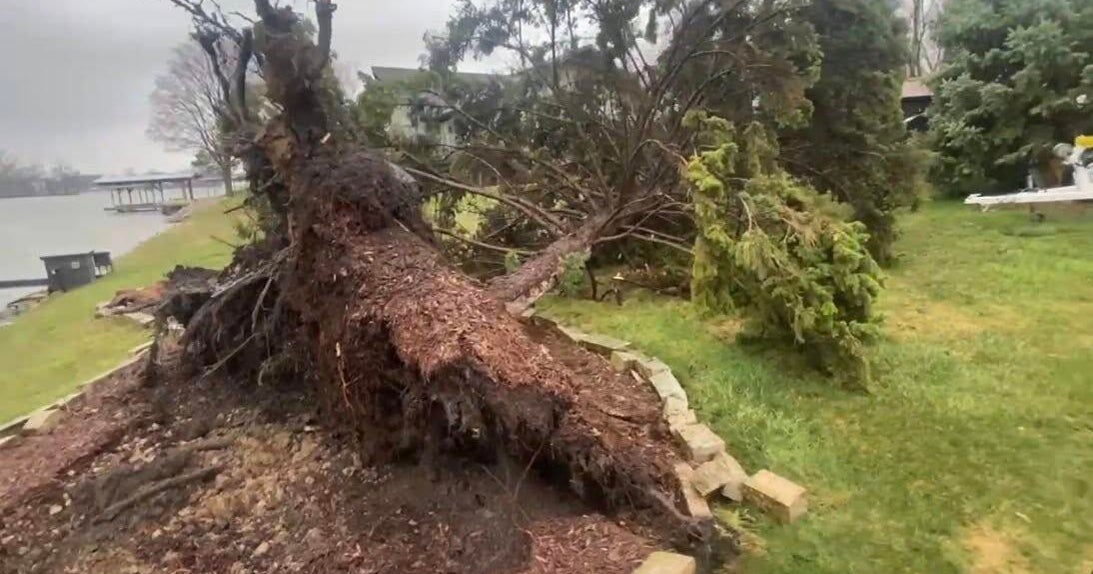
While the storms had weakened by the time they neared Chicago, they did cause major problems to the west.
In Bureau County west of Starved Rock State Park, winds were whipping as pounding rain fell and lightning flashed.
Later Tuesday evening, severe thunderstorm warnings were issued for Ogle, Winnebago, Henry, Bureau, Whiteside, Carroll, Jo Daviess, and Stephenson counties west and northwest of Chicago.
Earlier in the evening, strong storms caused severe damage as they ripped through Iowa.
A twister blasted through Rockwell City, Iowa, as air-raid sirens blared. Meanwhile, dashcam video in Sioux City, Iowa, caught lightning over farmland – and an Iowa City trooper recorded a funnel cloud while on patrol.
"It was zig-zagging all over the farmland," the trooper said.
Meanwhile, a portion of the Bong Bridge between Duluth, Minnesota, and Superior, Wisconsin, was shut down after powerful winds topped a semi-trailer truck.
In Kansas, winds of up to 100 mph caused widespread damage. And in Missouri, thousands were left without after storms hit Tuesday afternoon – also shearing off roofs and flipping a camper as hail came crashing down.
Lightning was seen in the Chicago area by the late evening, but severe weather was not.
Meanwhile, a striking rainbow was seen in the Chicago area as the sun returned before dusk. CBS 2 Photographer Tamott Wolverton captured some images from near the Museum of Science and Industry in Hyde Park.


The bulk of rain will be gone by 2 a.m.
A small chance of gusty showers and storms persists for Wednesday morning from 8 a.m. to 11 a.m., mainly for Northwest Indiana.


Colder air will arrive on Thursday with another round of showers. Breezy and much cooler weather is expected Friday and this weekend with highs in the 50s.


Forecast
Tonight: Evening severe weather threat. Breezy and warm. Low 62.
Wednesday: Morning showers and storms, then drier in the afternoon. Windy and mild. High 67.
Thursday: Showers in the afternoon and evening. High 62.